Drone Mapping: How It Works, Outputs, Software and Cost
What drone mapping is, how photos become orthomosaics, DSM/DTM, contours and 3D models, which drones and software to use, and what it costs in 2026.
Drone Mapping: How It Works, Outputs, Software and Cost
What drone mapping is, how photos become orthomosaics, DSM/DTM, contours and 3D models, which drones and software to use, and what it costs in 2026.
Table Of Content
- What Is Drone Mapping?
- How Mapping With Drones Works
- What Drone Mapping Produces
- How Accurate Is Drone Mapping?
- Drone Mapping Software: What to Look For
- Drone Mapping Applications
- Photogrammetry vs LiDAR Drone Mapping
- Which Drone for Mapping?
- What Drone Mapping Costs
- Getting Started with Drone Mapping
- Frequently Asked Questions

By Ranjan Suman, Co-Founder & Director
9 min read · Updated
Aeroyantra processes drone mapping data from $0 to start at $2.50 per credit - a typical 400-image map at 20 MP costs about $20. Professional is $69/month with 40 credits included.
What Is Drone Mapping?
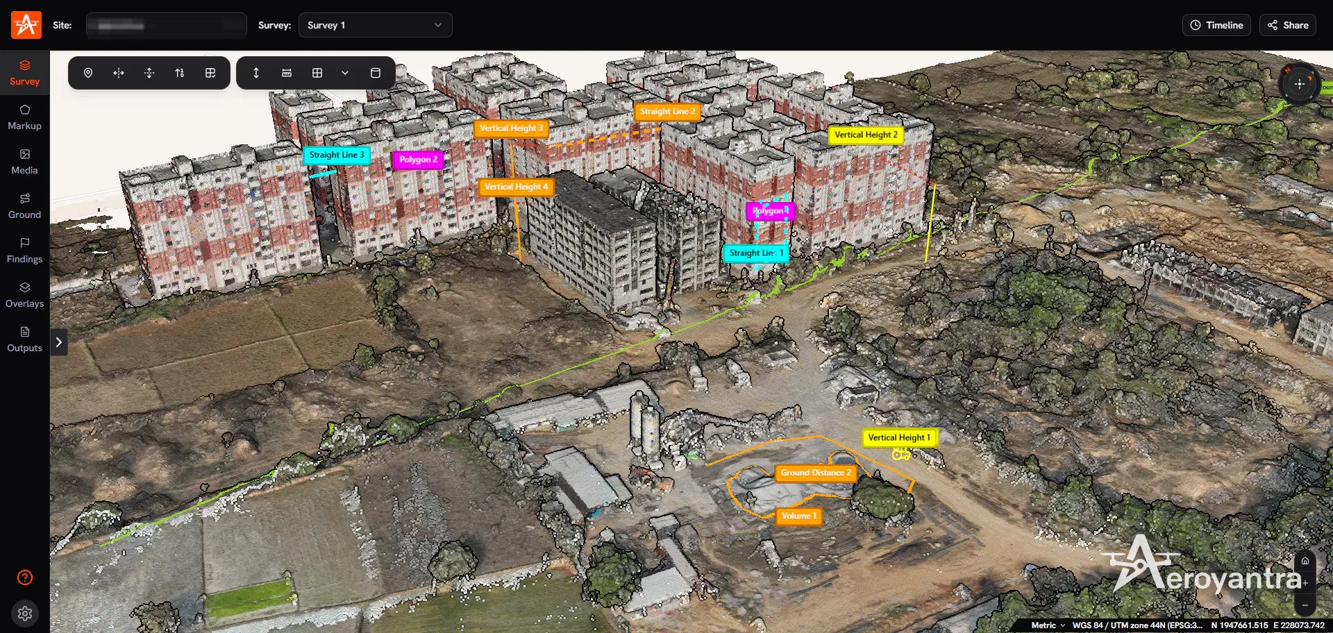
Drone mapping - aerial drone mapping, or simply mapping with drones - is the process of flying a drone over a site in a planned pattern, capturing overlapping photographs or LiDAR data, and turning that data into measurable, georeferenced maps. The result is not a photo album. It is an orthomosaic you can measure on, elevation models accurate enough for design and volumes, contours, point clouds and textured 3D models - all tied to real-world coordinates.
Aeroyantra is cloud drone mapping software built on its own photogrammetry engine. You upload images from any browser, and the platform returns orthomosaics, DSM/DTM, point clouds and 3D models in hours, with measurement, comparison and sharing tools in the same place. In India, Aeroyantra also flies the survey for you - see aerial survey services.
This guide covers how drone mapping works end to end, what it produces, how accurate it is, which drones and software to use, and what it costs.
How Mapping With Drones Works
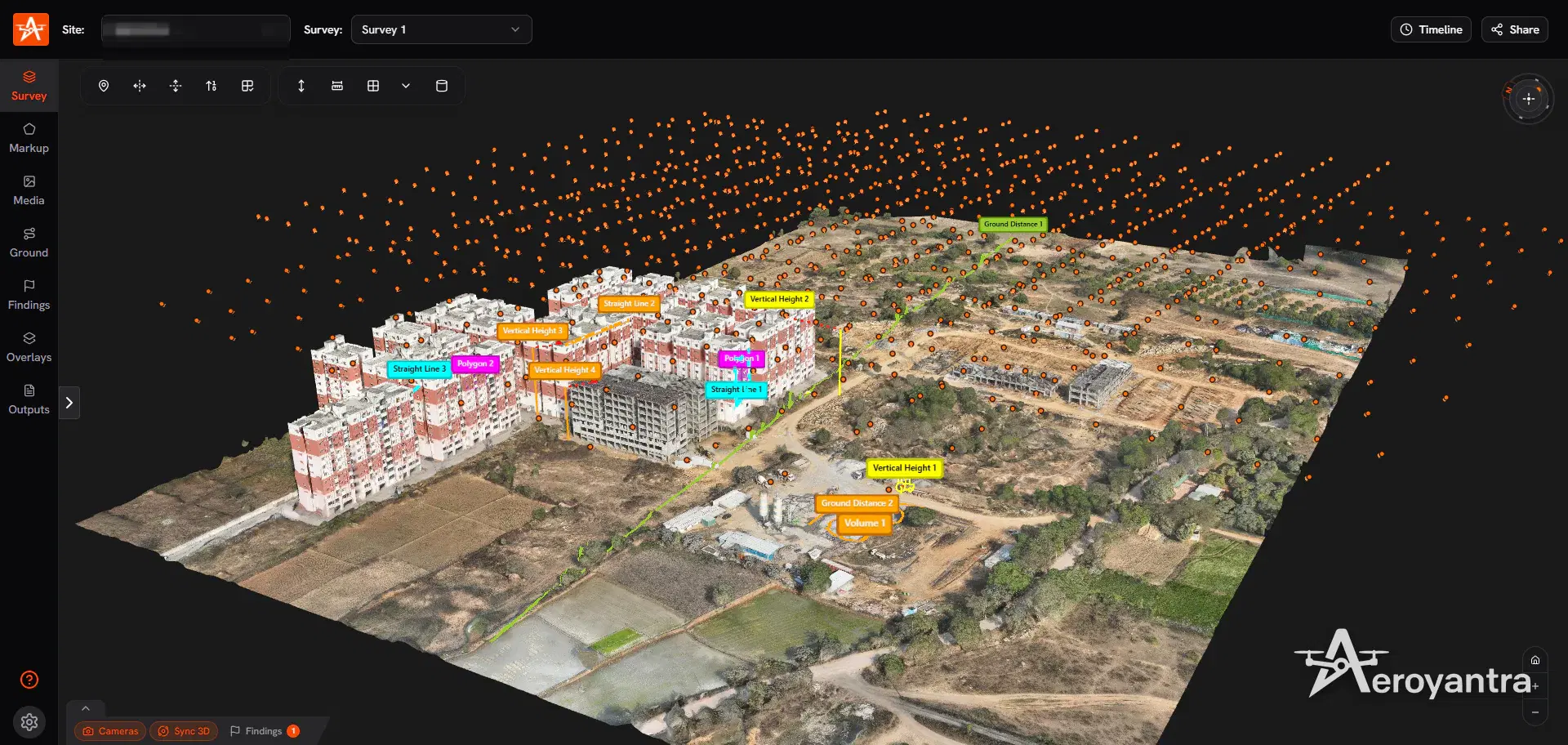
Every drone mapping project follows the same four steps.
1. Plan the flight
The flight plan sets the ground sample distance (GSD) - how many centimetres of ground each pixel covers - from the camera and the flight altitude. Survey work typically uses 70-80% forward overlap and 60-70% side overlap, so every point on the ground appears in many photos. Structures and facades need oblique images as well as straight-down ones. The GSD calculator guide works through the arithmetic before you fly.
2. Fly and control
The drone flies the grid automatically. Absolute accuracy comes from georeferencing: ground control points (GCPs) surveyed on the ground, RTK or PPK positions recorded by the drone, or both. See RTK vs PPK vs GCP for which to use, and the GCP placement guide for where to put them.
3. Process
Photogrammetry software finds the same features in overlapping photos, solves the position and orientation of every camera (bundle adjustment), then matches pixels densely to build a point cloud. From the point cloud it generates the surface models, the textured mesh and the orthomosaic. Our explainer on how photogrammetry builds 3D models from photos goes deeper.
4. Measure, compare and share
The outputs are only useful once people can work with them: measure a volume, cut a cross-section, compare this month with last month, send a link to the client. On Aeroyantra this happens in the browser, on the same site where the data was processed.
What Drone Mapping Produces
| Output | Format | What it is used for |
|---|---|---|
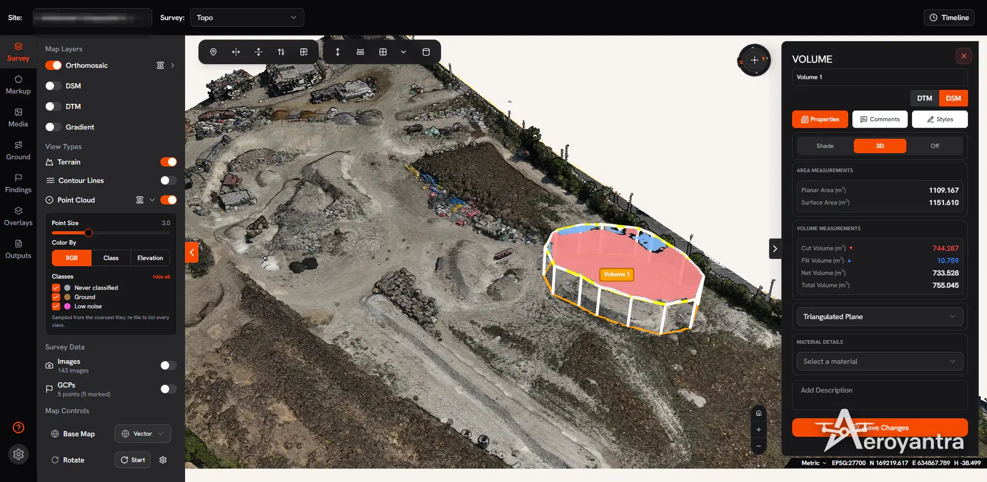
| Orthomosaic | GeoTIFF / PNG | A measurable, distortion-free aerial map; planning, progress, boundaries |
| Digital Surface Model (DSM) | GeoTIFF | Elevation of everything visible, including structures and trees |
| Digital Terrain Model (DTM) | GeoTIFF | Bare-earth surface for design, drainage and earthwork |
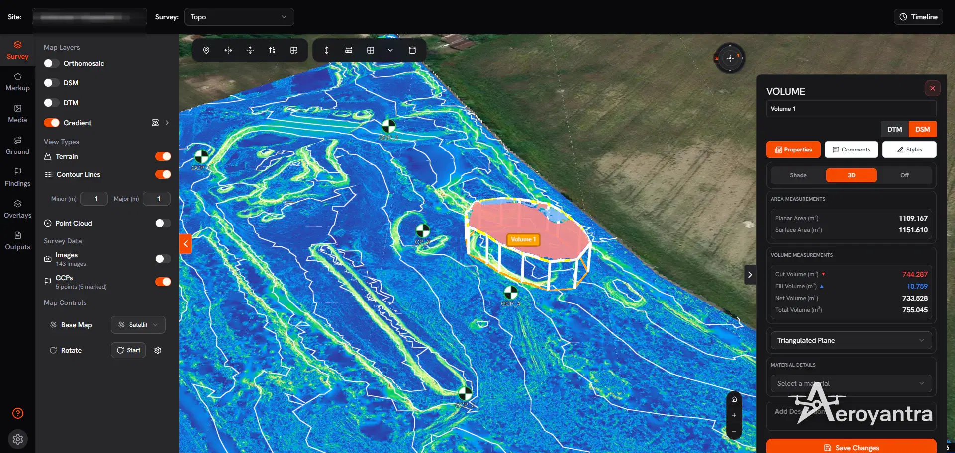
| Contours | Generated at any interval | Topographic drawings in CAD and GIS |
| Point cloud | LAZ | 3D measurement, CAD modelling, classification |
| Textured 3D model (optional add-on) | OBJ, GLB, 3D Tiles | Visual inspection, stakeholder review, structure measurement |
| Volumes and cross-sections | PDF, CSV, DXF, KML | Stockpiles, cut/fill, earthwork billing, profiles |
| Thermal and multispectral maps | GeoTIFF | Solar inspection, crop health (NDVI, NDRE) |
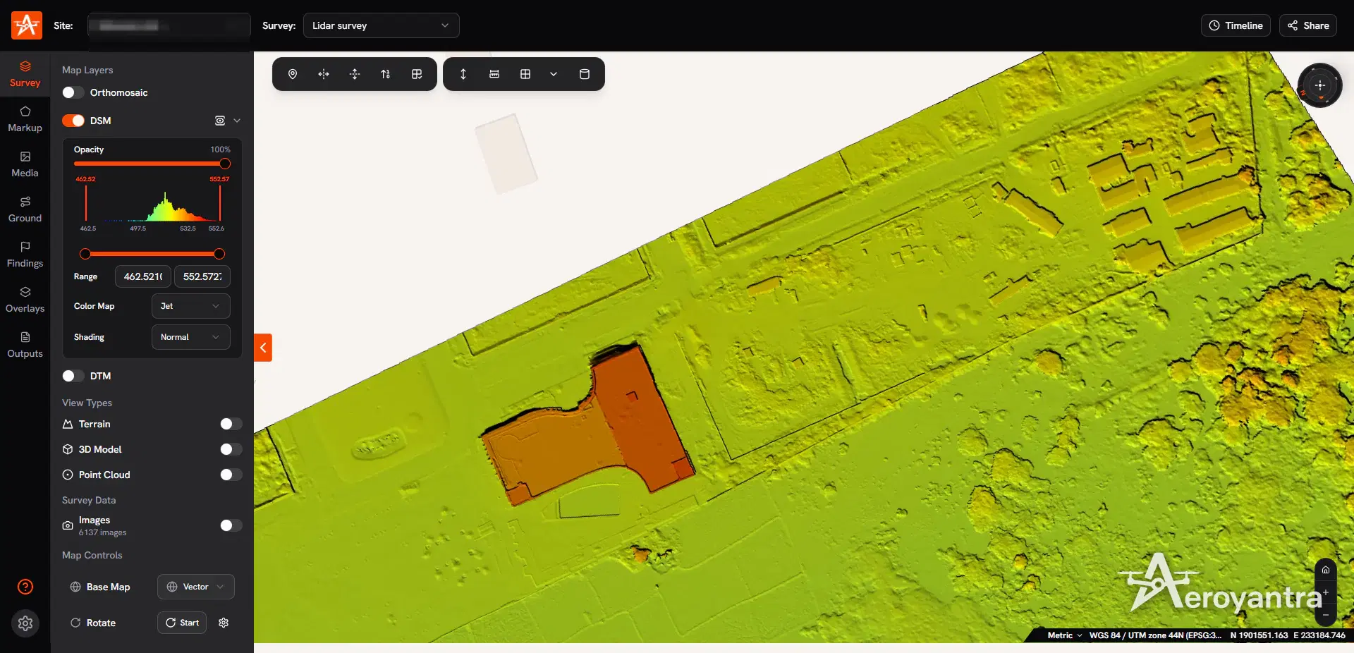
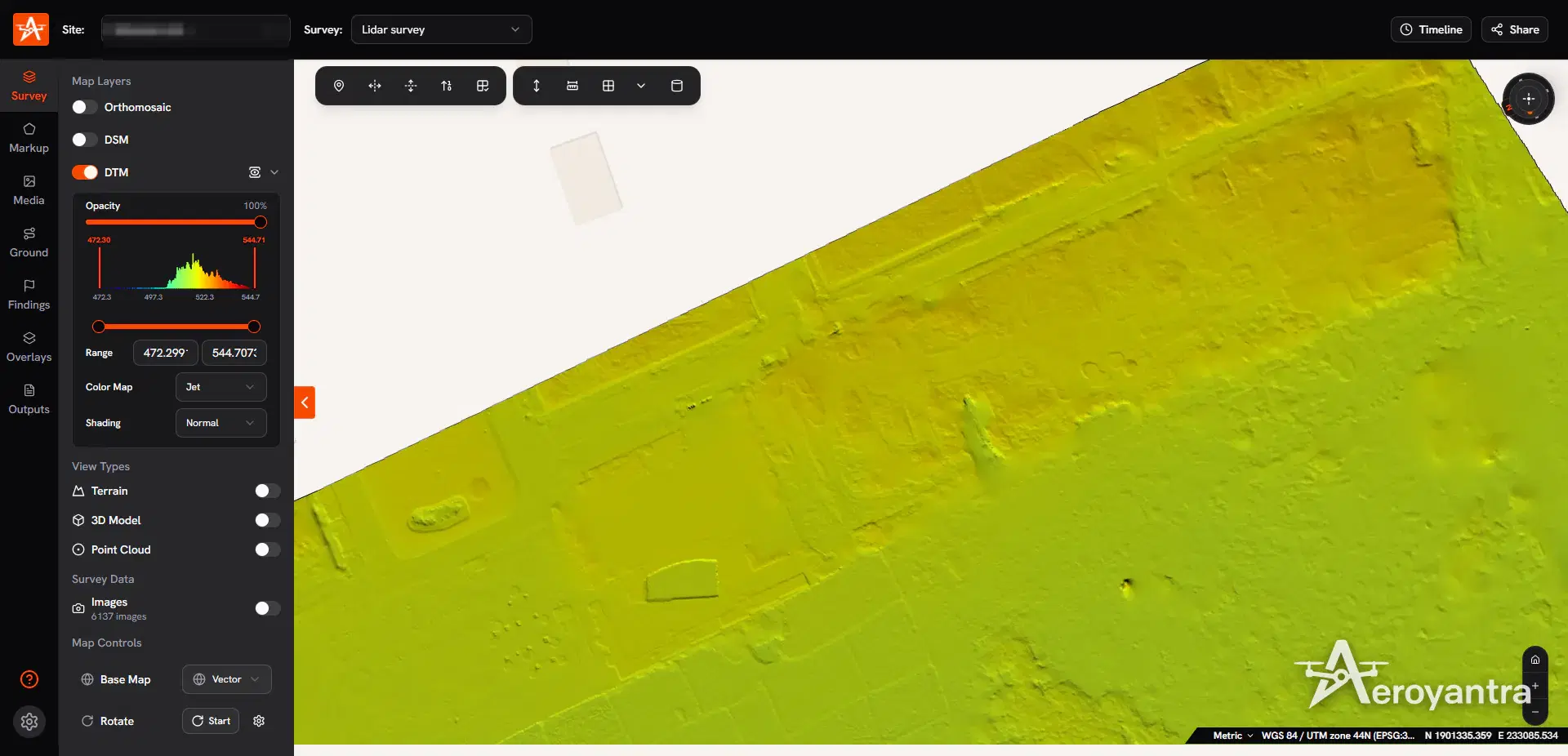
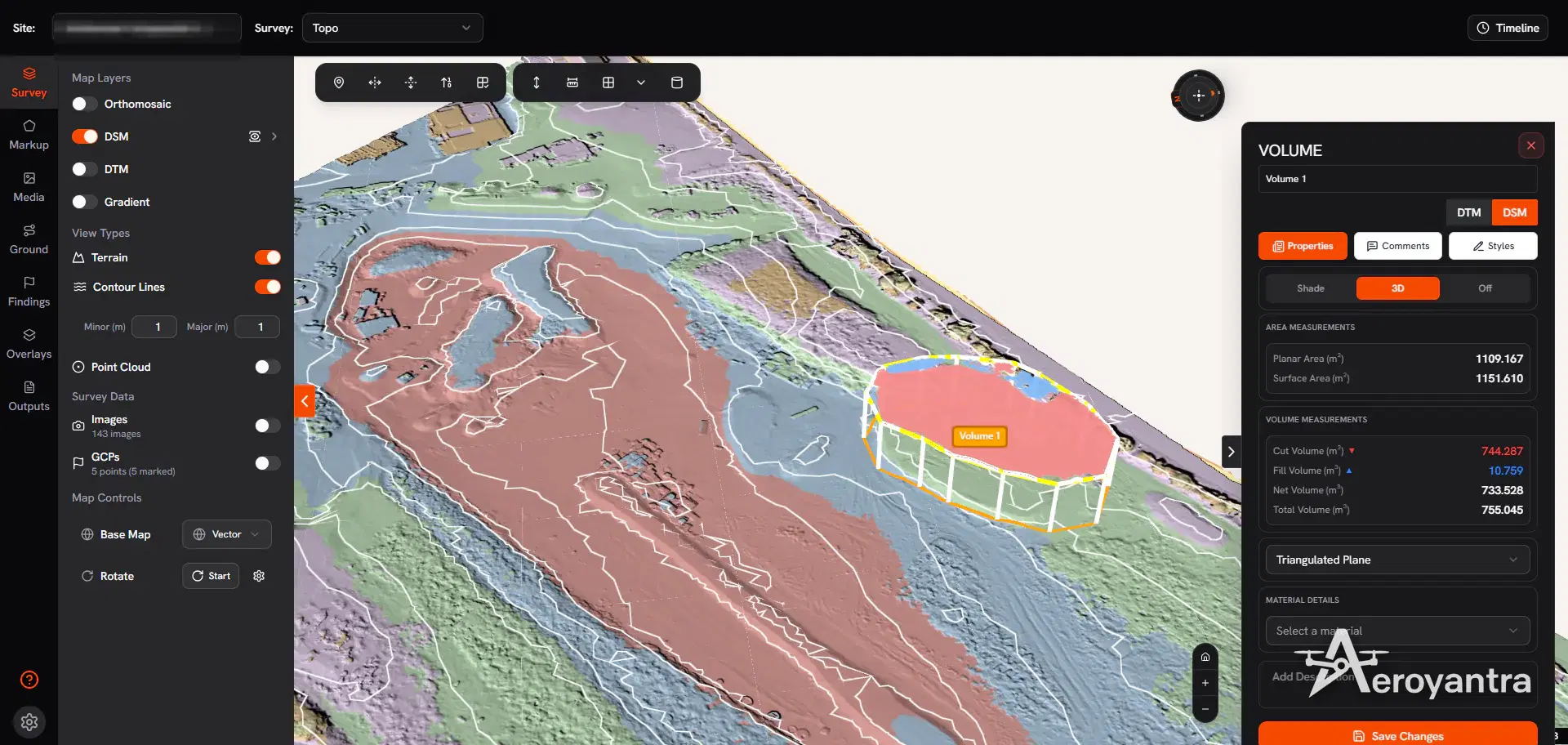
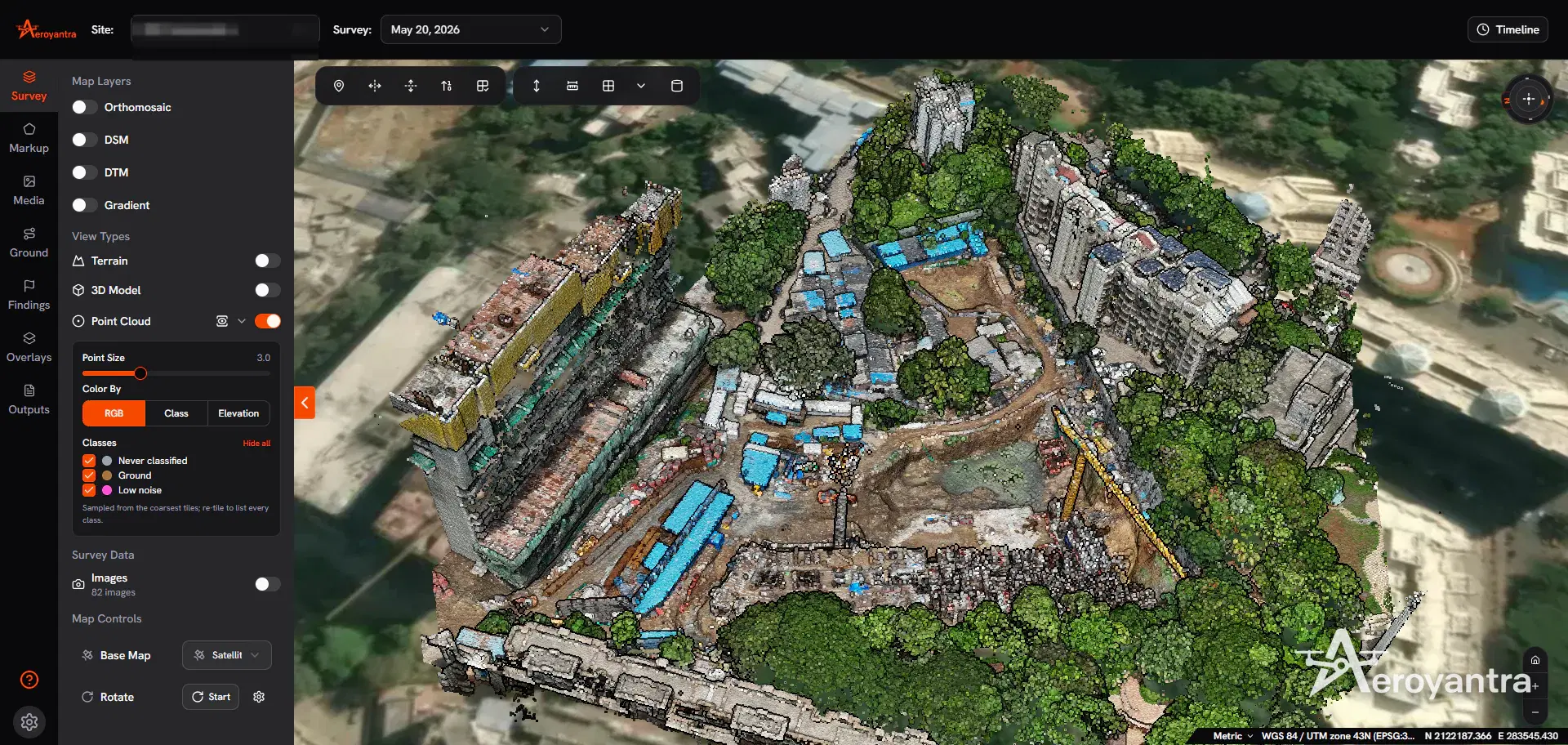
The topographic survey software page covers DSM, DTM, contour and cross-section outputs in detail, and the 3D mapping and point cloud page covers point clouds, meshes and 3D measurement.
How Accurate Is Drone Mapping?
Two kinds of accuracy matter:
- Relative accuracy - distances, areas and volumes inside one map. This is high even without ground control, which is why repeat stockpile or progress surveys can be compared reliably when they are flown the same way.
- Absolute accuracy - how closely the map matches real-world coordinates. This needs georeferencing. With RTK or PPK positioning and properly deployed ground control, Aeroyantra achieves 2-3 cm horizontal accuracy.
The professional habit is to prove accuracy rather than assert it: withhold some surveyed points as check points, and report the residuals. Aeroyantra's GCP quality report shows RMSE in X, Y and Z for every project, exportable as PDF or CSV.
Drone Mapping Software: What to Look For
Drone mapping software decides how fast you get results, what you can export, and how much you pay as your volume grows. Compare tools on:
- Pricing model - per seat, per product licence, or per dataset processed. Seat licences cost the same whether you fly once or fifty times a month.
- Hardware - desktop photogrammetry needs a GPU workstation; cloud processing does not.
- Outputs and formats - orthomosaic, DSM/DTM, point cloud, mesh, contours, and exports your CAD and GIS tools read.
- Measurement and comparison - volumes, cross-sections, survey-to-survey comparison and overlays of design files.
- Sharing - whether clients and site teams can open the data without a licence.
| Software | Model | Entry price (from our published comparisons) |
|---|---|---|
| Aeroyantra | Cloud, pay per use | $0, then $2.50 per credit; $69/month Professional |
| Pix4D | Six products, desktop and cloud | $49 to $4,990+ |
| DroneDeploy | Cloud, per seat | $329-$499 per seat per month |
| Agisoft Metashape | Desktop licence | $3,499 one-time plus workstation |
| WebODM | Open source, self-hosted | Free software; hardware is yours |
The best drone mapping software guide ranks these by real cost and use case, and the true cost of drone mapping software works through annual totals. Head-to-head comparisons: Pix4D, DroneDeploy, Agisoft Metashape and WebODM.
Drone Mapping Applications
| Industry | What drone mapping delivers |
|---|---|
| Construction | Earthwork cut/fill, progress tracking, as-built records, site documentation |
| Mining and quarrying | Stockpile and pit volumes, bench mapping, compliance surveys |
| Roads and highways | Corridor mapping, cross-sections, progress along the alignment |
| Rail and linear infrastructure | Corridor topography, embankments, right-of-way |
| Oil and gas and utilities | Pipeline and powerline corridors, facility surveys |
| Solar | Site terrain and slope, thermal panel inspection |
| Agriculture | NDVI and NDRE crop health maps, stand counts |
| Smart city and urban works | Base maps, land use, public works |
| Waste management | Landfill volumes and cell progression |
Photogrammetry vs LiDAR Drone Mapping
Photogrammetry reconstructs the surface from photographs. It is the cheaper option and it produces the true-colour orthomosaic everyone reads, but it only sees what the camera sees: under trees or dense scrub, the "ground" in the model is the canopy.
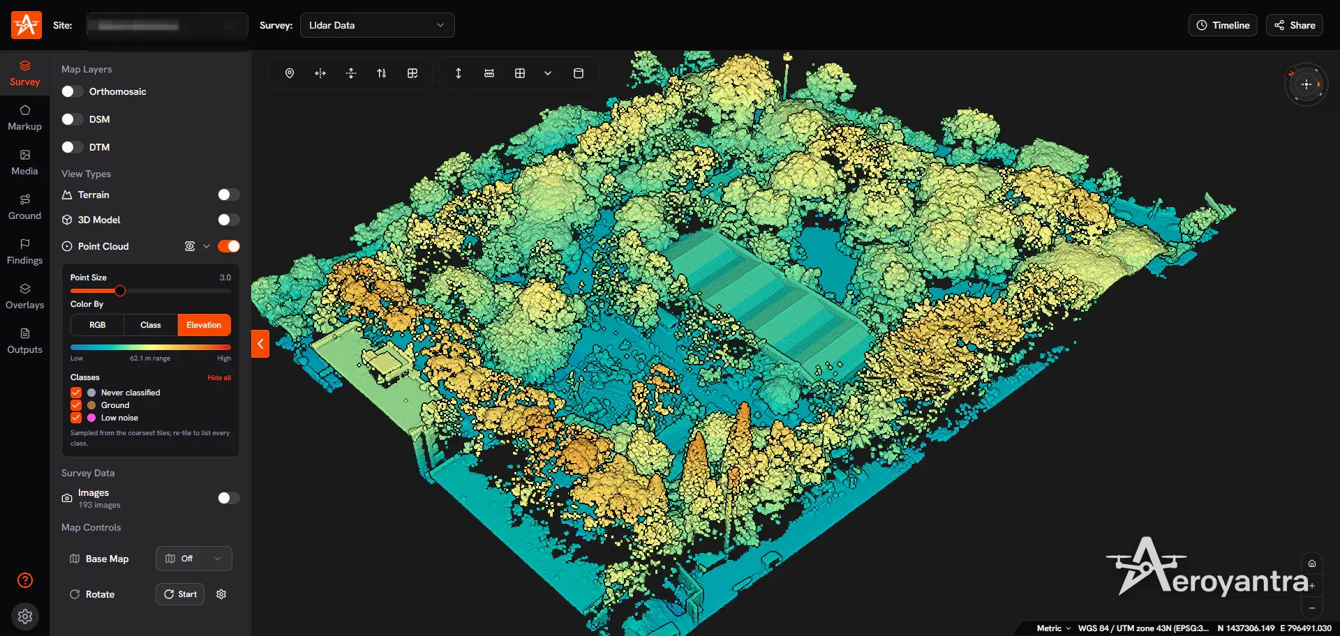
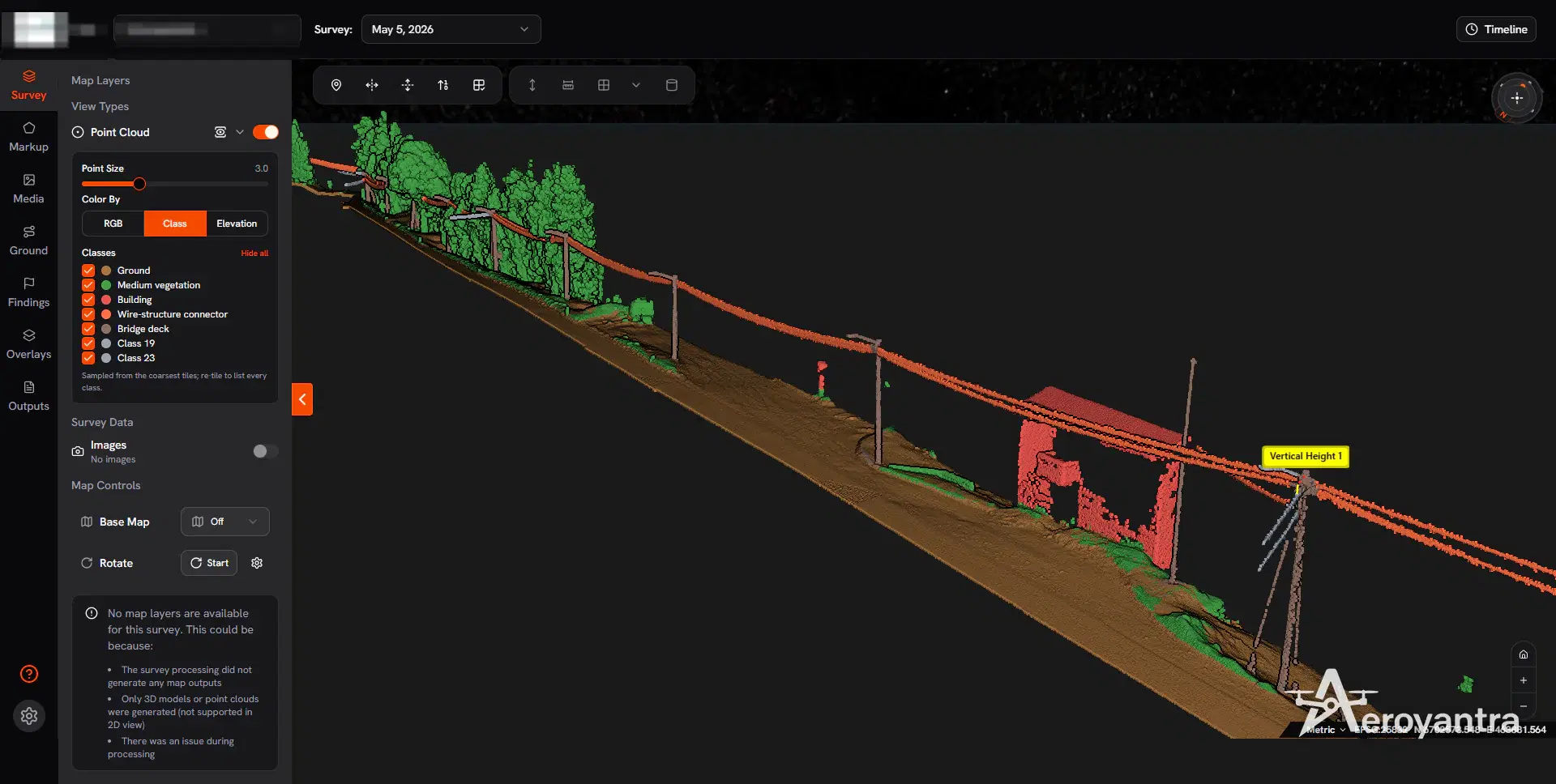
LiDAR measures distance with laser pulses. Several returns per pulse let it record the canopy and the ground beneath it, which is why it is the method for vegetated terrain, powerline corridors and hilly routes. The LiDAR vs photogrammetry comparison sets out the trade-offs, and drone LiDAR mapping on Aeroyantra explains how LiDAR point clouds are viewed and measured in the platform.
Which Drone for Mapping?
Mapping drones are chosen for the camera, not the airframe:
- A mechanical or global shutter avoids distortion when the drone is moving.
- RTK or PPK capability cuts the number of ground control points you need.
- Sensor size and resolution set the GSD at a given altitude.
- Flight time and form - quadcopters suit sites up to a few hundred acres and structures; fixed-wing drones cover larger areas per flight.
Popular choices are the DJI Mavic 3 Enterprise, Phantom 4 RTK, and Matrice 350 RTK with a Zenmuse P1, plus fixed-wing platforms such as the WingtraOne and eBee X. The supported drones and cameras guide lists every model with its processing cost on Aeroyantra.
What Drone Mapping Costs
There are two costs: processing the data, and capturing it.
- Processing - on Aeroyantra, $0 to start and $2.50 per credit, where one credit is one gigapixel. A typical 400-image map from a 20 MP camera is 8 credits, about $20. Credits fall to $1.67 at volume, and the Professional plan is $69/month with 40 credits included. Measurement, volume, contour and timeline tools are part of Professional, and the textured 3D model is an optional add-on at 1.5x credits. See pricing.
- Capture in India - if you would rather not fly, Aeroyantra's DGCA-certified teams survey the site. Indian market rates start around ₹35,000 for a site up to 1 acre; the drone survey cost guide has the full table.
Getting Started with Drone Mapping
- New to it? Start with the beginner's guide to drone mapping.
- Mapping large areas? Read the large-scale drone mapping guide.
- Selling mapping work? See how to start a drone mapping business and drone mapping certification.
- Measuring volumes? See drone mapping for earthworks and stockpiles.
- Need a quick coordinate conversion or GSD check? Aeroyantra's free GIS mapping tools run in the browser with no signup.
Best Drone Mapping Software, Ranked by Real Cost
Aeroyantra, Pix4D, DroneDeploy, Metashape and WebODM compared on pricing model, hardware and outputs.
Frequently Asked Questions
What is drone mapping?
Drone mapping is the process of flying a drone over a site in a planned pattern, capturing overlapping photographs or LiDAR data, and processing them into measurable, georeferenced maps: an orthomosaic, elevation models (DSM and DTM), contours, point clouds and 3D models. Aeroyantra processes drone mapping data in the cloud, so the outputs are ready in hours without a workstation.
How accurate is drone mapping?
Relative accuracy inside a single drone map is high even without ground control. Absolute accuracy depends on georeferencing: with RTK or PPK positioning and properly deployed ground control points, Aeroyantra achieves 2-3 cm horizontal accuracy. Check points withheld from processing prove the figure for each project.
What is the best drone for mapping?
For most survey work an RTK-capable drone with a mechanical-shutter camera is the best choice, such as the DJI Mavic 3 Enterprise, Phantom 4 RTK or Matrice 350 RTK with a Zenmuse P1. Fixed-wing drones such as the WingtraOne suit large areas, and LiDAR payloads suit vegetated ground. Aeroyantra processes images from any drone that writes geotagged photos.
How much does drone mapping software cost?
Pricing models differ widely. Seat-based subscriptions such as DroneDeploy run $329-$499 per seat per month, Pix4D sells six products from $49 to $4,990+, and Agisoft Metashape Professional is $3,499 one-time plus a workstation. Aeroyantra starts at $0 and charges $2.50 per credit only when a dataset is processed, so a typical 400-image map costs about $20.
What can drone mapping be used for?
The main drone mapping applications are construction progress and earthwork volumes, mining and stockpile measurement, topographic surveys for design, road, rail and powerline corridors, land and boundary mapping, agriculture crop health with NDVI, solar and industrial site planning, and urban base mapping. Aeroyantra supports all of them from the same set of outputs.
Is drone mapping the same as photogrammetry?
Not exactly. Photogrammetry is the most common drone mapping method: it reconstructs 3D geometry from overlapping photographs. Drone mapping also includes LiDAR, which measures distance with laser pulses and can reach the ground under vegetation, plus multispectral and thermal mapping. Aeroyantra handles photogrammetry, thermal and multispectral processing and imports processed LiDAR point clouds.
Process Your Next Survey on Aeroyantra
Upload drone images from any browser and get orthomosaics, DSM/DTM and point clouds back - with optional 3D models and Professional measurement tools - without a workstation or seat licences.
$0 to start, then $2.50 per credit. Professional is $69/month.
Keep exploring
Related services, platform features and guides
- Platform featureDrone 3D Mapping Software | Point Clouds and 3D ModelsDrone 3D mapping software that turns photos into point clouds and textured 3D models in your browser. From $2.50 per credit; measurement tools on Professional.Read more
- Platform featureDrone Topographic Survey Software | Contours, DSM & DTMDrone topographic survey software for DSM, DTM, contours at any interval, cross-sections and CAD exports. Contour and profile tools on Professional, $69/month.Read more
- Platform featureRTK Drone Mapping: RTK vs PPK vs GCP Accuracy GuideHow RTK, PPK and ground control set drone mapping accuracy, when you still need GCPs, and how Aeroyantra reports check-point RMSE. From $2.50 per credit.Read more
- Technical guideSupported Drones and Cameras for Drone MappingEvery drone and camera that works with Aeroyantra, from Mavic 3 Enterprise to WingtraOne, with sensor size and processing credits per 1,000 images.Read more
- ArticleBest Software for Drone Mapping 2026: 5 Tools by Real CostThe best software for drone mapping in 2026, by real cost: Aeroyantra from $0 at $2.50/credit, Pix4D $49-$4,990+, DroneDeploy $329-$499 per seat/month.Read more
- GuideAerial Survey Services in India | Drone Aerial MappingAerial survey and mapping across India by DGCA-certified drone teams: photogrammetry deliverables in 24-48 hours and LiDAR in 48-72 hours.Read more