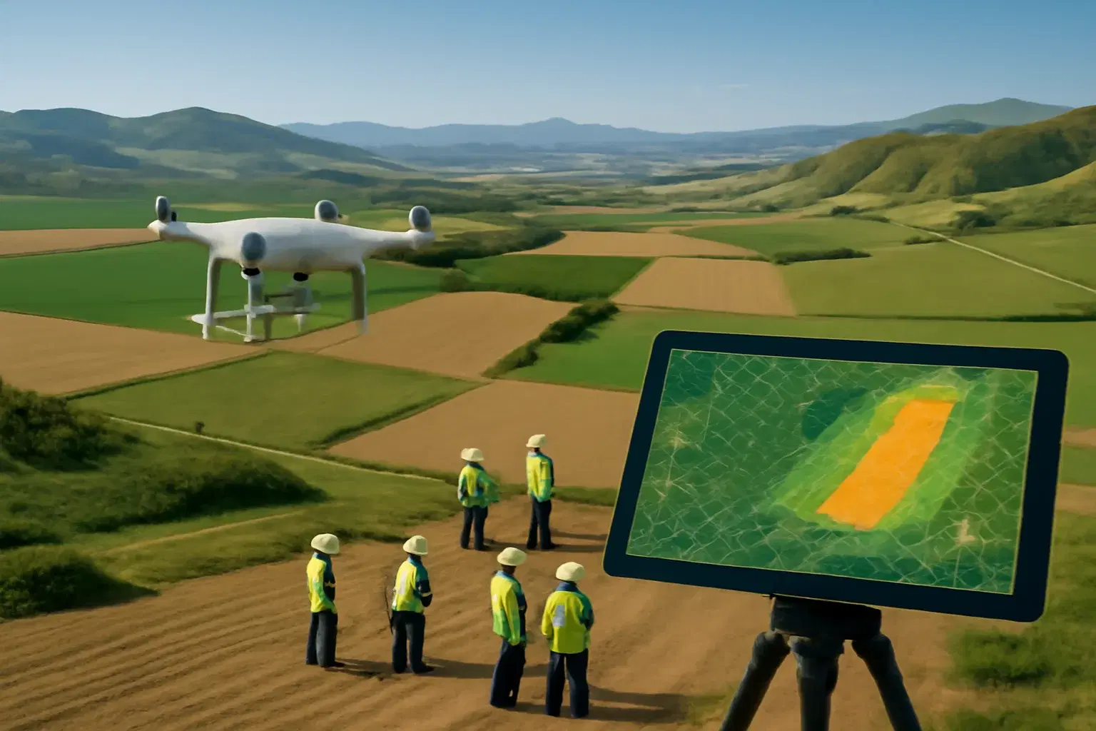
Large-Scale Drone Mapping: 100 to 20,000 Hectares
Field guide to large-scale aerial mapping from 100 to 20,000 hectares. Planning, execution, and processing for infrastructure, mining, and land survey.
Large-Scale Drone Mapping: 100 to 20,000 Hectares
Field guide to large-scale aerial mapping from 100 to 20,000 hectares. Planning, execution, and processing for infrastructure, mining, and land survey.
Table Of Content
- What You'll Learn
- Why Large-Scale Drone Mapping and Surveying Is a Different Discipline
- Choosing the Right Aerial Survey Drone for the Scale
- Flight Block Architecture
- Scaling Your Operations: What Changes at Each Level
- The Accuracy Decision: RTK, PPK, or GCPs?
- GCP Strategy at Scale: Where Most Projects Go Wrong
- In-Field Data Quality Control
- The Processing Pipeline for Large Projects
- India-Specific Considerations
- Pre-Mission Checklist
- Frequently Asked Questions
- The Bottom Line
- Ready to Scale Your Survey Operations?
What You'll Learn
This guide covers everything a drone survey professional needs to plan and execute a large-scale mapping campaign - from hardware selection and flight block architecture to the RTK vs PPK vs GCP decision and the processing pipeline that scales from 100 to 20,000 hectares.
Why Large-Scale Drone Mapping and Surveying Is a Different Discipline
Most drone operators learn photogrammetry on a 10-hectare plot. Then a client hands them a 5,000-hectare mining lease, and every assumption they built their workflow around falls apart. Large-scale aerial survey demands a completely different approach to UAV mapping services, hardware selection, and data management.
Large-scale drone mapping is not just "more of the same." The challenges are not technical - they are logistical. Battery management, team coordination, data integrity across hundreds of thousands of images, and an accuracy strategy that holds up across terrain you cannot fully control.
Getting any one of these wrong means re-flying. At scale, re-flying is catastrophic.
The key shift: On a small project, a mistake costs you an afternoon. On a 10,000-hectare project, it can cost you a week of field time, tens of thousands of rupees in mobilization, and your client relationship.
This guide covers the complete workflow so you don't have to learn those lessons the hard way.
Choosing the Right Aerial Survey Drone for the Scale
The single biggest mistake on large-scale projects is using the wrong aerial survey drone category. Flight time is the binding constraint, and it shapes every other decision.
Multirotor Aerial Mapping Drones: Up to ~500 Hectares
Aerial mapping drones like the DJI M3E or M350 RTK are the workhorses of commercial mapping. They are operationally flexible - VTOL, tight turning radius, and excellent integrated camera systems.
Their limitation is endurance. Expect 30-45 minutes of productive flight time per battery, which translates to roughly 80-120 hectares per flight depending on altitude and overlap settings.
For projects under 500 hectares, multirotors are the right call. For anything larger, you are fighting the hardware.
Best for: Construction monitoring, corridor surveys, urban areas, projects requiring frequent battery swaps at accessible locations.
Fixed-Wing Survey Drones: 500 ha to 5,000+ ha
Fixed-wing survey drones can cover 500-1,500 hectares per flight, making them the only practical option for large drone surveying and mapping campaigns. The trade-off is operational complexity - they need a clear runway or hand-launch area and are poorly suited for modeling vertical structures like stockpiles or building facades.
Best for: Agricultural drone mapping, large land parcels, open terrain with minimal obstructions.
VTOL Fixed-Wing Hybrids: 2,000+ ha on Complex Terrain
Platforms combining fixed-wing endurance with multirotor launch and landing capability are the most capable option for large, complex terrain. More expensive and requiring more operator training, but for projects above 2,000 hectares with varied topography, they pay for themselves in reduced field time.
Best for: Remote sites, projects with no clear runway, large-scale terrain modeling.
Hardware Comparison at a Glance
| Platform | Coverage/Flight | Best Scale | Key Limitation |
|---|---|---|---|
| Multirotor (M3E, M350) | 80-120 ha | Up to 500 ha | Battery endurance |
| Fixed-Wing | 500-1,500 ha | 500-5,000 ha | Needs launch/landing area |
| VTOL Hybrid | 300-800 ha | 2,000+ ha | Higher cost, more training |
Flight Block Architecture
No matter what drone you fly, any project larger than a single battery requires you to think in flight blocks - discrete, self-contained areas planned around your drone's realistic endurance.
How to Build Your Block Plan
Step 1: Calculate your usable flight time.
Subtract a 20-25% battery reserve from your drone's rated endurance. This is your planning number, not the spec sheet figure.
Step 2: Determine coverage per flight.
At 120m AGL with 75/65 front/side overlap, a typical multirotor covers 80-100 ha per flight. Lock in this number for your specific setup before you arrive on site.
Step 3: Draw blocks with 10-15% overlap.
Adjacent blocks must share enough imagery to stitch together cleanly during processing. Skimping on block overlap is one of the most common causes of seam artifacts in large-area mosaics.
Step 4: Place battery swap points strategically.
Locate your ground station at a centroid that minimizes travel time between blocks - not just at the nearest road access.
Step 5: Plan for contingencies.
Always build a 15-20% time buffer into each day for weather delays, equipment issues, and unexpected access problems.
Terrain-Following: Non-Negotiable on Hilly Ground
On flat terrain, a fixed-altitude flight is fine. On anything with significant elevation change - hill country, open-pit mines, terraced agriculture - you must use terrain-following mode.
A drone flying at a constant 120m barometric altitude over a 50m hill is effectively at 70m AGL on the upslope and 170m AGL on the downslope. Your GSD becomes inconsistent, your overlap degrades, and your model accuracy suffers.
Terrain-following keeps your GSD constant across the entire project area.
Rule of thumb: If your project area has more than 10m of elevation change, terrain-following is not optional.
Scaling Your Operations: What Changes at Each Level
The 100-Hectare Project
A single-day, single-operator job.
- Crew: 1 pilot
- Batteries: 4-6
- Data volume: 2,000-4,000 images (~15-30 GB)
- Key risk: Weather window. Plan for a morning flight to avoid afternoon convection and wind.
- Processing: Local workstation is sufficient.
The 1,000-Hectare Project
A multi-day campaign requiring a dedicated field team.
- Crew: 2 people minimum - a pilot and a ground support operator
- Power: A generator or vehicle-mounted charging station is essential. Relying on hotel power for overnight charging is not a plan, it is a gamble.
- Data volume: 20,000-50,000 images (~150-400 GB)
- Key risks: Lighting consistency across days, daily data backup discipline
Non-negotiable: A structured folder system from day one. Use YYYY-MM-DD_Block_01 naming and back up every SD card immediately after each flight. Discovering a corrupted card on day 3 of a 4-day campaign is a project-ending event.
The 10,000+ Hectare Project
This is a survey campaign, not a flight. Treat it like one.
- Crew: Multiple teams, potentially operating simultaneously
- Regulatory: At this scale in India, BVLOS operations are likely required. DGCA approval under the Drone Rules 2021 is mandatory. Build regulatory lead time into your project schedule - not as an afterthought.
- Data volume: 200,000+ images (multiple terabytes). Local processing is not viable. Cloud processing is the only scalable path.
- Key risk: Data inconsistency across teams.
Every team must use identical flight parameters - altitude, overlap, camera settings (manual ISO, fixed shutter speed, locked white balance). A single team that flew with auto-exposure creates a processing headache that can take days to resolve.
The Accuracy Decision: RTK, PPK, or GCPs?
This is the most consequential technical decision on any large-scale project, and it is widely misunderstood. Here is what the data actually shows.
Understanding RTK
An RTK drone corrects its GPS position in real time using a base station or NTRIP network. In good conditions - open sky, strong signal, reliable connectivity - RTK delivers approximately 2.5 cm accuracy in X, Y, and Z (roughly one pixel at standard mapping altitudes).
The problem is the phrase "in good conditions."
RTK accuracy degrades significantly when the correction signal drops. Without any corrections or GCPs (standalone mode), vertical accuracy falls to 3.6 meters - Pix4D's real-world test data. Even with GCPs but poor distribution, vertical errors of 65 cm are documented. RTK also begins to lose accuracy at baselines beyond 35 km from the correction source.
When RTK works best:
- Open terrain with clear sky
- Projects within 35 km of a CORS station or local base
- Fast-turnaround workflows where immediate results matter (construction monitoring, progress tracking)
Understanding PPK
PPK applies GNSS corrections after the flight, using logged raw satellite data. Because corrections are applied in a controlled environment with the complete dataset, PPK is not vulnerable to mid-flight signal loss.
PPK consistently delivers sub-3 cm accuracy even on remote sites, and supports baselines up to 100 km - nearly three times the effective range of RTK. It is the more defensible choice for any project where you cannot guarantee signal stability throughout the entire flight.
When PPK works best:
- Projects over 500 ha
- Remote sites without reliable CORS coverage
- BVLOS corridor surveys (highways, pipelines, powerlines)
- Any environment with signal obstructions (urban canyons, dense forest edges)
Understanding GCPs
Here is the distinction that separates professional surveyors from drone operators who produce maps:
RTK and PPK give you relative accuracy. The internal geometry of your model is correct - points are accurate in relation to each other.
What neither method guarantees is absolute accuracy - that your model is correctly anchored to real-world coordinates on the Earth's surface.
GCPs provide that anchor. They are physical markers at precisely surveyed locations that you tag in your imagery during processing. They pull your model into alignment with ground truth.
The analogy that works: RTK tells you precisely where the drone was. GCPs prove precisely where the map is.
The Quick-Reference Comparison
| Feature | RTK | PPK | GCP |
|---|---|---|---|
| Accuracy (horizontal) | ~2.5 cm | Sub-3 cm | Sub-cm (ground truth) |
| Accuracy (vertical, no GCPs) | ~2.5 cm | Sub-3 cm | N/A |
| Accuracy (standalone, no corrections) | 3.6 m | N/A | Depends on distribution |
| Needs live signal | Yes | No | No |
| Post-processing required | No | Yes | Yes |
| Max effective baseline | ~35 km | Up to 100 km | N/A |
| Field setup time | Low | Low | High |
| Best for | Fast surveys, construction | Large areas, BVLOS, remote | Legal-grade, absolute accuracy |
The Professional Recommendation: Hybrid Workflow
For any project requiring survey-grade deliverables, the industry standard is to combine methods:
- Fly with RTK or PPK for efficient data capture
- Place a strategic set of GCPs to anchor absolute accuracy
- Add independent checkpoints - surveyed points withheld from processing, used only to verify the final model
This hybrid approach requires fewer GCPs than a standalone GCP workflow (RTK/PPK reduces the density needed), while achieving better absolute accuracy than RTK/PPK alone.
Real-world result: A 108-acre site flown with PPK at 200 feet, using 6 GCPs and 3 checkpoints, achieved sub-3 cm horizontal accuracy with 60% reduction in survey time compared to a traditional GCP-only workflow.
GCP Strategy at Scale: Where Most Projects Go Wrong
How Many GCPs Do You Need?
The rule of thumb - one GCP per 50-100 ha - is a starting point, not a ceiling. Distribution matters more than density. A poorly distributed set of 20 GCPs will produce a worse result than a well-distributed set of 8.
As Pix4D's real-world tests demonstrate: adding a single GCP in the center of a field improved vertical accuracy from 65 cm to 6.6 cm. That is a 10x improvement from one marker.
GCP Distribution Principles
Perimeter first. Place GCPs around the boundary of your project area. Accuracy degrades as you move away from control points, so the perimeter defines your accuracy envelope.
Add interior points on a grid. Distribute interior GCPs evenly. Clustering control points in accessible areas and leaving large gaps elsewhere is one of the most common field mistakes.
Elevation control is critical. In terrain with significant relief - open-pit mines, hill country, terraced land - place GCPs at the highest and lowest points, and at intermediate elevations. Vertical drift is the hardest error to catch and the most damaging to volumetric calculations.
Linear projects need a staggered pattern. For highways, pipelines, and corridors, a single line of GCPs down the centerline is insufficient. Use a zig-zag pattern that provides control on both sides of the corridor.
GCP Placement by Project Type
| Project Type | Recommended Pattern | Minimum GCPs |
|---|---|---|
| Flat agricultural land | Grid | 5-8 |
| Hilly terrain | Grid + elevation control | 8-12 |
| Open-pit mine | Perimeter + pit floor + benches | 10-15 |
| Highway/pipeline corridor | Zig-zag staggered | 1 per 2 km |
| Urban area | Perimeter + interior grid | 8-12 |
Marking at Scale
For any project with more than 10 GCPs, number your markers visibly. Paint a large, high-contrast number beside each checkerboard or cross target. At scale, the time spent in post-processing trying to identify which GCP appears in which image is enormous. A painted number makes identification instant and eliminates errors.
Checkpoints: Your Accuracy Certificate
Checkpoints are withheld from processing entirely. After your final model is generated, you compare the model's coordinates at checkpoint locations against your surveyed ground truth. The residuals tell you the actual accuracy of your deliverable.
For client-facing work, checkpoint residuals are your accuracy certificate. They are the difference between saying "this map is accurate" and proving it.
Pro tip: Use a minimum of 3 checkpoints per project. For projects requiring legal documentation, use 5-10% of your total control point count as checkpoints.
In-Field Data Quality Control
Do not wait until you return to the office to discover a problem. After every flight, take 5 minutes to spot-check a sample of images on a laptop:
- Are images sharp, or is there motion blur from high wind?
- Is exposure correct, or did auto-settings drift?
- Are there cloud shadows crossing the project area?
- Does the flight log show any GPS anomalies or signal drops?
- Are geotags present and plausible?
Catching a problem on day 2 of a 5-day campaign means re-flying one block. Discovering it after you've demobilized means returning to site.
Common Field Errors and How to Catch Them Early
| Issue | How to Detect in Field | Fix |
|---|---|---|
| Motion blur | Zoom into sample images | Reduce speed or wait for lower wind |
| Exposure drift | Check histogram on sample images | Switch to manual exposure settings |
| GPS anomaly | Review flight log timestamps | Re-fly affected block |
| Incomplete coverage | Check map view in mission app | Extend block overlap |
| Corrupted SD card | Verify file count matches expected | Replace card, re-fly |
The Processing Pipeline for Large Projects
Large-scale projects produce data volumes that make local processing impractical. A 10,000-hectare project can generate 200,000+ images totaling several terabytes. The workflow:
1. Data ingestion and QC
Organize images by flight block, discard blurred or underexposed shots, verify geotag integrity. This step determines whether your downstream processing is clean or contaminated.
2. Aerotriangulation
The software finds common tie points across all images and builds the initial block geometry. On large datasets, this alone can take hours on local hardware.
3. GCP and checkpoint tagging
Manually identify and mark control points in the relevant images. This step determines your absolute accuracy - rushing it is the most common cause of failed quality reports.
4. Re-optimization with GCPs
Reprocess the project with control point data integrated. Review residuals before proceeding.
5. Dense point cloud generation
Computationally intensive. This is where processing time is dominated on local machines.
6. Classification
Separating ground points from vegetation, structures, and noise for DTM generation.
7. Deliverable generation
Orthomosaic, DSM, DTM, contours, volume reports.
Local vs Cloud Processing: The Real Comparison
| Factor | Local Workstation | Cloud Processing |
|---|---|---|
| Cost | High upfront (hardware) | Pay-per-project |
| Processing time (10,000 ha) | Weeks | Days |
| Scalability | Fixed | Unlimited |
| Risk of hardware failure | High | Managed |
| Parallelization | Limited | Full |
| Team access | Single machine | Anywhere |
At this scale, the bottleneck is almost never data capture - it is processing. A project that takes 5 days to fly can take weeks to process on local hardware, with no parallelization and significant risk of hardware failure mid-job.
Aeroyantra's cloud processing pipeline ingests large datasets in parallel, automates aerotriangulation and point cloud generation, and produces survey-grade orthomosaics, DSMs, and volume reports without requiring any local hardware investment. A dataset that would take weeks on a workstation processes in days on our platform - and scales linearly as your project grows.
India-Specific Considerations
DGCA Regulations for Large-Scale Operations
Under the Drone Rules 2021, operations beyond visual line of sight (BVLOS) require explicit DGCA approval. For projects above 2,000-3,000 hectares, BVLOS is often the only practical operational model.
Key regulatory requirements:
- BVLOS approval: Apply through the Digital Sky Platform. Build 4-6 weeks of lead time into your project schedule.
- Green/Yellow/Red zones: Verify airspace classification for your entire project area before mobilizing. Large projects frequently span multiple zone classifications.
- Remote Pilot Certificate (RPC): Required for all commercial operations. Ensure your entire field team holds valid RPCs.
- Drone registration: All drones used commercially must be registered on the Digital Sky Platform with a valid UAS Operator Permit (UAOP).
CORS Network Coverage in India
India's CORS (Continuously Operating Reference Station) network is less dense than networks in the US or EU. In many rural and remote areas - where large-scale surveys are most common - CORS coverage is sparse or absent.
Practical implications:
- In areas without reliable CORS coverage, set up a local base station rather than relying on NTRIP. This adds setup time but guarantees a correction source throughout your flight.
- PPK's 100 km baseline capability is particularly valuable in India, where the distance to the nearest CORS station frequently exceeds RTK's effective 35 km range.
- For projects in remote states (Rajasthan, Madhya Pradesh, Northeast India), plan for local base station setup as the default, not the fallback.
NavIC Integration
India's NavIC satellite system provides additional GNSS constellation coverage, particularly strong in the Indian subcontinent. Drones and base stations with NavIC support achieve better satellite geometry in Indian conditions - more satellites in view means better position solutions, especially at low elevation angles in hilly terrain.
When specifying hardware for India-based large-scale surveys, NavIC support is worth the premium.
Pre-Mission Checklist
Before mobilizing any team, verify every item:
Regulatory
- DGCA airspace clearance confirmed for entire project area
- BVLOS approval obtained if required
- All pilots hold valid Remote Pilot Certificates
- All drones registered on Digital Sky Platform
Flight Planning
- Flight blocks planned with correct overlap and battery reserve
- Terrain-following enabled for projects with >10m elevation change
- Block overlap set to minimum 10-15%
- Contingency blocks identified for weather delays
Ground Control
- GCP locations scouted and accessible (not in standing water, dense vegetation, or restricted land)
- Sufficient markers prepared and numbered
- GCP coordinates surveyed and recorded
- Checkpoint locations identified and withheld from processing plan
Equipment and Power
- Battery charging logistics confirmed (generator, inverter, or shore power)
- Backup batteries available for each platform
- SD cards formatted and verified (no errors)
- Backup SD cards available
Data Management
- Folder naming convention established before day one
- Daily backup protocol assigned to a specific team member
- Backup storage device available on site
- Cloud upload plan for end-of-day backup
Team Coordination
- Flight parameters documented and shared with all teams
- Camera settings locked (manual ISO, fixed shutter, locked white balance)
- Communication protocol established between teams
- Emergency contact list confirmed
Frequently Asked Questions
How many GCPs do I need for a 1,000-hectare survey?
As a baseline, plan for 10-15 GCPs on a 1,000-hectare project - more if the terrain has significant relief. Distribution matters more than density. A well-distributed set of 10 GCPs will outperform a poorly distributed set of 20.
Can I use RTK alone for large-scale mapping in India?
RTK alone is viable for flat terrain within 35 km of a CORS station with reliable connectivity. For most large-scale projects in India - particularly in rural areas with sparse CORS coverage - PPK is the safer choice. The 100 km baseline capability eliminates the connectivity dependency that makes RTK unreliable in remote locations.
What is the difference between a GCP and a checkpoint?
Both are physically surveyed markers. GCPs are used during processing to anchor your model to real-world coordinates. Checkpoints are withheld from processing entirely and used only to verify the final model's accuracy. Checkpoints are how you prove your map is accurate, not just claim it.
How do I handle lighting inconsistency across a multi-day campaign?
Lock all camera settings to manual before the first flight and do not change them. Fly at consistent times of day - ideally the same 2-3 hour window each morning. Avoid flying in mixed lighting conditions (partial cloud cover). If you must fly in variable light, use the same settings and note the conditions in your field log for the processing team.
What DGCA approvals do I need for a large-scale survey in India?
For VLOS operations, you need a valid UAS Operator Permit and Remote Pilot Certificate. For BVLOS operations - required for many large-scale projects - you need additional DGCA approval through the Digital Sky Platform. Apply at least 4-6 weeks before your planned start date.
What deliverables can I produce from a large-scale drone survey?
Standard deliverables include georeferenced orthomosaics, Digital Surface Models (DSM), Digital Terrain Models (DTM), contour maps, and volumetric reports. For mining and earthworks projects, cut/fill analysis and stockpile volume calculations are common additions. All deliverables should include an accuracy report with checkpoint residuals.
The Bottom Line
Large-scale drone mapping rewards preparation and punishes improvisation. The teams that consistently deliver survey-grade results on 5,000 and 10,000-hectare projects are not necessarily flying better drones - they are planning more rigorously, managing data more carefully, and using an accuracy strategy that holds up under real-world conditions.
The flight is 20% of the job. The planning, GCP strategy, and processing pipeline are the other 80%.
Ready to Scale Your Survey Operations?
Aeroyantra's cloud processing platform is built for exactly this scale - parallel processing, automated workflows, and survey-grade outputs with no hardware investment required.
Talk to our team about your next large-scale project
Last updated: July 2025. Have a question not covered here? Contact our survey team - we respond within one business day.
Related Articles
Explore more insights and stories from our blog

Beginner's Guide to Drone Mapping & Aerial Survey
How drone mapping and aerial survey works. Choosing a drone, capturing data, processing 3D models, and real applications in surveying and construction.

What is Photogrammetry? Drone 3D Mapping Explained
How photogrammetry converts drone photos into accurate 3D models. Workflow, accuracy, and applications in surveying, construction, and mining projects.

LiDAR vs Photogrammetry: Which is Better?
Compare LiDAR and photogrammetry for drone surveys. Accuracy, cost, terrain suitability, and use cases for construction, mining, and infrastructure mapping.