Drone Mapping Business: How to Start, Price and Get Clients
How to start a drone mapping business in the US: Part 107, the surveying-license line, insurance, equipment and job costing from $20 of processing per map.
Drone Mapping Business: How to Start, Price and Get Clients
How to start a drone mapping business in the US: Part 107, the surveying-license line, insurance, equipment and job costing from $20 of processing per map.
Table Of Content
- The Short Answer
- What a Drone Mapping Business Actually Sells
- The Legal Floor: Part 107, Registration and Remote ID
- Where Mapping Ends and Licensed Surveying Begins
- Insurance: What Clients Will Ask For
- Equipment: The Drone and How You Get Accuracy
- Software: What Processing Costs Per Job
- How to Price Drone Mapping Services
- Finding Your First Clients and Recurring Contracts
- A 30/60/90-Day Launch Plan
- Frequently Asked Questions
- Is a drone mapping business profitable?
- Do I need a surveyor's license to do drone mapping?
- What license do I need to start a drone mapping business?
- How much does drone mapping software cost for a small business?
- What drone do I need to start a drone mapping business?
- How do I price drone mapping services?

By Vishal Singh Dhami, Co-Founder & Director
14 min read · Published October 26, 2026
The Short Answer
A drone mapping business sells measurements, not pictures. Contractors pay for earthwork quantities, quarries for stockpile inventories, engineers for topographic base maps. To start one in the US you need an FAA Part 107 remote pilot certificate, a registered drone that meets Remote ID, insurance your clients accept, and a clear idea of where mapping ends and licensed land surveying begins in your state.
Processing no longer needs a workstation or a seat license. Aeroyantra's Basic plan is $0 a month, and a typical 400-image map at 20 MP uses 8 credits - $20 of processing, deducted only when the job processes successfully.
What a Drone Mapping Business Actually Sells
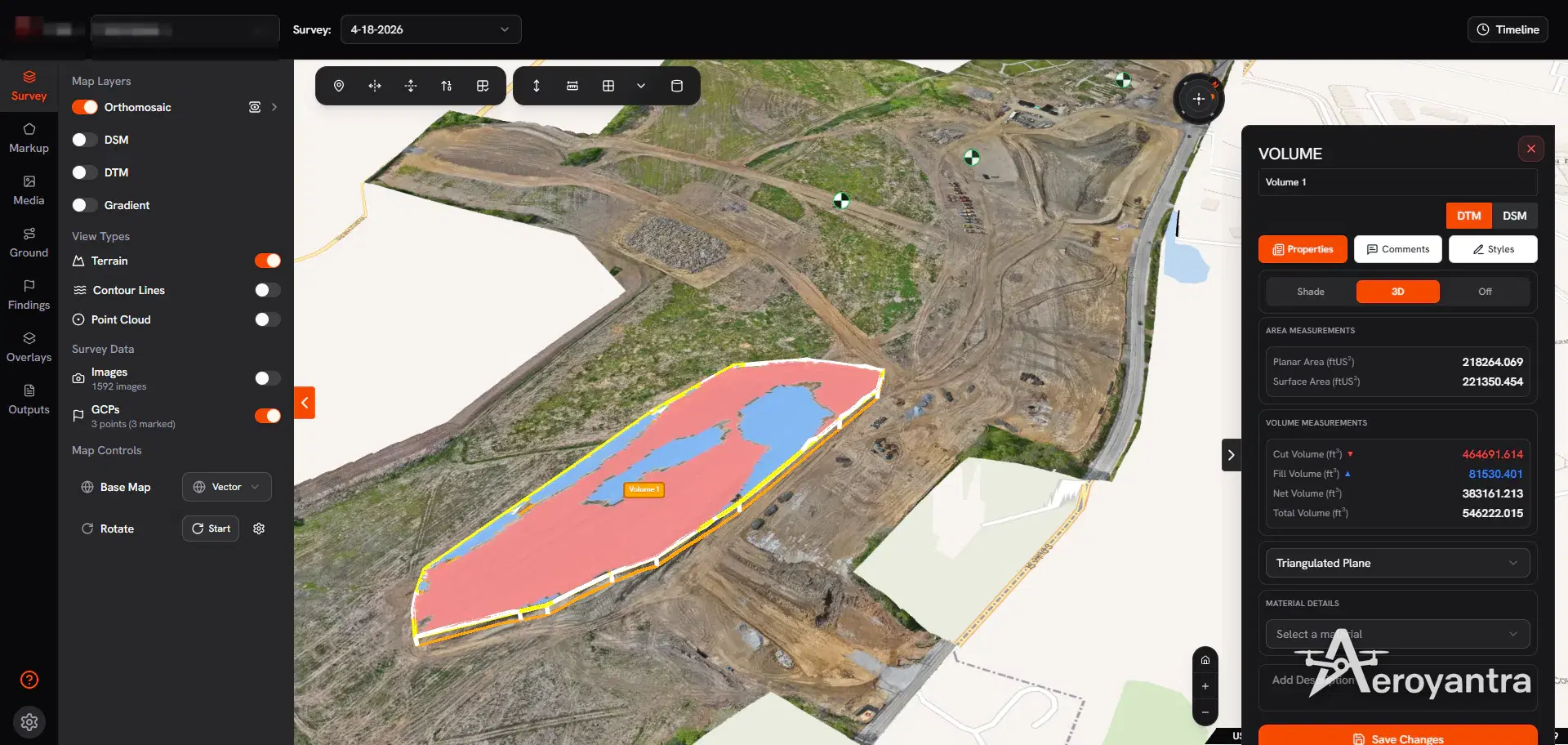
Clients rarely buy a flight. They buy an answer: how much material moved, how much stone is in the pile, whether the pad matches the plan, what the ground looks like before design.
| Market | The client's question | Deliverables | How often |
|---|---|---|---|
| Construction - GCs, earthwork subs, developers | How far along are we, and how much was cut and filled? | Orthomosaic, cut/fill volumes, date-to-date comparison, findings | Recurring, tied to pay applications |
| Aggregates and quarries | How much material is on the ground? | Stockpile volumes with material mass | Recurring, at inventory dates |
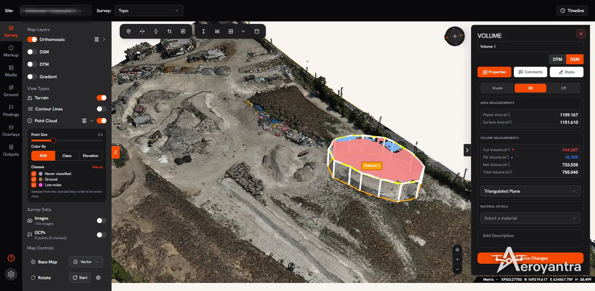
| Civil engineers and land developers | What does the site look like before design? | DSM, DTM, contours, cross-sections, DXF and LAZ | Per project |
| Roofs, facades and assets | Where are the defects? | Textured 3D model, measurements, findings | Per project or periodic |
| Agriculture | Where is the crop stressed? | NDVI and NDRE maps, thermal maps | Through the season |
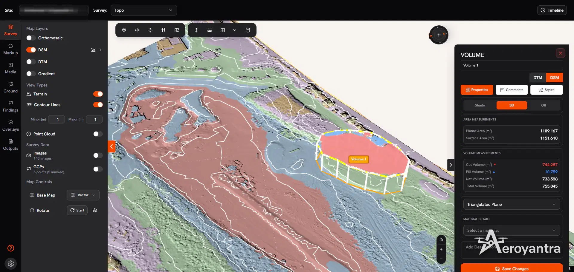
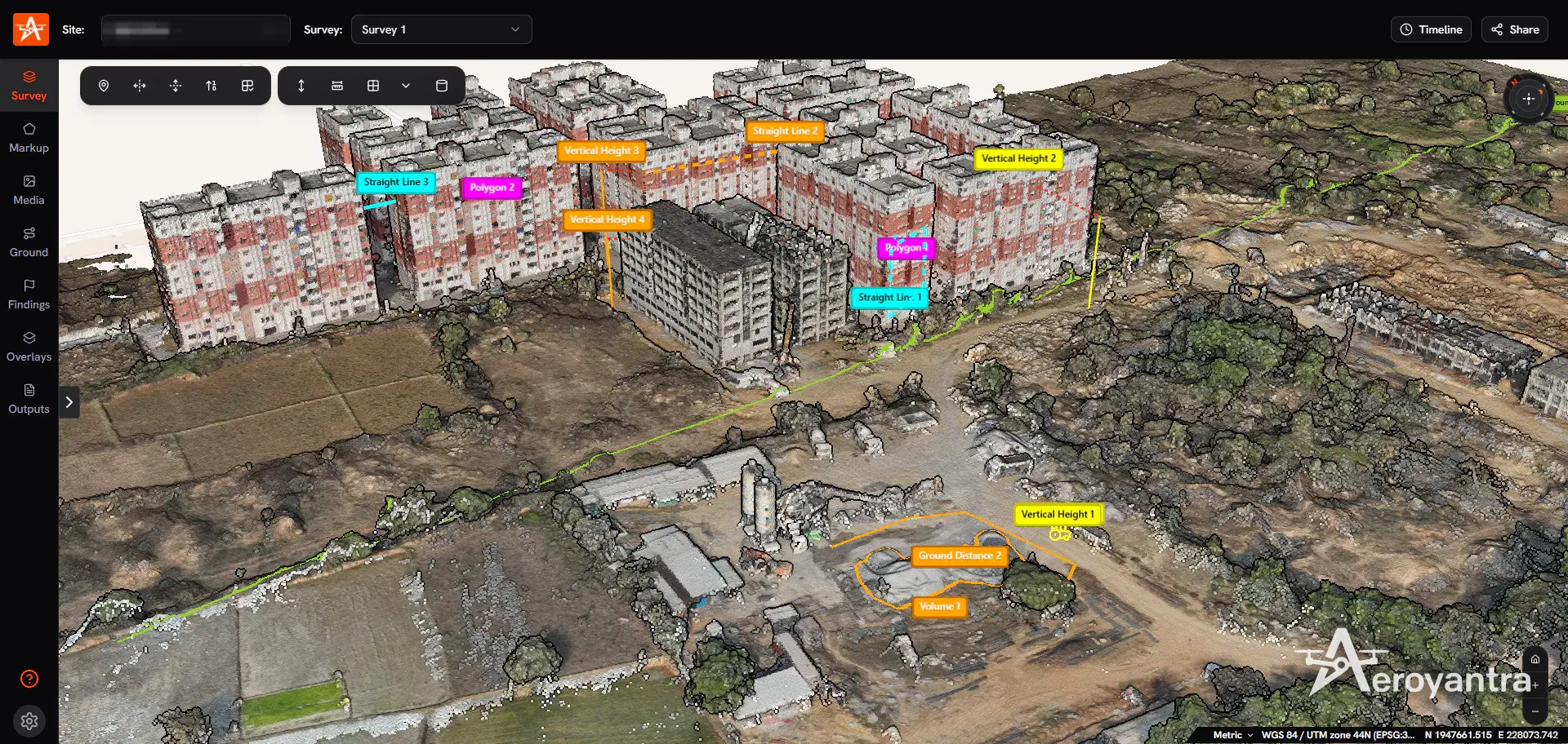
Aeroyantra produces all of these from geotagged drone photos - the drone mapping overview explains each output, and the platform feature list shows the measurement tools.
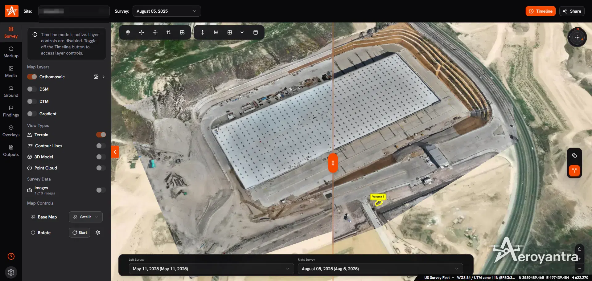
The markets are not equal for a new business. Construction and aggregates repeat: the same site needs a new map every pay period or inventory date - see how earthwork and stockpile volumes are measured. Topographic maps are one-off jobs, while roof and facade inspection and agriculture are event-driven or seasonal. On construction contracts you can add 360 site walkthroughs so the client sees inside the building too. Pick one primary market for the first year, and pitch the client's question ("month-end stockpile inventory"), not a list of outputs.
The Legal Floor: Part 107, Registration and Remote ID
Commercial drone flying in the US falls under the FAA's Small UAS Rule, 14 CFR Part 107:
- Remote pilot certificate. You must be at least 16, able to read, speak, write and understand English, and pass the "Unmanned Aircraft General - Small (UAG)" knowledge test at an FAA-approved testing center. The FAA says testing centers charge approximately $175. You apply in IACRA on FAA Form 8710-13 and get a temporary certificate once the TSA security background check clears.
- Recurrent training. Due every 24 calendar months (14 CFR 107.65), through a free online course on the FAA Safety Team (FAASTeam) site.
- Registration. Each drone flown under Part 107 is registered individually on FAADroneZone: $5 per drone, valid for three years (14 CFR 48.30 and 48.100).
- Remote ID. Required since September 16, 2023 (14 CFR 89.105). Comply with a standard Remote ID drone or a broadcast module; the third option, flying inside an FAA-Recognized Identification Area, rarely fits a client site.
- Airspace. Class B, C and D airspace, and the surface area of Class E airspace at an airport, need prior ATC authorization (14 CFR 107.41); the FAA's LAANC system approves many requests in near real time. Altitude is capped at 400 feet above ground level (14 CFR 107.51) - the GSD calculator shows what that means for your camera.
Fees are as published by the FAA at the time of writing. Testing prices are set by the provider and can change, so confirm when you book.
Drone mapping certification: what you legally need
The full certification path for a commercial mapping pilot, in the order you will actually do it.
Where Mapping Ends and Licensed Surveying Begins
Part 107 makes you a legal pilot, not a surveyor. Land surveying is licensed state by state, and some definitions are broad enough to cover drone photogrammetry.
North Carolina is the clearest case. Its surveying act (N.C. Gen. Stat. § 89C-3(7)) includes "determining the configuration or contour of the earth's surface" by "applying the principles of mathematics or photogrammetry". When the state board told a drone operator who advertised orthomosaic maps that he was practicing land surveying without a license, he sued. In 360 Virtual Drone Services LLC v. Ritter (May 20, 2024), the Fourth Circuit sided with the board: selling two- or three-dimensional maps or models of land that contain measurable data, without a license or a licensed surveyor's supervision, is conduct the state can regulate. The US Supreme Court declined to hear the appeal in April 2026.
Other states draw the line elsewhere, so read your own board's rules before you publish a price list:
| Work | Where it usually sits | What to do |
|---|---|---|
| Aerial photos and video with no measurable data | Generally outside surveying | Sell it |
| Orthomosaics, volumes, contours or 3D models with measurable data | State-dependent - the North Carolina case sits here | Check with your board; state intended use in every proposal |
| Property lines, boundaries, easements, anything stamped | Land surveying | A licensed professional land surveyor (PLS) must be in responsible charge |
The usual way through is a partnership. Survey firms need flight and processing capacity; you need a PLS who sets control, reviews the data and signs. Structure matters: North Carolina exempts unlicensed people only when they work "as an employee or assistant under the responsible charge" of a licensed surveyor.
Three habits help. Keep "survey" out of your business name unless you are licensed - North Carolina's act also reaches firms using "land surveyor" or "land surveying" in their name. Write intended use into every proposal ("for progress tracking and quantity estimates, not boundary determination"). And ask your board in writing when a job sits in the gray zone. This guide is not legal advice.
Insurance: What Clients Will Ask For
Expect the insurance question before the price question. General contractors and site owners usually want a certificate of insurance before you go on site, often naming them as an additional insured.
- Drone liability - third-party injury and property damage. This is the policy clients ask to see; confirm it explicitly covers unmanned aircraft.
- Hull and equipment - damage to the drone, camera and GNSS gear.
- Professional liability (errors and omissions) - matters once clients pay subcontractors or design grading from your numbers.
Required limits vary by contract, so read the insurance clause before you quote - a higher limit is a cost that belongs in your price. Premiums depend on your state, aircraft, limits and claims history; get quotes from aviation-specialist brokers.
Equipment: The Drone and How You Get Accuracy
Any drone that writes geotagged images can produce a map; a mechanical shutter and a 20 MP or larger sensor make cleaner ones. Aeroyantra processes data from the DJI Mavic 3 Enterprise and Matrice 350 RTK through to fixed-wings like the WingtraOne - the supported drones and cameras guide has the full list. New to flight planning? Start with the beginner's guide to drone mapping.
Absolute accuracy - where the map sits on the earth - depends on how you georeference it:
| Method | Field effort | Use it for |
|---|---|---|
| Drone GNSS only | Lowest | Visual progress records, marketing imagery |
| Ground control points (GCPs) | Targets set and measured before each flight | Volumes, topographic work, comparison with design |
| RTK or PPK | Base station or correction service | Larger sites with fewer targets |
| RTK/PPK plus GCPs and check points | Highest | Survey-grade work a PLS will sign |
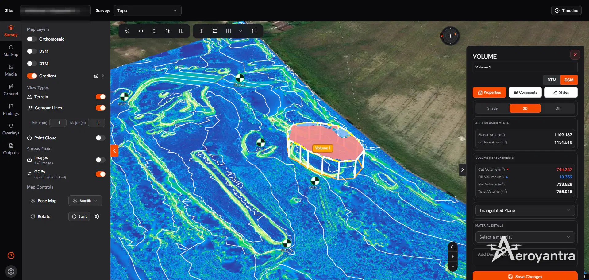
With RTK or PPK georeferencing and properly deployed ground control, Aeroyantra achieves 2-3 cm horizontal accuracy. Aeroyantra also processes RTK datasets without GCPs and still reports residuals against check points, and its GCP quality report gives RMSE in X, Y and Z as PDF or CSV - the page a client or partner surveyor actually reads. See RTK, PPK and GCP workflows and GCP placement for survey-grade accuracy. If a job needs measured control and you do not own a GNSS rover, your PLS partner can set it.
Software: What Processing Costs Per Job
Seat licenses and workstations are fixed costs - you pay them in the months you do not fly too.
| Software | Published price | Pricing model |
|---|---|---|
| DroneDeploy | $329-$499 per seat per month | Per seat, billed annually |
| Pix4Dmapper | ~$4,990 | Perpetual; desktop needs a $2,000-$5,000 GPU workstation |
| Pix4Dcloud | $49-$249 per month | Subscription |
| Agisoft Metashape Professional | $3,499 | One-time, plus a workstation |
| WebODM | Free | Open source; production workstation $5,000-$10,000 |
| Aeroyantra Basic | $0 per month, $2.50 per credit | Pay per use, 1 user |
| Aeroyantra Professional | $69 per month, 40 credits included | 3 users, volumetrics, cut/fill, timeline, full DXF/LAS/PDF exports |
On Aeroyantra, 1 credit is 1 gigapixel processed. A 400-image map from a 20 MP camera is 8 gigapixels: 8 credits, or $20 - $13.36 at the $1.67 bulk rate for 500+ credits. High-density, thermal and multispectral processing count 2x, and each image is billed at no more than 30 MP. Most projects up to 500 images finish in 2-4 hours.
For a new business, the cost follows the work: a slow month costs nothing, and you know each job's processing cost before you quote. One caveat - volumetrics, cut/fill and timeline comparison are on Professional, so budget $69 a month if you sell volumes. Clients open results through unlimited view-only share links with no account. More on 3D mapping and point clouds, topographic survey software, pricing (Basic keeps data 60 days) and the true cost of drone mapping software.
Best drone mapping software for 2026, by real cost
Five tools compared on what a working operator actually pays - licenses, seats, hardware and per-job processing.
How to Price Drone Mapping Services
This guide does not quote market rates: published averages rarely say what site size, accuracy or deliverables they assume. Build each price from your own costs:
Price = (field hours + office hours) x your hourly cost + direct costs + contingency + margin
| Line | What goes in it |
|---|---|
| Mobilization and travel | Drive time, mileage, overnight stays - repeated every visit |
| Site setup | Airspace authorization, site induction, GCP layout and measurement |
| Flight | Batteries at your target GSD, plus a re-fly allowance for weather |
| Processing | Credits x rate: 400 images at 20 MP = $20 on Basic, double for high-density |
| QA and reporting | GCP residuals, volume base planes, findings, PDF report, client call - the most underestimated line |
| Overhead share | Insurance, drone replacement, software plan, training - annual cost divided by expected jobs |
| Margin | Profit after you have paid yourself |
A worked example: a monthly stockpile inventory at one quarry, 400 images per visit. Processing is $20 a visit at the Basic rate, and on Professional the 40 included credits cover five sites like it each month. Processing is the smallest line on that invoice; your time is the largest, so price that first.
For repeat clients, quote per visit with a fixed deliverable list, or a monthly retainer with a weather clause, and price extras such as cross-sections or NDVI as add-ons. To sanity-check, ask survey firms what they pay subcontractors.
Finding Your First Clients and Recurring Contracts
Build a portfolio you own. Fly a site you have permission to fly and produce the exact deliverable you plan to sell. Send prospects a share link, not a PDF - they open the map in a browser without an account. Aeroyantra's 14-day free trial needs no credit card.
Sell the series, not the flight. One map shows one day; the value is the comparison. Aeroyantra's timeline shows two survey dates in split-screen or blend mode, and the Compare Survey base plane measures volume change between them.
Go where the cadence already exists: general contractors and earthwork subs billing monthly progress, aggregate yards counting inventory, developers grading pads, and survey firms that need flight capacity.
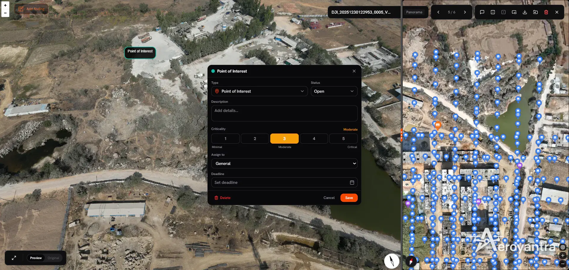
Package by audience. A project manager wants a share link and findings with severity, assignee and deadline. An estimator wants volumes in CSV or PDF. An engineer wants DXF contours and a LAZ point cloud.
Use proof from operators like you. Angel Wings Drone Services launched in 2025 as a one-person business in Hood River, Oregon, serving surveying firms, forestry operations, watershed groups and fisheries. When checkpoint errors on the owner's previous DroneDeploy setup came back above client tolerance, she tested alternatives, combined ground control with PPK-corrected image positions, moved processing to Aeroyantra, and now leads with accuracy when quoting.
A 30/60/90-Day Launch Plan
Days 1-30: legal and setup
- Pass the UAG knowledge test and apply for your remote pilot certificate in IACRA
- Register each drone ($5, valid three years) and confirm Remote ID
- Read your state surveying board's rules; list what you will and will not sell
- Get liability, hull and professional liability quotes; set up the entity and bookkeeping
- Open an Aeroyantra account ($0 Basic or the 14-day trial) and process practice datasets
Days 31-60: portfolio and workflow
- Fly sample sites, at least one with GCPs and check points
- Produce your market's deliverables and a sample report
- Build a costing sheet from the table above with your real times
- Write proposal templates with scope, intended use and accuracy statements
- Approach local survey and engineering firms about partner work
Days 61-90: recurring work
- Pitch contractors, aggregate yards and developers with your share-link portfolio
- Quote a series - per pay period or per month - not a single flight
- Ask your first recurring client for a referral and a case study
- Review your plan: above about 28 credits a month, the 40 credits in the $69 Professional plan cost less than buying them at $2.50 each on Basic - and you need Professional anyway to sell volumes
Frequently Asked Questions
Is a drone mapping business profitable?
It can be, and the most predictable profit comes from recurring work: construction sites and aggregate yards that need a new map on a fixed schedule. Keep fixed costs low while volume is uncertain. Aeroyantra has no seat licenses and its Basic plan is $0 a month, so a 400-image map costs $20 of processing, and only when you have a job to bill. Your own time is the largest cost, so price it first.
Do I need a surveyor's license to do drone mapping?
It depends on your state and on what you sell. In 360 Virtual Drone Services v. Ritter (2024), the Fourth Circuit upheld North Carolina's position that selling maps or 3D models of land with measurable data, without a license or a licensed surveyor's supervision, is regulated surveying. Boundary and property-line work belongs to a licensed professional land surveyor. Check your state board's rules and partner with a PLS where needed.
What license do I need to start a drone mapping business?
An FAA Part 107 remote pilot certificate, earned by passing the Unmanned Aircraft General - Small knowledge test; the FAA says testing centers charge approximately $175. Each drone must be registered for $5, valid for three years, and must meet Remote ID. Recurrent training is due every 24 calendar months and is free online. Some states also treat measurable mapping deliverables as surveying.
How much does drone mapping software cost for a small business?
DroneDeploy is $329-$499 per seat per month billed annually, and Agisoft Metashape Professional is $3,499 one-time plus a workstation. Aeroyantra's Basic plan is $0 a month at $2.50 per credit, and a 400-image map at 20 MP uses 8 credits, or $20. Aeroyantra Professional is $69 a month with 40 credits included, plus volumetrics, cut/fill and timeline comparison.
What drone do I need to start a drone mapping business?
Any drone that writes geotagged photos can produce a map; a mechanical shutter and a 20 MP or larger sensor help. Common choices include the DJI Mavic 3 Enterprise, Phantom 4 RTK, Matrice 350 RTK with a Zenmuse P1, and the fixed-wing WingtraOne. RTK or PPK improves absolute accuracy but is not mandatory, and Aeroyantra processes all of them and reports GCP and check point residuals.
How do I price drone mapping services?
Build each quote from your own costs: travel, field time including ground control, processing, QA and reporting time, a share of insurance and equipment, then margin. Processing is usually the smallest line; on Aeroyantra a 400-image map at 20 MP costs $20. For recurring sites, quote a fixed price per visit or per month with a defined deliverable list.
Keep exploring
Related services, platform features and guides
- ArticleDrone Mapping Certification: What You Legally NeedThere is no single drone mapping certification. US pilots need a Part 107 certificate (about $175 test), $5 drone registration and Remote ID. Full guide.Read more
- ArticleBest Software for Drone Mapping 2026: 5 Tools by Real CostThe best software for drone mapping in 2026, by real cost: Aeroyantra from $0 at $2.50/credit, Pix4D $49-$4,990+, DroneDeploy $329-$499 per seat/month.Read more
- ArticleDrone Survey Case Study: Angel Wings Drone ServicesHow Angel Wings Drone Services left DroneDeploy and reached under 1 cm checkpoint error with GCP + PPK processing on Aeroyantra in Hood River, Oregon.Read more
- Platform featureRTK Drone Mapping: RTK vs PPK vs GCP Accuracy GuideHow RTK, PPK and ground control set drone mapping accuracy, when you still need GCPs, and how Aeroyantra reports check-point RMSE. From $2.50 per credit.Read more
- Technical guideSupported Drones and Cameras for Drone MappingEvery drone and camera that works with Aeroyantra, from Mavic 3 Enterprise to WingtraOne, with sensor size and processing credits per 1,000 images.Read more
- GuideDrone Mapping: How It Works, Outputs, Software and CostWhat drone mapping is, how photos become orthomosaics, DSM/DTM, contours and 3D models, which drones and software to use, and what it costs in 2026.Read more
Related Articles
Explore more insights and stories from our blog
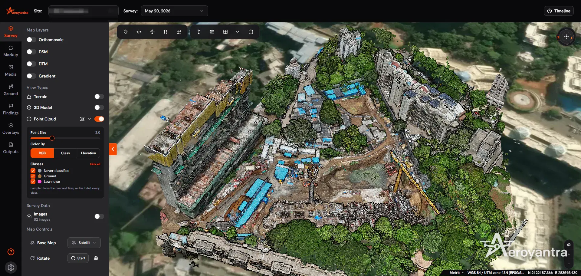
Best Software for Drone Mapping 2026: 5 Tools by Real Cost
The best software for drone mapping in 2026, by real cost: Aeroyantra from $0 at $2.50/credit, Pix4D $49-$4,990+, DroneDeploy $329-$499 per seat/month.
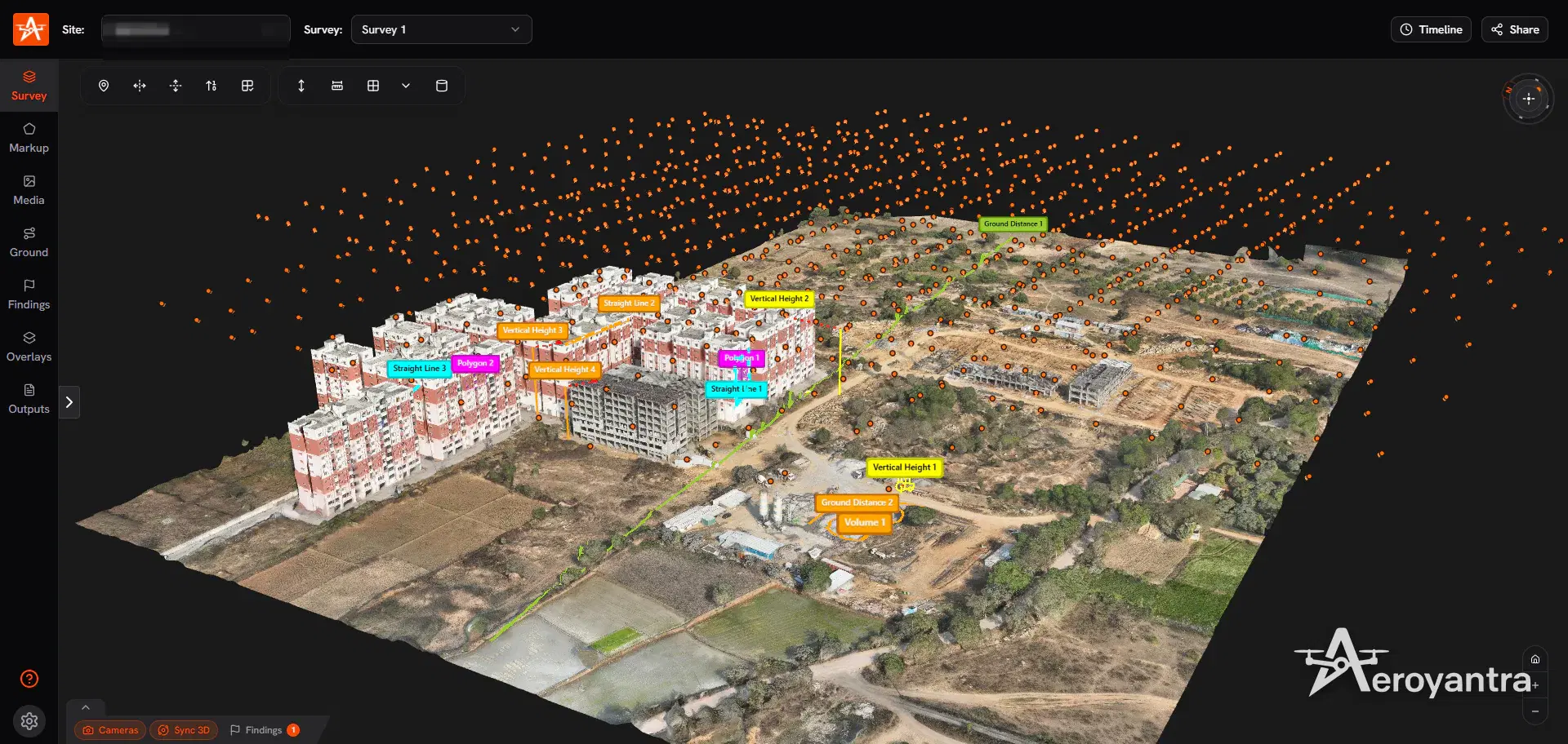
Drone Mapping Certification: What You Legally Need
There is no single drone mapping certification. US pilots need a Part 107 certificate (about $175 test), $5 drone registration and Remote ID. Full guide.
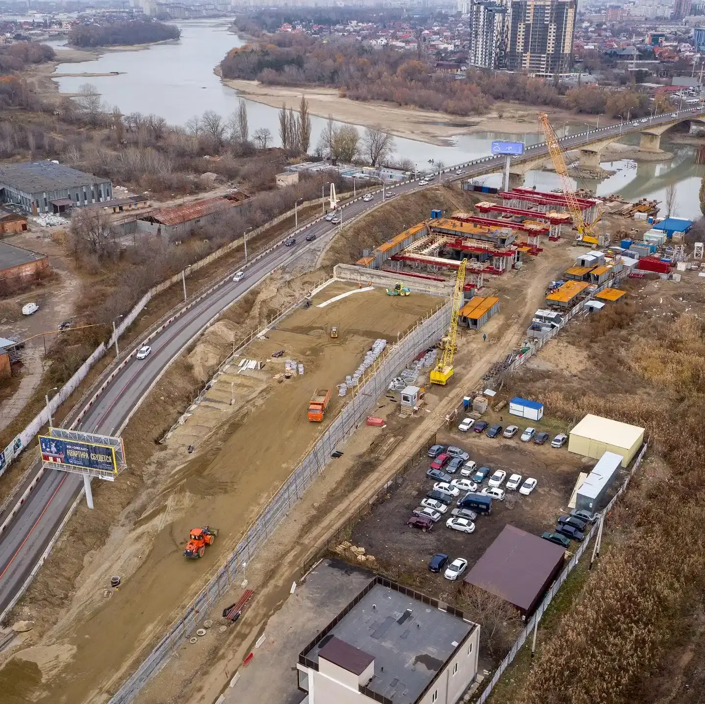
Drone Roof & Facade Inspection: Software, Costs & Workflow 2026
Drone roof inspection software costs $0-$499/seat/month. Aeroyantra is pay-per-use at $2.50/credit. Full workflow, from flight plan to the client report.