DGPS Survey Services in India | GNSS Ground Control
DGPS survey services across India: GNSS control points, GCPs and check points, boundary coordinates and monographs for drone, LiDAR and engineering surveys.
DGPS Survey Services in India | GNSS Ground Control
DGPS survey services across India: GNSS control points, GCPs and check points, boundary coordinates and monographs for drone, LiDAR and engineering surveys.
Table Of Content

By Vishal Singh Dhami, Co-Founder & Director
7 min read · Updated
DGPS surveys are quoted on point count, site spread and access, with a written quote within 2 hours. For reference, complete drone surveys in India start around ₹35,000 for a site up to 1 acre (market rates).
DGPS Survey Services Across India
Every survey-grade map, drawing and volume report rests on a handful of points whose coordinates are known precisely. A DGPS survey fixes those points. Aeroyantra's India survey teams run DGPS surveys for control networks, drone survey ground control, land and boundary coordinates, and corridor control for roads and railways - as a standalone job or alongside a drone aerial survey, so the ground control and the drone data share one datum.
You receive coordinates in your project coordinate system, monographs for every control point, and a QA record that shows how well the points check against each other.
What Is a DGPS Survey?
DGPS stands for differential GPS - in practice, differential GNSS, using GPS and the other satellite constellations. Two receivers work together:
- A base station sits over a point with known coordinates and measures how far the satellite positions are off at that moment.
- A rover occupies each new point, and the base's corrections are applied to it.
A handheld GPS has metre-level error. Applying differential corrections brings positions to centimetre level, which is what control networks, drone survey ground control and engineering setting-out need.
There are two common ways to run it:
- Static (post-processed) DGPS - both receivers log data for a period, and the baseline between them is processed afterwards. Used for primary control and long baselines.
- RTK - corrections stream to the rover live by radio or network, so coordinates are available in the field. Used for detail points, GCPs and stake-out where coverage is reliable.
DGPS vs Other Positioning Methods
| Method | Typical accuracy class | Best for |
|---|---|---|
| Handheld GPS | Metre-level | Reconnaissance, rough locations |
| DGPS (static or RTK) | Centimetre-level | Control networks, GCPs, boundary coordinates |
| Total station | Millimetre to centimetre, relative to control | Setting out, structural detail, confined areas |
| RTK/PPK drone | Centimetre-level per photo position | Mapping large areas fast; still checked against DGPS points |
The methods work together. DGPS establishes the control; the total station and the drone survey hang off it. The drone survey vs total station comparison shows how they divide the work on a project.
When You Need a DGPS Survey
- Ground control for drone and LiDAR surveys. GCPs and independent check points tie the drone data to real coordinates and prove its accuracy. See the GCP placement guide.
- Site control networks for construction. A set of fixed, documented points that every contractor and every survey on the project works from.
- Land and boundary coordinates. Plot corners, layout points and boundary pillars fixed in a known coordinate system for land and property surveys.
- Road and railway corridors. Control along the alignment with monographs, as required for road and railway DPR and construction surveys.
- Mining leases. Control for repeat volumetric and compliance surveys on mine sites.
- Benchmark and datum transfer. Carrying a known coordinate or level onto a new site so new work matches existing drawings.
- Topographic surveys. Control and spot levels for topographic surveys.
DGPS and Drone Surveys: One Datum
DGPS control and drone surveys are usually run together. The workflow ties them into one dataset:
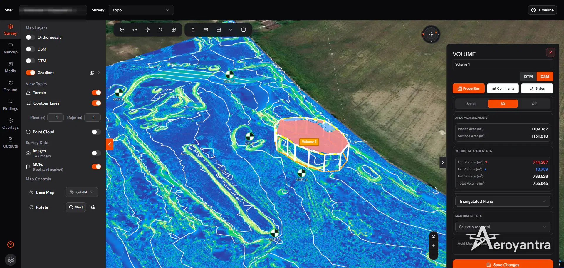
- DGPS fixes the GCPs and check points, in the project coordinate system.
- The drone flies with the targets in view, with RTK or PPK where the drone supports it.
- The control is imported into the Aeroyantra platform from CSV and marked on the photos.
- Processing uses the GCPs; the check points are withheld and their residuals are reported, so the accuracy is measured rather than claimed.
With RTK or PPK georeferencing and properly deployed DGPS ground control, Aeroyantra achieves 2-3 cm horizontal accuracy on drone surveys. The RTK vs PPK vs GCP guide explains how the georeferencing methods compare.
What You Receive
- Coordinate list of every point (CSV and spreadsheet), with easting, northing and elevation in your project coordinate system - for example WGS 84 / UTM, or a local site grid
- Control point monographs - coordinates, description, photographs and access notes, so any later survey can reoccupy the point
- QA record - closure and check results so the control can be audited
- CAD and GIS files - points as DXF and KML for drawings and maps
- Drone survey integration - when the DGPS supports a drone survey, the control is applied in processing and the check point report is included with the deliverables
DGPS for Land and Boundary Work
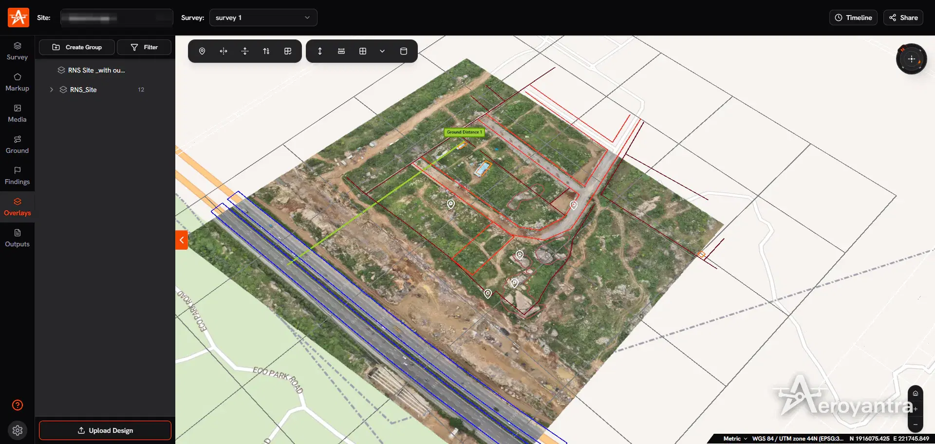
Land buyers in India usually want to know one thing: does the plot on the ground match the plot on paper? DGPS fixes the boundary and corner coordinates; a drone orthomosaic shows the ground; and the khasra map, layout plan or CAD drawing overlaid on that orthomosaic shows where they agree and where they do not. Aeroyantra's platform takes overlays as DXF, Shapefile, KML, GeoJSON or PDF.
How a DGPS Survey Works
- Requirement. Number and purpose of points, the coordinate system, and any existing benchmark to connect to. Aeroyantra quotes in writing within 2 hours.
- Reconnaissance and point selection. Imagery review and a site visit to choose stable, open-sky locations for each point.
- Base setup. The base station is set over a known point or benchmark, or a new reference is established.
- Observation. Static sessions for primary control, RTK for detail points and GCPs.
- Processing and checks. Baselines are processed and the points checked against each other and against any independent control.
- Deliverables. Coordinate list, monographs, QA record and CAD/GIS files, plus the drone survey outputs when the jobs are combined.
Where Aeroyantra Runs DGPS Surveys
Aeroyantra mobilises DGPS and drone survey teams pan-India. See drone survey locations for city pages, or share your site through the contact page.
Aerial Survey Services in India
Photogrammetry and LiDAR aerial surveys controlled with DGPS ground control: photogrammetry in 24-48 hours, LiDAR in 48-72.
Frequently Asked Questions
What is a DGPS survey?
A DGPS (differential GPS) survey fixes the coordinates of points on the ground using two GNSS receivers: a base station over a known point and a rover over each new point. The base measures the satellite errors and those corrections are applied to the rover, bringing positions from the metre-level error of a handheld GPS to centimetre level. Aeroyantra runs DGPS surveys across India for control networks, drone survey GCPs and boundary coordinates.
What is the difference between DGPS and RTK?
RTK is a form of differential GNSS in which the corrections reach the rover live over a radio or network link, so coordinates are available in the field. A static DGPS survey records data at the base and rover and processes it afterwards, which suits long baselines and control points that need the highest confidence. Aeroyantra uses the method that suits the accuracy and site conditions.
Do I need a DGPS survey for a drone survey?
If the drone survey must match real-world coordinates to a few centimetres, yes: ground control points and check points are surveyed with DGPS so the drone data can be tied to them and its accuracy proven. With RTK or PPK georeferencing and DGPS ground control, Aeroyantra achieves 2-3 cm horizontal accuracy on drone surveys.
How much does a DGPS survey cost in India?
The cost depends on the number of points, how spread out the site is, access, and whether the points must connect to an existing benchmark. Aeroyantra quotes each DGPS survey in writing within 2 hours of receiving the site location and point requirement. When DGPS control is part of a drone survey, it is scoped with the survey; complete drone surveys in India start around ₹35,000 for a site up to 1 acre at market rates.
What is a control point monograph?
A monograph is the record of a surveyed control point: its coordinates and elevation, the coordinate system, a description and photographs of the marker, and directions to find it again. Aeroyantra prepares monographs so that later surveys, contractors and authorities can reoccupy the same points.
Keep exploring
Related services, platform features and guides
- GuideAerial Survey Services in India | Drone Aerial MappingAerial survey and mapping across India by DGCA-certified drone teams: photogrammetry deliverables in 24-48 hours and LiDAR in 48-72 hours.Read more
- Survey serviceLand SurveyBoundary mapping & area calculationRead more
- Survey serviceTopographic SurveyTerrain mapping with survey-grade accuracyRead more
- Technical guideGCP Placement Guide for Survey-Grade AccuracyUse 5-10 ground control points: one near each corner, one central, spread in elevation. Keep a third as check points for 2-3 cm horizontal accuracy.Read more
- Platform featureRTK Drone Mapping: RTK vs PPK vs GCP Accuracy GuideHow RTK, PPK and ground control set drone mapping accuracy, when you still need GCPs, and how Aeroyantra reports check-point RMSE. From $2.50 per credit.Read more
- LocationsDrone Survey Locations in IndiaCity and state pages for Aeroyantra drone survey teams across India.Read more