Aerial Survey Services in India | Drone Aerial Mapping
Aerial survey and mapping across India by DGCA-certified drone teams: photogrammetry deliverables in 24-48 hours and LiDAR in 48-72 hours.
Aerial Survey Services in India | Drone Aerial Mapping
Aerial survey and mapping across India by DGCA-certified drone teams: photogrammetry deliverables in 24-48 hours and LiDAR in 48-72 hours.
Table Of Content
- Aerial Survey Services Across India - From One Flight to Survey-Grade Data
- What Is an Aerial Survey?
- Aerial Survey Methods: Photogrammetry, LiDAR, Multispectral and Thermal
- What an Aerial Survey Delivers
- Choosing a Drone for Aerial Mapping
- Aerial Survey Accuracy: GCPs, RTK, PPK and DGPS Control
- Aerial Survey vs Ground Survey
- Aerial Survey Applications in India
- How an Aeroyantra Aerial Survey Works
- Aerial Survey Cost in India
- Where Aeroyantra Flies
- Frequently Asked Questions

By Vishal Singh Dhami, Co-Founder & Director
11 min read · Updated
Typical Indian market rates for a drone aerial survey: ₹35,000 for a site up to 1 acre, ₹400 per acre at 100-500 acres and ₹300 per acre above 500 acres. Aeroyantra sends a written quote within 2 hours.
Aerial Survey Services Across India - From One Flight to Survey-Grade Data
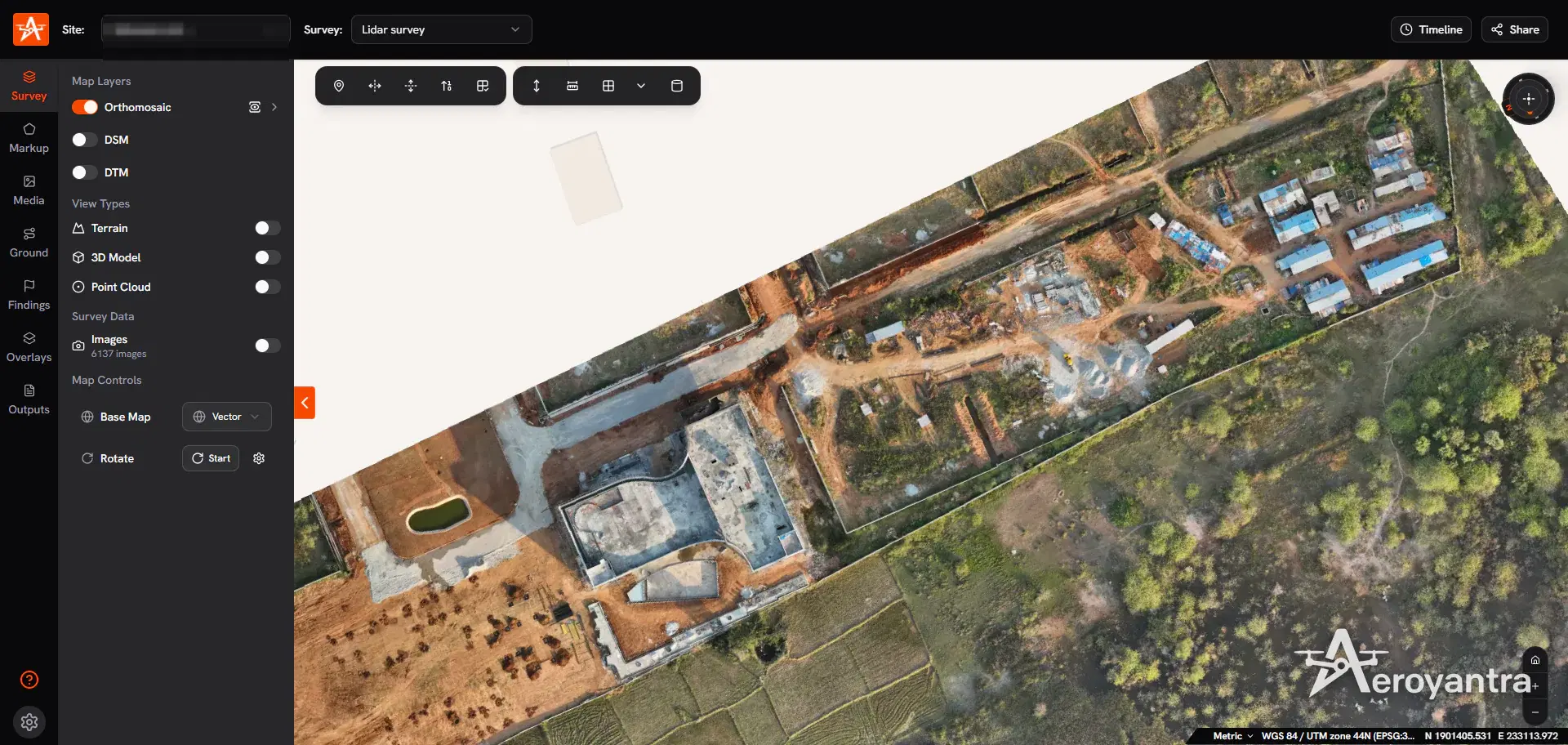
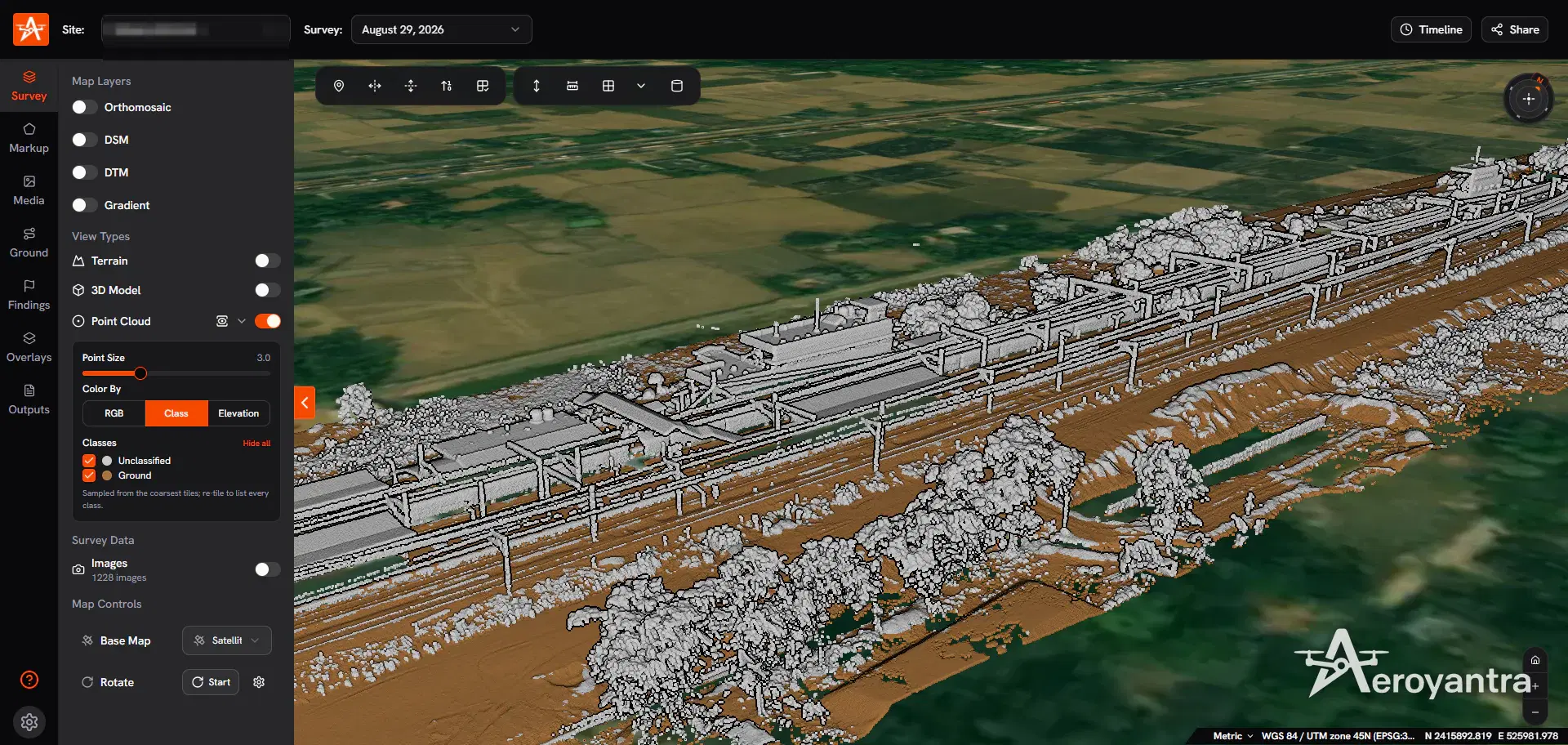
An aerial survey replaces days of ground measurement with one planned flight. A survey drone captures thousands of overlapping images or LiDAR returns, and processing turns them into georeferenced maps that engineers can measure from: an orthomosaic, a digital surface model (DSM), a bare-earth digital terrain model (DTM), contours, point clouds and volumes.
Aeroyantra runs aerial surveys across India with DGCA-certified pilots, and processes every dataset on its own photogrammetry engine. Photogrammetry deliverables arrive within 24-48 hours of the flight and LiDAR within 48-72 hours, in your required formats and coordinate system, together with a browser link where your team can measure, compare and share the site without installing software.
This page explains the methods, the deliverables, the accuracy you can expect and what an aerial survey costs in India, so you can scope the job before you ask for a quote.
What Is an Aerial Survey?
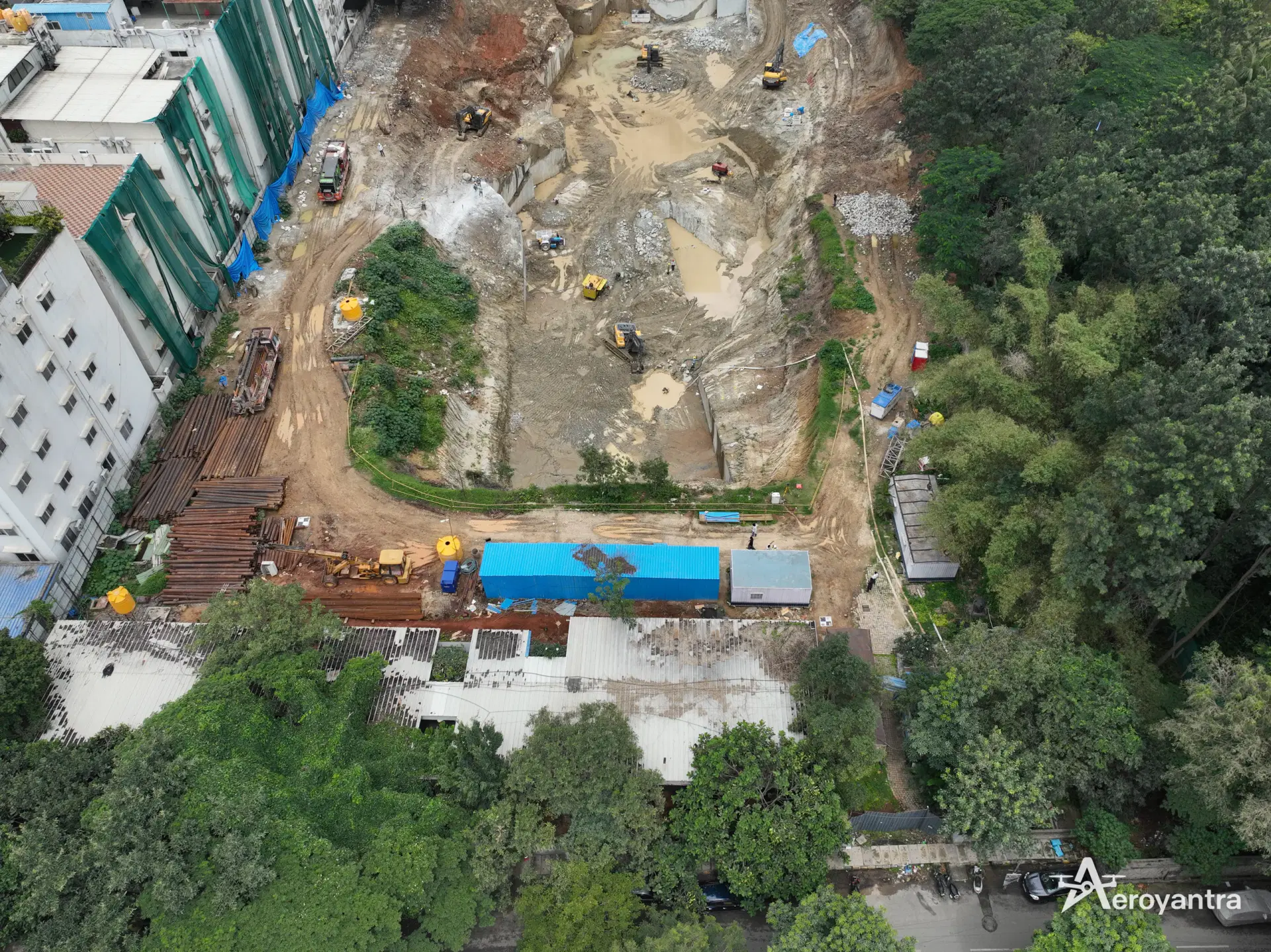
An aerial survey measures the ground from the air instead of walking it. An aerial drone survey - also called aerial drone surveying, or aerial surveying and mapping - means mapping with drones: a survey drone flies the grid, and photogrammetry or LiDAR processing turns the data into maps and 3D models. Three platforms do this work:
| Platform | Typical coverage | Ground detail | Where it fits |
|---|---|---|---|
| Survey drone (UAV) | A single plot to a few thousand acres, or long corridors | Centimetre-level | Construction, mining, land, roads, utilities |
| Manned aircraft | District and state scale | Coarser than a drone | Regional mapping programmes |
| Satellite | Regional to national | Coarser still, cloud-dependent | Land-use change, early planning |
For project sites in India, the drone is the practical choice. It flies below cloud, mobilises in a day, captures detail fine enough for grade checks and volume reconciliation, and can repeat the same flight every week so surveys can be compared like for like.
Aerial survey or aerial mapping? The terms overlap. "Aerial survey" usually means measured, survey-grade work controlled with ground control points (GCPs) or RTK, with a stated accuracy. "Aerial mapping" is the broader act of producing maps from the air. A good aerial survey delivers both from the same flight.
Aerial Survey Methods: Photogrammetry, LiDAR, Multispectral and Thermal
The sensor decides what the survey can see. Aeroyantra selects it from the site conditions and the deliverables you need.
| Method | What the drone captures | Best for | Main outputs |
|---|---|---|---|
| Photogrammetry | Overlapping RGB photographs (70-80% forward, 60-70% side overlap) | Open terrain, construction, stockpiles, land parcels | Orthomosaic, DSM, DTM, contours, point cloud, 3D model |
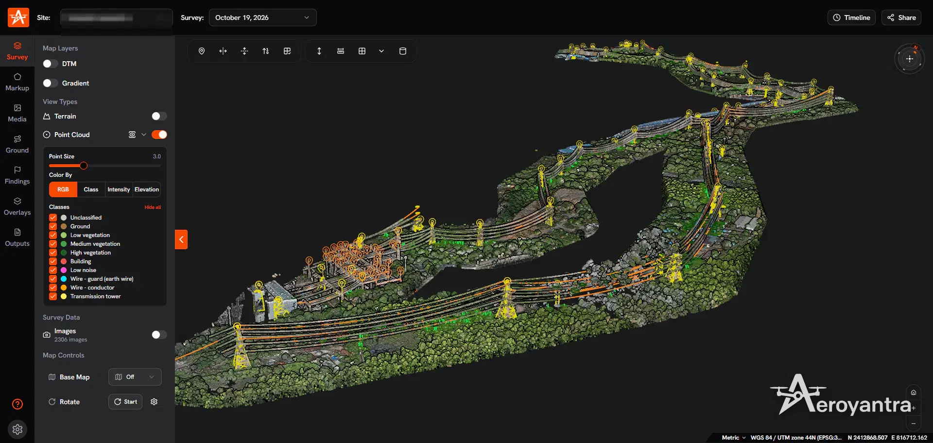
| LiDAR | Laser returns, several per pulse | Vegetated land, corridors, powerlines, hilly terrain | Classified point cloud, bare-earth DTM, contours, profiles |
| Multispectral | Narrow spectral bands | Crop health, plantations | NDVI and NDRE maps |
| Thermal | Surface temperature | Solar plants, industrial assets | Thermal orthomosaic, temperature heatmap |
Photogrammetry is the right default on open sites. It is cheaper and gives you a true-colour map that everyone on the project can read. LiDAR is the right call where the ground is hidden: under tree canopy, scrub, crops or dense vegetation, because laser pulses reach the ground between the leaves. Our LiDAR vs photogrammetry comparison covers the trade-offs in detail, and the LiDAR survey service page covers corridor and terrain work.
What an Aerial Survey Delivers
Every Aeroyantra aerial survey is processed into engineering-ready files, not just pictures - drone mapping and modeling in one delivery: 2D maps for planning and 3D models for measurement. A standard photogrammetry survey includes:
- Orthomosaic (GeoTIFF) - a distortion-free, measurable aerial map of the whole site
- Digital Surface Model (DSM) - elevation of everything the drone sees, including structures and trees
- Digital Terrain Model (DTM) - the bare-earth surface, for design, drainage and earthwork
- Contours at the interval your drawings need, on the DSM or DTM
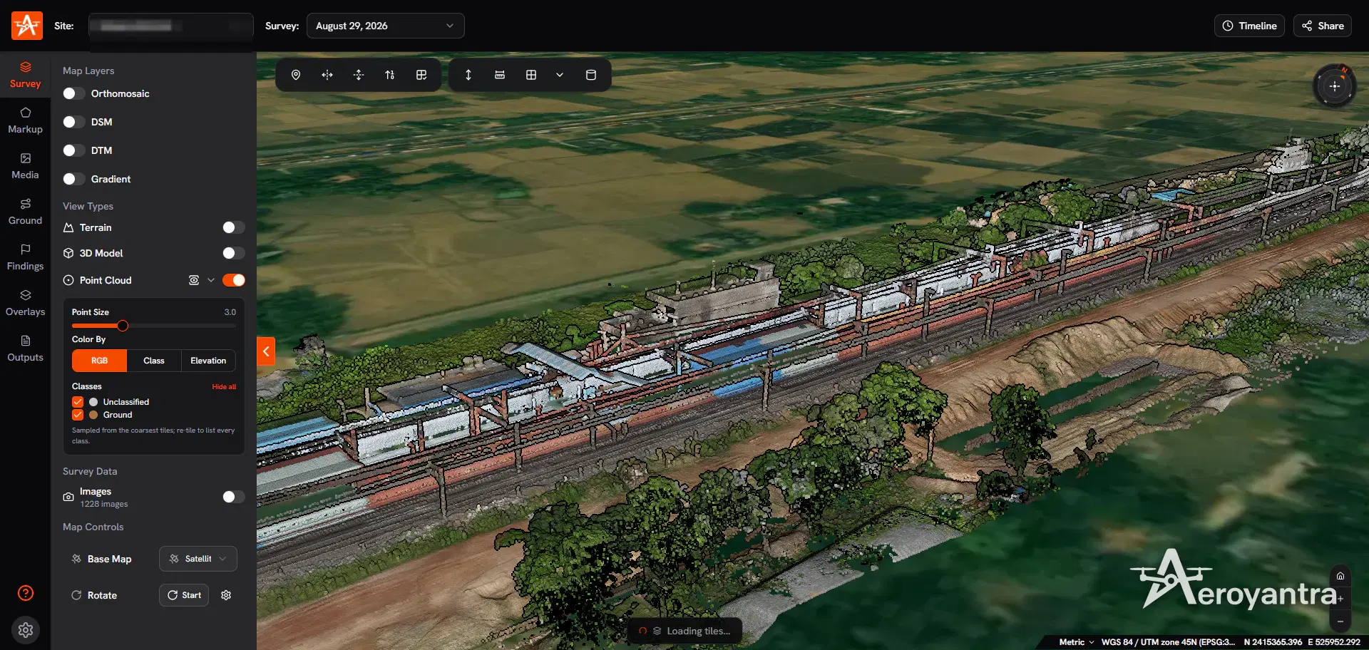
- Point cloud (LAS/LAZ) and a textured 3D model for measurement and visualisation
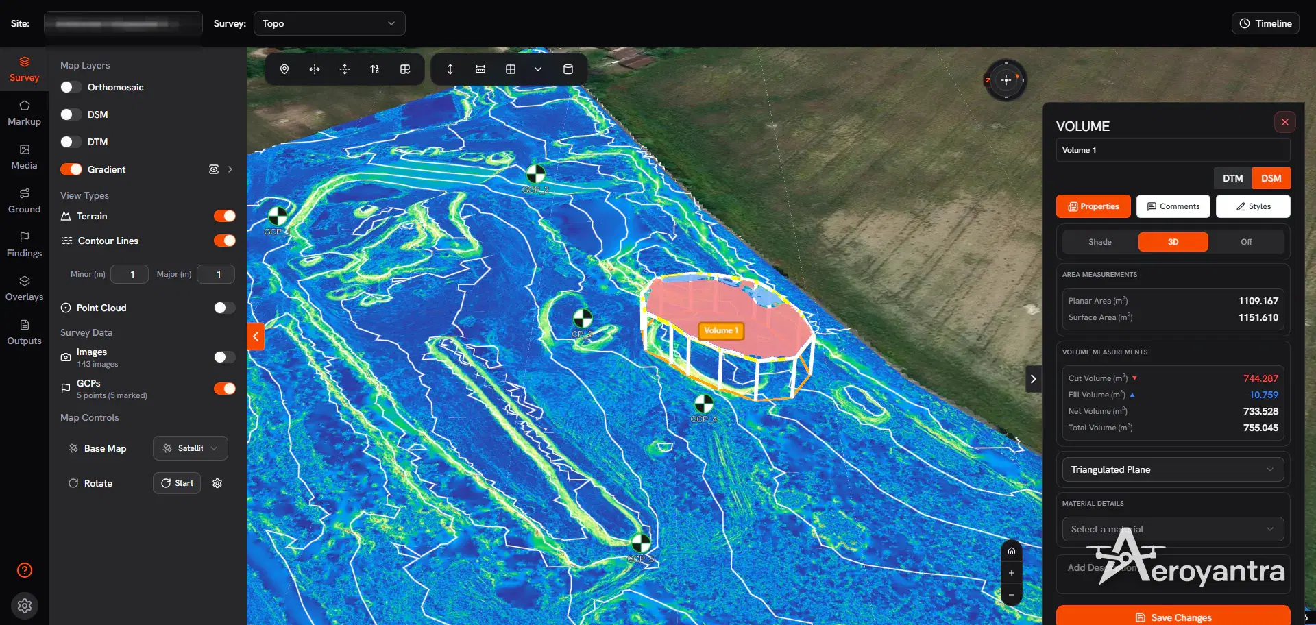
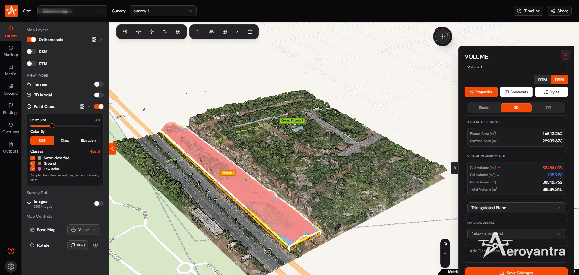
- Volumes, cross-sections and elevation profiles for earthwork and stockpile reconciliation
- CAD and GIS exports - DXF for AutoCAD and Civil 3D, SHP and KML for GIS
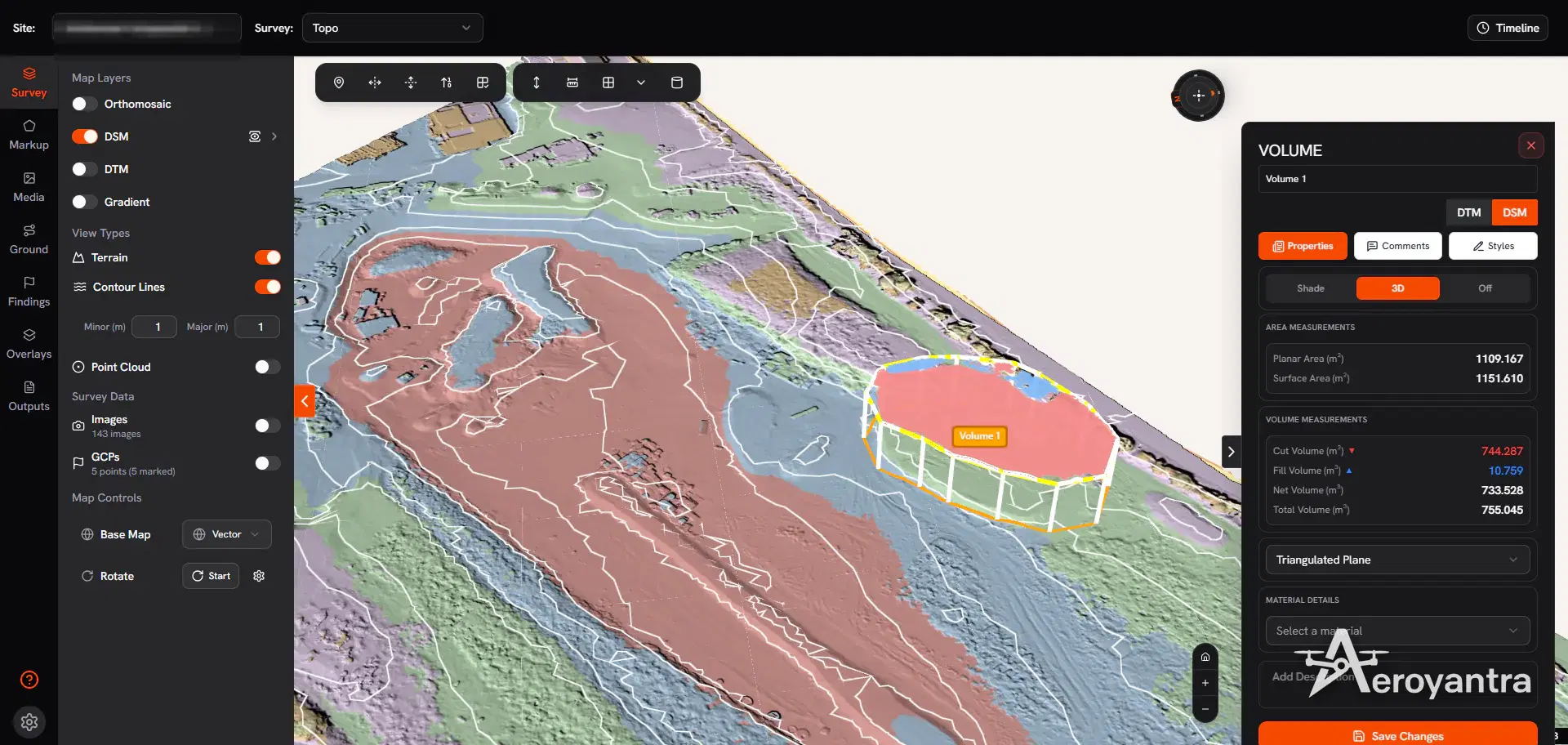
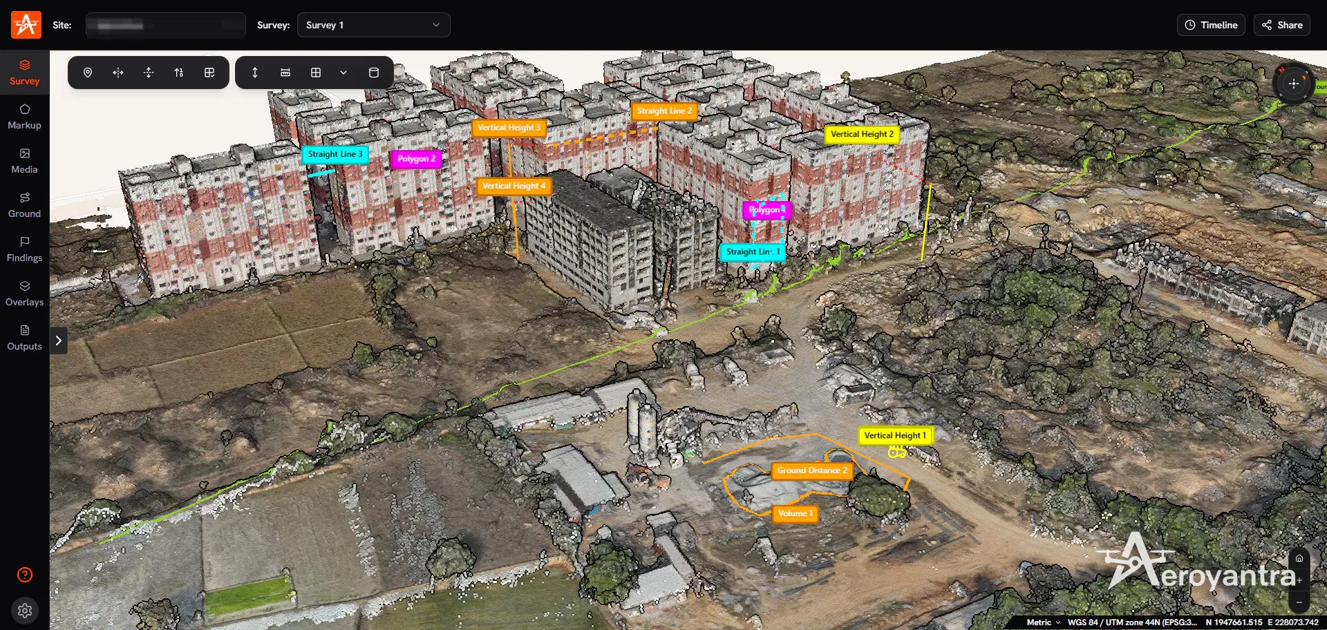
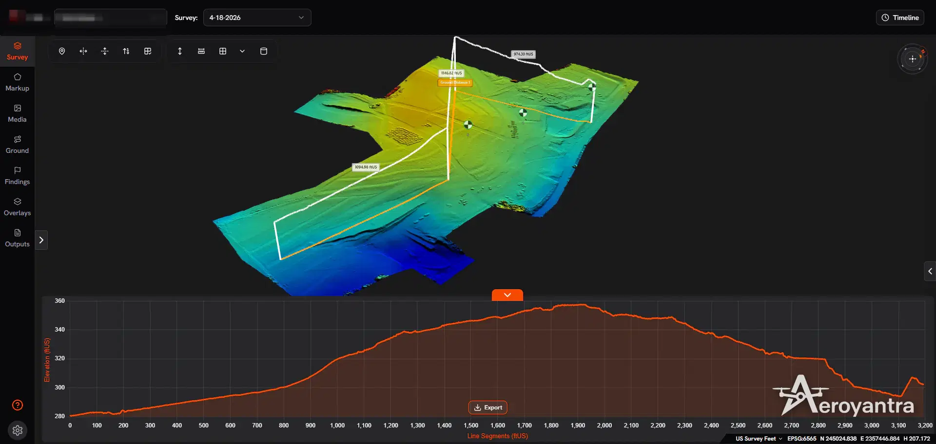
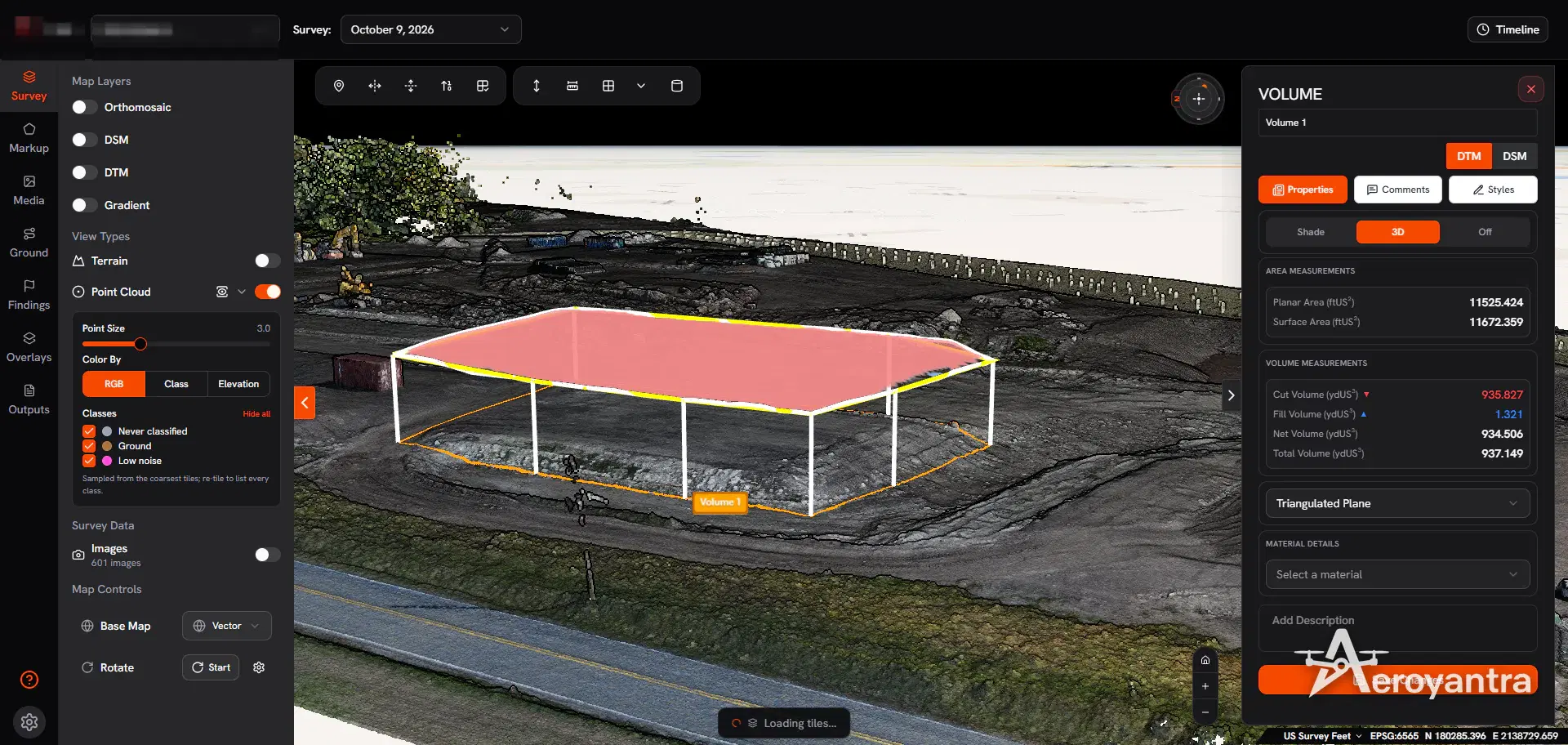
Deliverables are loaded into the Aeroyantra platform as well as handed over as files. Your team gets one link to the site, where anyone can switch between the orthomosaic, DSM, DTM, point cloud and 3D model, take measurements and compare survey dates. The 3D mapping and point cloud tools and topographic survey tools pages show what can be done with the data after delivery.
Choosing a Drone for Aerial Mapping
The aerial survey drone decides how much ground one flight covers and how fine the detail is. Drones for mapping fall into four groups:
- RTK multirotor mapping drones such as the DJI Mavic 3 Enterprise or Phantom 4 RTK - the usual drone for mapping sites up to a few hundred acres, structures and stockpiles.
- Large-sensor multirotors such as a Matrice 350 RTK with a 45 MP Zenmuse P1, for finer detail per flight.
- Fixed-wing mapping drones such as the WingtraOne or eBee X - the drone for aerial mapping of large areas and long corridors.
- LiDAR payloads for aerial drone mapping where vegetation hides the ground.
Aeroyantra picks the platform from the site size, the vegetation and the accuracy the project needs. The supported drones and cameras guide lists the common mapping drones and what each costs to process.
Aerial Survey Accuracy: GCPs, RTK, PPK and DGPS Control
Accuracy is set on the ground before the drone takes off. Aeroyantra controls every survey-grade aerial survey in one of two ways:
- Ground control points (GCPs) - marked targets surveyed with DGPS, placed at the corners, perimeter and elevation range of the site. Our GCP placement guide explains how many you need and where.
- RTK or PPK georeferencing - the drone records corrected positions for every photo, either live (RTK) or after the flight (PPK). The RTK vs PPK vs GCP guide compares the three.
With RTK or PPK georeferencing and properly placed ground control, Aeroyantra achieves 2-3 cm horizontal accuracy. Some points are always withheld as independent check points, so the accuracy is measured rather than claimed: the residuals at those points are reported with your deliverables.
When a project needs its own control network, benchmark transfer or boundary coordinates, Aeroyantra runs a DGPS survey alongside the flight, so the drone data and the ground control share one datum.
Aerial Survey vs Ground Survey
A total station measures selected points one at a time. A drone aerial survey captures a continuous surface of the whole site, from which any point, line, area or volume can be measured later - including points nobody thought to measure on the day.
| Drone aerial survey | Total station / ground survey | |
|---|---|---|
| Coverage | Full site surface in one flight | Selected points and strings |
| Field time on a large site | Hours | Days |
| Repeatability | Same flight plan every visit | Depends on crew and stations |
| Volumes | Measured from the full surface | Interpolated between sections |
| Best for | Topography, volumes, progress, corridors | Setting out, structural control, confined areas |
Drone surveys do not make ground survey obsolete. Total stations remain the right tool for setting out, high-precision structural control and confined areas. Our published analysis puts the cost saving of drone surveys at 30-70% against traditional methods, depending on terrain and control requirements. The drone survey vs total station article walks through where each method wins.
Aerial Survey Applications in India
Aeroyantra's aerial survey teams work across these project types, each with its own deliverable set:
- Mining and quarrying - stockpile and pit volumes, bench mapping and IBM Rule 34A submissions. See mining surveys and the Rule 34A compliance guide.
- Construction and real estate - pre-construction topography, earthwork cut/fill, monthly progress and RERA documentation. See construction surveys and construction drone mapping.
- Roads and highways - corridor mapping, cross-sections and progress for NHAI, MoRTH and state projects. See road surveys.
- Railways and metro - corridor topomaps and DPR terrain data. See railway surveys.
- Land and property - boundary mapping, area verification and plot layouts. See land surveys.
- Powerlines and utilities - LiDAR corridor surveys, tower and conductor mapping. See utility surveys.
- Agriculture - NDVI crop health and stand counts. See agriculture surveys.
- Solar and industrial - site terrain, slope analysis and thermal inspection. See industrial surveys.
How an Aeroyantra Aerial Survey Works
- Share the site. Send a KML, coordinates or a map pin, the approximate area, and what you need the data for. Aeroyantra replies with the method, the deliverables and a written quote within 2 hours.
- Airspace and planning. The team checks the Digital Sky airspace zone, arranges any permission needed for Yellow or Red Zones, and plans the flight altitude, overlap and ground control for the accuracy you need.
- Ground control. GCPs and check points are placed and surveyed with DGPS, or an RTK/PPK workflow is set up where that is enough.
- Flight. DGCA-certified pilots fly the site, usually in a single day for typical project sites.
- Processing and QA. Data is processed in-house, checked against the check points, and exported to your coordinate system and formats.
- Delivery. Photogrammetry files arrive within 24-48 hours of the flight and LiDAR within 48-72 hours, and the site is live in the Aeroyantra platform for your team.
Aerial Survey Cost in India
Indian market rates for drone photogrammetry aerial surveys, from our 2026 drone survey cost guide:
| Area | Typical cost (INR) | Pricing model |
|---|---|---|
| Up to 1 acre | ₹35,000 | Lump sum |
| 1-10 acres | ₹55,000 | Lump sum |
| 10-50 acres | ₹75,000 | Lump sum |
| 50-100 acres | ₹95,000 | Lump sum |
| 100-500 acres | ₹400 per acre | Per acre |
| 500 acres and above | ₹300 per acre | Per acre |
Mobilisation near major metros adds about ₹5,000, and GST on survey services is 18%. LiDAR is priced higher per acre, and corridors are priced per kilometre. Compare quotes on deliverables, not just price: an orthomosaic alone is not the same job as an orthomosaic with a DTM, contours and a point cloud. Our guide to choosing a drone mapping service provider in India lists what to ask for.
Drone Survey Cost in India 2026
Per-acre rates for photogrammetry and LiDAR, the eight factors that move a quote, and a checklist for comparing providers.
Where Aeroyantra Flies
Aeroyantra mobilises pan-India, with teams covering metro regions, mining belts and infrastructure corridors. Browse drone survey locations for city pages, or contact the team with your site.
Frequently Asked Questions
What is an aerial survey?
An aerial survey measures the ground from the air instead of walking it. A survey drone flies a planned grid, captures overlapping photographs or LiDAR returns, and software turns them into georeferenced maps: an orthomosaic, elevation models (DSM and DTM), contours, point clouds and volumes. Aeroyantra flies aerial surveys across India with DGCA-certified pilots and delivers photogrammetry outputs within 24-48 hours of the flight and LiDAR within 48-72 hours.
How much does an aerial survey cost in India?
Indian market rates for a drone photogrammetry aerial survey start at about ₹35,000 for a site up to 1 acre, rising to ₹95,000 for 50-100 acres, then ₹400 per acre for 100-500 acres and ₹300 per acre above 500 acres, plus mobilisation. LiDAR costs more per acre. Aeroyantra sends a written quote within 2 hours of receiving the site location, area and required deliverables.
How accurate is a drone aerial survey?
With RTK or PPK georeferencing and properly placed ground control points, Aeroyantra achieves 2-3 cm horizontal accuracy on drone aerial surveys. Accuracy is proven, not assumed: independent check points are surveyed with DGPS and the residuals are reported with the deliverables.
Do I need DGCA permission for an aerial survey?
For most commercial aerial surveys in Green Zone airspace, no advance permission is needed beyond a registered drone and a certified remote pilot. Surveys in Yellow or Red Zones, near airports, defence areas or international borders need permission through the Digital Sky platform. Aeroyantra checks the airspace zone and handles any permission before mobilising.
What is the difference between aerial survey and aerial mapping?
The terms overlap. Aerial survey usually means the measured, survey-grade work - controlled with GCPs or RTK, with stated accuracy - while aerial mapping is the broader act of producing maps from the air, including visual orthomosaics for planning. Aeroyantra delivers both from the same flight: the survey-grade elevation data and the visual map layers.
Which drone is used for aerial survey?
Most photogrammetry aerial surveys in India are flown with RTK-capable mapping drones such as the DJI Mavic 3 Enterprise, Phantom 4 RTK or Matrice 350 RTK with a Zenmuse P1 camera. Vegetated sites and corridors need a LiDAR payload such as the Zenmuse L2. Aeroyantra chooses the drone and sensor from the site conditions and the accuracy the project needs.
Keep exploring
Related services, platform features and guides
- Survey serviceDGPS Survey Services in India | GNSS Ground ControlDGPS survey services across India: GNSS control points, GCPs and check points, boundary coordinates and monographs for drone, LiDAR and engineering surveys.Read more
- Survey serviceLiDAR SurveyBare-earth terrain through vegetation, corridors and powerlinesRead more
- Survey serviceTopographic SurveyTerrain mapping with survey-grade accuracyRead more
- GuideDrone Mapping: How It Works, Outputs, Software and CostWhat drone mapping is, how photos become orthomosaics, DSM/DTM, contours and 3D models, which drones and software to use, and what it costs in 2026.Read more
- ArticleDrone Survey Cost in India 2026 | Per Acre PricingDrone survey cost in India for 2026. Per acre pricing breakdown by project type, deliverables, area size, and accuracy level. Compare service providers.Read more
- Survey serviceDrone Aerial Photography and Video Services in IndiaDrone aerial photography and videography for construction progress, highway projects, real estate and industrial sites in India, flown by DGCA-certified pilots.Read more