Everything related to the Aeroyantra cloud platform, browser tools, and commercial plans.
Explore specialized workflows for mining, construction, infrastructure, energy, and enterprise sectors.
Browse service lines by output type, project environment, and delivery requirement.
Read the material that supports evaluation, project planning, and field execution.
Industrial Plant and Solar Site Surveys for Expansion, EPC, and Operations Teams
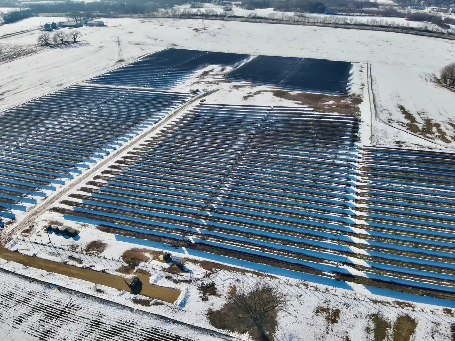
Industrial and renewable projects fail when site data is old, incomplete, or impossible to share across consultants, EPC contractors, and owners. Our DGCA-certified teams capture factories, warehouses, process plants, industrial parks, and solar sites with RTK drones, LiDAR, and thermal payloads, then deliver terrain models, design overlays, inspection reports, and progress documentation formatted for Indian industrial and energy workflows.
Drone Survey Services for Industrial Applications
Service packages using drone mapping for manufacturing, industrial infrastructure, and solar workflows.
Solar Park and Renewable Site Surveys with Drone Mapping
Terrain baseline, slope analysis, drainage study, and pile alignment checks using drone surveying and mapping and aerial mapping drone for utility-scale solar and hybrid energy sites.
Factory and Plant Expansion Aerial Mapping
Current-site aerial drone survey documentation for brownfield expansion, utility routing, logistics circulation, and contractor coordination.
Warehouse and Industrial Park Drone Mapping
High-resolution drone mapping services for industrial parks, logistics hubs, rooftop solar, and warehousing developments.
Thermal and Asset Health Inspection
Visual and thermal inspection for panel rows, roofs, facades, switchyards, and exposed industrial assets.
Industrial EPC, Expansion, and Brownfield Drone Mapping Support
Survey-grade drone mapping and surveying across every phase of industrial project delivery, from pre-construction site planning to brownfield tie-ins and final as-built verification.
What We Support
Where It Fits Best
LiDAR and Close-Range Inspection for Industrial Assets
Reality capture for structures where dimensional tolerance, deformation, roof condition, or difficult access can slow maintenance and shutdown planning.
What We Inspect
Inspection Deliverables
Drone inspection reduces dependence on scaffolding, boom lifts, and rope access for many external inspections while preserving a georeferenced asset record for future cycles.
Solar EPC, Rooftop, and O&M Workflows
Survey-grade drone mapping and thermal inspection for solar projects from pre-construction through commissioning and long-term operations.
Pre-Construction and Installation
Operations and Thermal Inspection
India Industrial and Renewable Program Support
We tailor deliverables for Indian industrial and renewable programs where owners, EPC teams, lenders, and consultants need current site evidence in formats they can use immediately.
Renewable Energy Workflows
Industrial Expansion Workflows
Standard Deliverables
Industrial Project Types We Support
Survey support across manufacturing, warehousing, and renewable infrastructure.
Manufacturing Plants
Steel, cement, food, chemical, and general process manufacturing sites
Warehousing and Logistics
Logistics parks, freight hubs, cold chain sites, and distribution centers
Solar and Renewable Energy
Utility-scale solar, rooftop portfolios, and hybrid energy developments
Industrial Parks
Large campus developments, special zones, and private industrial estates
Ports and Material Handling
Yards, conveyors, stockpiles, and heavy-industrial logistics assets
Brownfield Expansions
Existing operational facilities adding new lines, sheds, or utility blocks
Frequently Asked Questions
Common questions about industrial and solar drone surveys
We survey factories, warehouses, industrial parks, process plants, logistics campuses, rooftop solar sites, and utility-scale solar assets. Services include terrain mapping, as-built documentation, thermal inspection, volume measurement, and expansion planning support.
Our surveys provide slope analysis, aspect mapping, shading study support, and 3D terrain models. This data helps optimize panel placement, calculate mounting requirements, and identify areas unsuitable for installation.
Yes, we coordinate with facility teams to survey during operational hours following safety protocols. Our drones can capture overhead imagery without disrupting production or requiring equipment shutdown.
We provide as-built orthomosaics showing current layout, 3D models for visualization, terrain data for foundation design, and CAD-compatible files for integration with expansion plans.
We achieve 5-10cm accuracy suitable for panel layout planning and civil design. Terrain models include slope analysis and elevation data needed for mounting structure design and drainage planning.
For maximum value, we recommend surveys at five key phases: pre-construction baseline, earthworks validation tied to billing cycles, structural milestones before the next package proceeds, installation completion, and final as-built closeout. Brownfield projects also benefit from a pre-expansion capture of the existing operating facility.
With RTK or PPK georeferencing, well-defined earthwork and stockpile areas can typically be measured within about 1% volume accuracy. Accuracy depends on site geometry, flight parameters, and whether the area is clearly visible and accessible for capture.
Yes. We support design-to-as-built comparison workflows where the processed orthomosaic, DSM, or LiDAR point cloud is aligned against your design model. The output is a deviation heatmap and quantified report showing where construction deviates from design intent, at user-defined tolerance thresholds. Supported formats include DXF, DWG, IFC, and major BIM platform exports.
Yes. We inspect roofs, facades, storage tanks, sheds, process structures, and other hard-to-access assets with close-range imagery, LiDAR, and thermal payloads where required. The result is a georeferenced inspection pack that engineers and maintenance teams can review without relying on scaffolding for every cycle.
Yes. Thermal payload integration is available for industrial inspection workflows. A single mission can collect RGB, LiDAR, and thermal data simultaneously, producing a fused dataset where thermal anomalies are georeferenced against the 3D site model for precise location and context.
Yes. Drone surveys are especially useful for industrial parks, logistics hubs, and warehouse campuses because they capture the current layout, drainage, roof area, circulation, and available expansion land in a single dataset. This helps planning teams evaluate road movement, utility tie-ins, and future build-out options faster.
Yes. We produce georeferenced, time-stamped aerial records and progress reports suitable for SECI project monitoring, state discom construction verification, and lender or independent engineer reporting. We recommend confirming the exact reporting structure needed before the first survey cycle.
Yes. We support pre-construction site surveys, installation progress documentation, commissioning inspection, and rooftop verification for PM-KUSUM agricultural solar and PM Surya Ghar projects. These surveys help owners, EPC teams, and implementing agencies maintain a current georeferenced site record.
After piling is completed, a drone survey captures a high-resolution model of pile positions. Those positions are compared against the design layout and any deviations are highlighted in a report, making it easier to correct issues before mounting structures and modules are installed.
The highest-value thermal inspections are typically at commissioning, during the first operational year, and then on an annual or bi-annual cycle. This helps identify hotspot, mismatch, or warranty issues before they become production losses.