
Beginner's Guide to Drone Mapping & Aerial Survey
How drone mapping and aerial survey works. Choosing a drone, capturing data, processing 3D models, and real applications in surveying and construction.
Beginner's Guide to Drone Mapping & Aerial Survey
How drone mapping and aerial survey works. Choosing a drone, capturing data, processing 3D models, and real applications in surveying and construction.
Table Of Content
- What You'll Learn
- What Is Drone Mapping and Aerial Survey, Really?
- Step 1: Choosing Your First Mapping Drone
- Step 2: Understanding GSD Before You Fly
- Step 3: Planning Your Automated Flight
- Step 4: Capturing High-Quality Data in the Field
- Step 5: Processing Your Images into a Map or Model
- What Deliverables Can You Produce?
- Aerial Photogrammetry vs LiDAR Survey: Which Do You Need?
- Common Beginner Mistakes
- India-Specific: DGCA Rules You Need to Know
- Pre-Flight Checklist
- FAQ
- Your Journey Starts Now
What You'll Learn
This guide takes you from zero to your first professional-grade map - covering drone selection, the one concept most beginners miss (GSD), flight planning, field execution, and processing. No expensive hardware required.
What Is Drone Mapping and Aerial Survey, Really?
Drone mapping - also called aerial photogrammetry, drone surveying and mapping, or UAV aerial survey - is the process of capturing hundreds of overlapping aerial photographs and processing them into accurate, georeferenced maps and 3D models.
It is not the same as drone photography. A single aerial photo is just a picture. Drone mapping requires systematic, overlapping image capture from a planned flight path, followed by specialized processing software that reconstructs the terrain in three dimensions.
The output is not just a pretty image. It is a measurable, georeferenced dataset - meaning you can take real-world distance, area, and volume measurements directly from it.
The core principle: The software identifies thousands of common points across overlapping images, triangulates their 3D position, and reconstructs the terrain. This process - called photogrammetry - can achieve horizontal accuracy within 2-3 cm and vertical accuracy within 5 cm under the right conditions.
Where drone mapping and surveying is used
- Construction: Site planning, progress monitoring, earthwork volume calculations
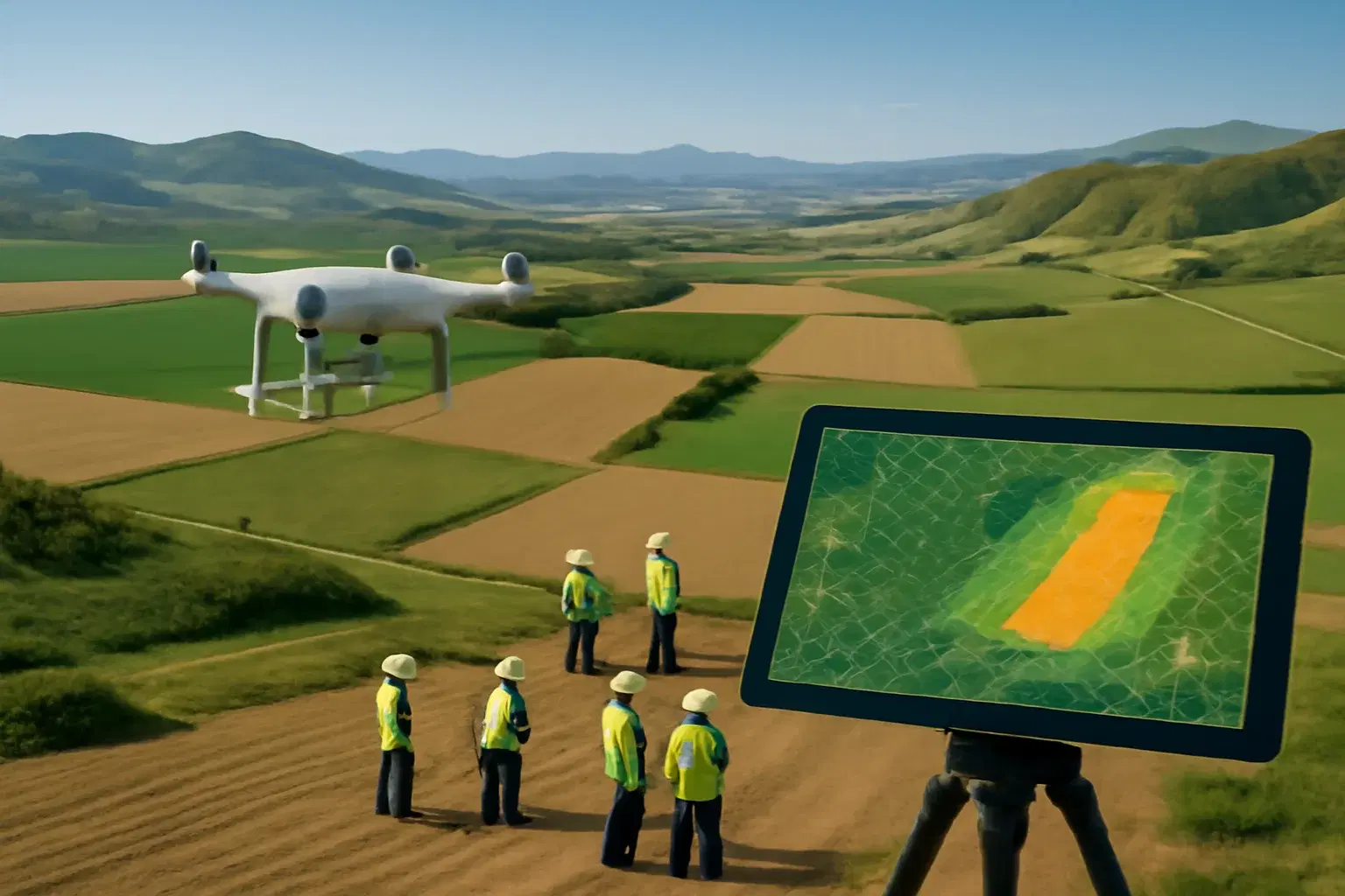
- Agriculture: Crop health mapping, irrigation planning, yield estimation
- Mining: Stockpile volumes, pit surveys, haul road monitoring
- Land Survey: Drone land survey for topographic maps, boundary surveys, and contour generation
- Infrastructure: Road and pipeline corridor surveys using drones for surveying and mapping
- Aerial Mapping: GIS mapping, topographical survey, and large-area aerial mapping projects
- Real estate: Site visualization, large estate documentation
Step 1: Choosing Your First Mapping Drone
Not all camera drones are suitable for professional mapping. Here is what actually matters.
The features that determine mapping quality
Drone mapping camera: sensor size and resolution
The drone mapping camera is the most important piece of equipment in your kit. Look for a sensor that is 20 megapixels or larger. More pixels means more detail per image, which directly improves your final map resolution.
Mechanical shutter vs rolling shutter
This is the most overlooked specification for beginners. A rolling shutter reads the sensor row by row, which means a drone moving at speed introduces a subtle distortion into each image - the top of the image is captured at a slightly different position than the bottom. For casual photography this is invisible. For photogrammetry, it introduces errors that compound across thousands of images.
A mechanical (global) shutter captures the entire sensor simultaneously, eliminating this distortion entirely. For any serious mapping work, a mechanical shutter is not optional.
Flight time
Longer flight time means more area covered per battery. The practical threshold for mapping is 30 minutes minimum. Below that, you spend more time on the ground swapping batteries than in the air collecting data.
GPS stability and automation capability
The drone must be able to execute a pre-planned automated grid mission with precision. This is standard on all modern enterprise drones.
RTK/PPK capability for precision drone mapping
RTK (Real-Time Kinematic) and PPK (Post-Processed Kinematic) provide centimeter-level positioning accuracy. RTK mapping is the professional standard for survey-grade drone surveying work. As a beginner, you can start without them - but plan to upgrade as your projects demand higher accuracy. RTK drone mapping is now the minimum expectation for any professional aerial drone survey delivered to engineering or government clients.
Recommended starter drones
| Drone | Shutter Type | Camera | Best For |
|---|---|---|---|
| DJI Mavic 3 Enterprise (M3E) | Mechanical | 20MP 4/3 CMOS | Best all-around beginner choice |
| DJI Phantom 4 Pro V2 | Mechanical | 20MP 1" CMOS | Proven workhorse, still excellent |
| DJI M350 RTK + P1 | Mechanical | 45MP full-frame | Professional survey-grade work |
| DJI M3E RTK | Mechanical | 20MP + RTK | Step up when accuracy matters |
Starting recommendation: The DJI Mavic 3 Enterprise is the best entry point for most beginners - portable, mechanical shutter, 43-minute flight time, and excellent image quality. The DJI Phantom 4 Pro V2 is a more affordable option if budget is a constraint.
Step 2: Understanding GSD Before You Fly
This is the concept most beginner guides skip entirely. Understanding it will make every flight decision clearer.
What is GSD?
Ground Sampling Distance (GSD) is the distance on the ground that one pixel in your image represents. It is measured in centimeters per pixel.
- A GSD of 2 cm/pixel means each pixel represents a 2cm x 2cm area on the ground. High detail.
- A GSD of 10 cm/pixel means each pixel represents a 10cm x 10cm area. Lower detail.
Lower GSD = higher resolution = more detail. This is counterintuitive because a lower number sounds worse, but it means each pixel covers less ground - so you see more.
What controls your GSD?
For most drones, the sensor and focal length are fixed. That means altitude is the primary variable you control. Fly lower and your GSD decreases (more detail). Fly higher and your GSD increases (less detail, more coverage per flight).
The trade-off is real:
- A Mavic 3 Enterprise at 120m AGL produces approximately 3.2 cm/pixel GSD
- The same drone at 50m AGL produces approximately 1.3 cm/pixel GSD - but requires 3-4x more images and flight time to cover the same area
GSD by application
| Application | Required GSD | Recommended Altitude (M3E) |
|---|---|---|
| Large-area land survey | 5-10 cm/pixel | 150-200m |
| Construction monitoring | 3-5 cm/pixel | 100-120m |
| Agricultural mapping | 3-5 cm/pixel | 100-120m |
| Detailed site inspection | 1-3 cm/pixel | 50-80m |
| Engineering survey | 1-2 cm/pixel | 40-60m |
The practical rule: Always ask your client what GSD they need before planning your flight. A client who needs 5 cm/pixel does not need you flying at 60m - that wastes battery time and generates far more data than necessary. A client who needs 1 cm/pixel cannot accept a 150m altitude flight.
Motion blur and GSD
There is one more GSD relationship beginners miss: motion blur. For sharp images, your drone's motion blur during the shutter exposure should not exceed 1x your GSD value. At low altitudes (low GSD), you must fly slower to prevent blur. This is why low-altitude flights take significantly longer than high-altitude ones - it is not just more images, it is also a slower flight speed.
Step 3: Planning Your Automated Flight
You do not manually fly a drone for mapping. You use a flight planning application to create an automated mission. The drone follows the planned path, captures images at set intervals, and returns to the launch point when complete.
The most important setting: overlap
Overlap tells the drone how much each photo should overlap with adjacent photos. This redundancy is what allows photogrammetry software to find common points between images and reconstruct the terrain.
- Front overlap (along the flight path): 75-80%
- Side overlap (between flight lines): 70-75%
Do not reduce these to save time. Insufficient overlap is the single most common cause of holes, blurring, and failed processing in beginner projects. At 60% overlap, your results will be noticeably worse. At 50%, processing may fail entirely in complex terrain.
Key flight planning parameters
Altitude: Determines your GSD (see Step 2). Set this based on what your project actually requires.
Flight pattern: A standard grid (lawnmower) pattern works for flat terrain and 2D map production. For 3D modeling of structures - buildings, stockpiles, monuments - add a second pass with the camera angled at 45 degrees (oblique imagery). This captures the vertical faces that a nadir (straight-down) pass misses.
Camera angle: For 2D maps and terrain models, point the camera straight down (90 degrees / nadir). For 3D building models, combine nadir with oblique passes.
Flight speed: Your planning app will calculate this based on altitude, overlap, and camera trigger interval. Do not override it manually - the app is optimizing for consistent image capture.
Flight planning apps
| App | Platform | Best For |
|---|---|---|
| DJI Pilot 2 | iOS/Android | DJI drones, direct GSD input |
| DroneDeploy | iOS/Android | Multi-platform, cloud sync |
| Pix4Dcapture | iOS/Android | Pix4D workflow integration |
| Litchi | iOS/Android | Budget option, basic missions |
For beginners: DJI Pilot 2 is the easiest starting point if you are flying a DJI drone. It allows you to input your required GSD directly and calculates altitude and speed automatically.
Step 4: Capturing High-Quality Data in the Field
The flight itself is the shortest part of the workflow. Getting it right requires preparation, not skill.
Before you launch
Check airspace regulations. In India, check the DGCA's Digital Sky platform before every flight. Verify the airspace classification for your site - Green zones allow flight without prior permission, Yellow zones require approval, and Red zones are restricted. Do this the day before, not at the launch site.
Check weather. Wind is your biggest enemy. Above 7-8 m/s (25-30 km/h), image quality degrades significantly due to motion blur and inconsistent flight paths. Avoid flying in rain - beyond the obvious equipment risk, water droplets on the lens ruin images.
Ideal lighting conditions: An overcast day with uniform cloud cover is actually better than bright sunshine for mapping. Direct sun creates harsh shadows that obscure terrain detail and create processing artifacts. If you must fly in sun, aim for early morning or late afternoon when shadows are long but consistent.
Lock your camera settings to manual. This is critical and widely ignored by beginners. Auto-exposure causes your camera to adjust brightness between shots, creating inconsistent images that are harder to stitch. Set:
- ISO: 100-200 (lowest practical value)
- Shutter speed: Fast enough to prevent blur (1/1000s or faster at typical altitudes)
- White balance: Locked (not auto)
During the flight
Start the automated mission and monitor from the ground. You are watching for:
- Unexpected obstacles entering the flight path
- Battery level (know your return-to-home threshold)
- Flight log for any GPS anomalies
Do not interfere with the mission unless there is a safety issue. Every manual intervention interrupts the systematic capture pattern.
After landing: immediate field QC
Before packing up, spend 5 minutes reviewing a sample of images on your controller or laptop:
- Are images sharp? (Check edges and fine detail)
- Is exposure consistent across the set?
- Are geotags present? (Check image EXIF data)
- Does the image count match what the mission planned?
Catching a problem at the site means a 10-minute re-flight. Discovering it back at the office means returning to site.
Step 5: Processing Your Images into a Map or Model
You have hundreds or thousands of geo-tagged images. Now comes photogrammetry.
How photogrammetry processing works
The software runs through several stages:
- Aerotriangulation - Finds thousands of common "tie points" across overlapping images and calculates the precise position and orientation of every camera shot
- Dense point cloud generation - Reconstructs the terrain as millions of 3D points based on the triangulated positions
- Mesh generation - Connects the point cloud into a continuous 3D surface
- Orthomosaic generation - Projects the imagery onto the terrain model and stitches it into a single, geometrically corrected top-down image
- DSM/DTM generation - Creates elevation models from the point cloud
This process is computationally intensive. On a typical workstation, a 500-image project can take 2-4 hours. A 5,000-image project can take 24-48 hours - or longer.
The old way vs the modern way
The old way required a high-end workstation (often costing ₹2,00,000 or more) with a powerful GPU, plus expensive desktop software subscriptions that can run into lakhs of rupees per year. Processing happened on your machine, which meant one project at a time, no parallelization, and the risk of hardware failure mid-job.
The modern way is cloud processing. This is exactly what Aeroyantra was built for.
Instead of investing in hardware and software licenses, you upload your images to our platform and our cloud servers do the processing. The workflow:
- Upload your images securely to your Aeroyantra project
- Configure your processing settings (resolution, output types)
- Process - our cloud infrastructure handles aerotriangulation, point cloud generation, and deliverable creation in parallel
- Download your finished outputs - orthomosaic, DSM, 3D model, and more
A project that takes 24 hours on a local workstation processes in a few hours on our platform. There is no hardware to buy, no software to install, and no subscription required. Aeroyantra operates on a pay-per-use model - you pay only for the projects you process.
For beginners, this removes the single biggest barrier to getting started.
What Deliverables Can You Produce?
Understanding what each output is - and when to use it - helps you scope projects correctly and set client expectations.
| Deliverable | What It Is | When You Need It |
|---|---|---|
| Orthomosaic | Geometrically corrected aerial map (GeoTIFF) | Any 2D mapping project |
| DSM (Digital Surface Model) | Elevation model including all surfaces (buildings, trees) | Construction, general terrain |
| DTM (Digital Terrain Model) | Bare-earth elevation model (vegetation removed) | Flood modeling, agriculture, roads |
| 3D Model / Point Cloud | Full 3D reconstruction of the area | Inspections, heritage documentation, stockpiles |
| Contour Map | Elevation lines at set intervals | Engineering, land planning |
| Volume Report | Cut/fill or stockpile volume calculations | Mining, earthworks, construction |
Aerial Photogrammetry vs LiDAR Survey: Which Do You Need?
This question comes up constantly for beginners. Here is the honest answer.
Photogrammetry uses overlapping camera images to reconstruct 3D models. It produces visually rich, textured outputs and is significantly more affordable. Limitation: it cannot see through vegetation. In dense forest or tall crops, the terrain model represents the canopy, not the ground.
LiDAR uses laser pulses to measure distance. It can penetrate vegetation gaps to reach bare earth, making it the standard for forestry, flood modeling, and any application where you need the ground surface under a canopy. It is significantly more expensive - a LiDAR payload for a mapping drone typically costs ₹15-30 lakh or more.
For most beginners, photogrammetry is the right starting point. The applications where LiDAR is genuinely necessary (dense forest, powerline corridor surveys under canopy) are specialized. The vast majority of construction, agriculture, mining, and land survey work is done with photogrammetry.
| Factor | Photogrammetry | LiDAR |
|---|---|---|
| Cost | Low (camera only) | High (₹15-30 lakh+ payload) |
| Visual output | Rich, textured | Point cloud only |
| Under-canopy accuracy | Poor | Excellent |
| Processing complexity | Moderate | High |
| Best for | Construction, agriculture, general survey | Forestry, flood modeling, dense vegetation |
Common Beginner Mistakes
These are the errors that consistently produce failed or low-quality results.
Reducing overlap to save time. The most common mistake. Flying at 60% overlap instead of 75% saves maybe 20% of flight time but significantly degrades output quality - and in complex terrain, causes processing failures. Never compromise on overlap.
Using auto-exposure. Inconsistent exposure across your image set creates visible seams in the final orthomosaic and makes processing harder. Lock all camera settings to manual before the first flight.
Flying in wind above 7-8 m/s. Motion blur is invisible in individual images but shows up clearly in the final map as softness and stitching artifacts. Check wind speed at altitude, not just at ground level - it is often significantly higher.
Ignoring GSD requirements. Flying at a default altitude without knowing what GSD your project needs is guesswork. A construction client who needs 2 cm/pixel will reject a map produced at 150m altitude.
Not doing field QC. Reviewing images at the site takes 5 minutes and catches problems that would otherwise require a return trip. Make it a non-negotiable habit.
Skipping DGCA compliance. Flying without checking airspace classification is not just a legal risk - in Yellow and Red zones, it can result in fines, equipment confiscation, and permit revocation. Check Digital Sky before every flight.
India-Specific: DGCA Rules You Need to Know
Flying commercially in India requires compliance with the Drone Rules 2021. Here is what every beginner needs to know.
Drone categories
India classifies drones by weight:
| Category | Weight | Key Requirement |
|---|---|---|
| Nano | Under 250g | Minimal restrictions |
| Micro | 250g to 2 kg | Registration required |
| Small | 2 kg to 25 kg | Registration + UAOP required |
| Medium | 25 kg to 150 kg | Full commercial licensing |
Most professional mapping drones (DJI M3E, M350) fall in the Small category.
What you need for commercial mapping
- Drone registration on the Digital Sky Platform (mandatory for all drones above Nano)
- UAS Operator Permit (UAOP) for commercial operations with Small and above drones
- Remote Pilot Certificate (RPC) - obtained through a DGCA-approved training organization
- Airspace clearance - check Digital Sky before every flight for zone classification
Airspace zones
- Green zone: No prior permission needed. You can fly.
- Yellow zone: Permission required through Digital Sky. Apply at least 24 hours in advance.
- Red zone: Restricted. No civilian drone operations permitted.
Important: The Digital Sky map is updated regularly. A site that was Green last month may have changed classification. Always check on the day of or day before your flight.
Pre-Flight Checklist
Run through this before every mission:
Regulatory
- Airspace zone confirmed on Digital Sky Platform
- UAOP and RPC documents accessible
- Site owner permission obtained if required
Equipment
- Drone firmware updated
- All batteries fully charged
- SD card formatted and verified (no errors)
- Propellers inspected - no cracks or chips
- Gimbal calibration checked
- Return-to-home altitude set above all obstacles
Flight Planning
- Mission loaded and reviewed in planning app
- Altitude set for required GSD
- Overlap set to minimum 75/75
- Flight time estimated and within battery capacity
Camera Settings
- ISO locked (100-200)
- Shutter speed locked (1/1000s or faster)
- White balance locked
- Image format set (RAW for professional work, JPEG acceptable for standard projects)
Field Conditions
- Wind speed checked at altitude
- No rain or incoming weather
- Site access confirmed
Post-Flight
- Image count verified against mission plan
- Sample images reviewed for sharpness and exposure
- SD card backed up before leaving site
FAQ
What is the difference between an orthomosaic and a regular aerial photo?
A regular aerial photo is a single image with perspective distortion - objects at the edges appear to lean outward, and the scale varies across the image. An orthomosaic is geometrically corrected so that every point is shown from directly above, at a consistent scale. You can take accurate measurements from an orthomosaic. You cannot from a regular aerial photo.
How accurate is drone mapping?
Under the right conditions - correct overlap, stable flight, good GPS - drone photogrammetry achieves horizontal accuracy of 2-3 cm and vertical accuracy of approximately 5 cm. This is sufficient for most commercial applications. For legal-grade survey work requiring sub-centimeter accuracy, you need RTK/PPK positioning combined with ground control points.
Do I need ground control points (GCPs) as a beginner?
For your first few projects on flat terrain, you can produce useful maps without GCPs. The map will have relative accuracy (internal geometry is correct) but may not be precisely anchored to real-world coordinates. For any client-facing work where measurements matter, adding 4-5 GCPs significantly improves absolute accuracy and is worth the extra field time.
How long does processing take?
On a local workstation, a 500-image project typically takes 2-4 hours. A 2,000-image project can take 12-24 hours. On Aeroyantra's cloud platform, the same projects process in a fraction of the time through parallel processing - and you do not need any local hardware.
What drone should I buy first?
The DJI Mavic 3 Enterprise is the best starting point for most beginners. It has a mechanical shutter (critical for mapping quality), a 20MP 4/3 CMOS sensor, 43-minute flight time, and is compact enough to transport easily. If budget is a constraint, the DJI Phantom 4 Pro V2 is still an excellent mapping drone despite being an older model.
Can I start a drone mapping business in India?
Yes - and the demand is growing rapidly across construction, agriculture, and infrastructure sectors. Drone mapping services and aerial survey services are in high demand from construction firms, mining companies, and government agencies. You will need a UAOP, Remote Pilot Certificate, and registered drone. Start with smaller drone survey mapping projects (10-50 ha) to build your workflow confidence before taking on larger commercial contracts.
What is the difference between a DSM and a DTM?
A DSM (Digital Surface Model) represents the elevation of everything on the ground - buildings, trees, vehicles, and terrain. A DTM (Digital Terrain Model) represents bare-earth elevation only, with above-ground objects removed. For flood modeling, road design, and agricultural applications, you typically need a DTM. For construction progress monitoring and general site surveys, a DSM is usually sufficient.
Your Journey Starts Now
Drone mapping is one of the most valuable and fastest-growing skills in the geospatial industry. The barriers that made it inaccessible five years ago - expensive hardware, complex software, steep learning curves - have been systematically removed.
The flight is the easy part. Understanding GSD, planning correctly, and processing your data into deliverables your clients can actually use - that is where the skill is built.
Start with a single project on a site you can access easily. Fly at 120m with 75/75 overlap. Review your images in the field. Then upload to Aeroyantra and see what your data becomes.
Ready to process your first flight?
Aeroyantra's pay-per-use cloud platform turns your drone images into professional orthomosaics, DSMs, and 3D models - no hardware investment, no subscription required.
Start your first project on Aeroyantra
Last updated: July 2025. Questions about your first mapping project? Contact our team - we respond within one business day.
Related Articles
Explore more insights and stories from our blog

What is Photogrammetry? Drone 3D Mapping Explained
How photogrammetry converts drone photos into accurate 3D models. Workflow, accuracy, and applications in surveying, construction, and mining projects.

Drone 3D Mapping Case Study: Water Tank Bilaspur
How Travancore Aviations used drone photogrammetry to map an under-construction overhead water tank in Bilaspur. Accurate 3D model for construction planning.
Large-Scale Drone Mapping: 100 to 20,000 Hectares
Field guide to large-scale aerial mapping from 100 to 20,000 hectares. Planning, execution, and processing for infrastructure, mining, and land survey.