Topographic survey | DSM with 1 m contours and a volume polygon
Topographic
Topographic Survey
Terrain capture with RTK and PPK workflows for contours, DSM, DTM, and grading decisions on civil and land development projects.
Everything related to the Aeroyantra cloud platform, browser tools, and commercial plans.
Explore specialized workflows for mining, construction, infrastructure, energy, and enterprise sectors.
Browse service lines by output type, project environment, and delivery requirement.
Read the material that supports evaluation, project planning, and field execution.

Aeroyantra provides lidar survey and drone mapping services in Rudrapur, Uttarakhand with DGCA-certified pilots, survey-grade aerial survey processing, and fast delivery for engineering, infrastructure, and industrial teams.
Typical cost: Aeroyantra's 2026 India cost guide puts a LiDAR survey at ₹55,000–₹95,000 for a site up to 100 acres, then about ₹4,600 per acre at 100–500 acres (market rates). See the 2026 cost guide
A planned industrial city in the Udham Singh Nagar district with SIDCUL industrial estate, integrated transport hub, and flat agricultural Terai surroundings.
Industrial estate expansion surveys, factory construction monitoring, and logistics park development.
LiDAR survey in Rudrapur produces classified point clouds and bare-earth terrain models that are essential when vegetation, built structures, or ground complexity make photogrammetry-only approaches insufficient. Across Uttarakhand's terrain — Flat Terai industrial zone — LiDAR provides the elevation confidence needed for corridor planning, engineering design, and infrastructure documentation.
Rudrapur has active demand from sidcul industrial estate and automotive manufacturing — sectors where lidar survey outputs directly support planning, execution, and reporting workflows.
The local terrain in Rudrapur — Flat Terai industrial zone — benefits from aerial survey coverage that captures complete site data in a single campaign, avoiding the access constraints of ground-only methods.
Local conditions include flat terrain with industrial cluster density. Our team plans for these factors in advance, adjusting flight parameters, timing, and control workflows to ensure consistent output quality.
Airspace and Compliance
Standard DGCA compliance; forest department NOCs required in many areas; sensitive border zones in the north.
Delivery Timeline
Standard turnaround after field capture is 48-72 hours. Mobilization and clearance timelines depend on site access and area-specific approval requirements.
Bare-earth terrain capture and classified point clouds for vegetated, difficult, or corridor-heavy sites that need higher-confidence elevation data. This page provides detailed information about lidar survey drone surveying and mapping services available in Rudrapur, Uttarakhand.
High-density point cloud capture for terrain, corridor, and difficult ground conditions.
DTM, DSM, contours, and section-ready surfaces for engineering workflows.
Vegetation-penetrating terrain extraction for infrastructure and linear projects.
Packaged outputs suitable for CAD, GIS, and survey review cycles.
Best fit for
Vegetated terrain
Linear infrastructure
Dense sites
View full service details
Open LiDAR SurveyScreens and photos from recent projects processed on the Aeroyantra platform. Deliverables for Rudrapur come in the same formats.

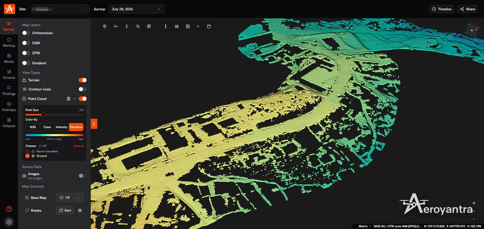
coastal road feature extraction, lidar survey
Bare-earth elevation model of the road corridor and junctions

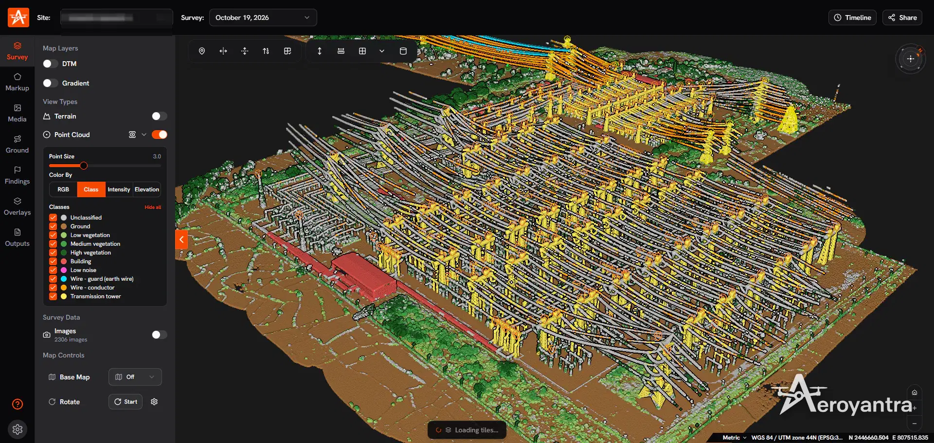
electrical substation lidar survey
Classified point cloud of substation equipment, gantries and structures

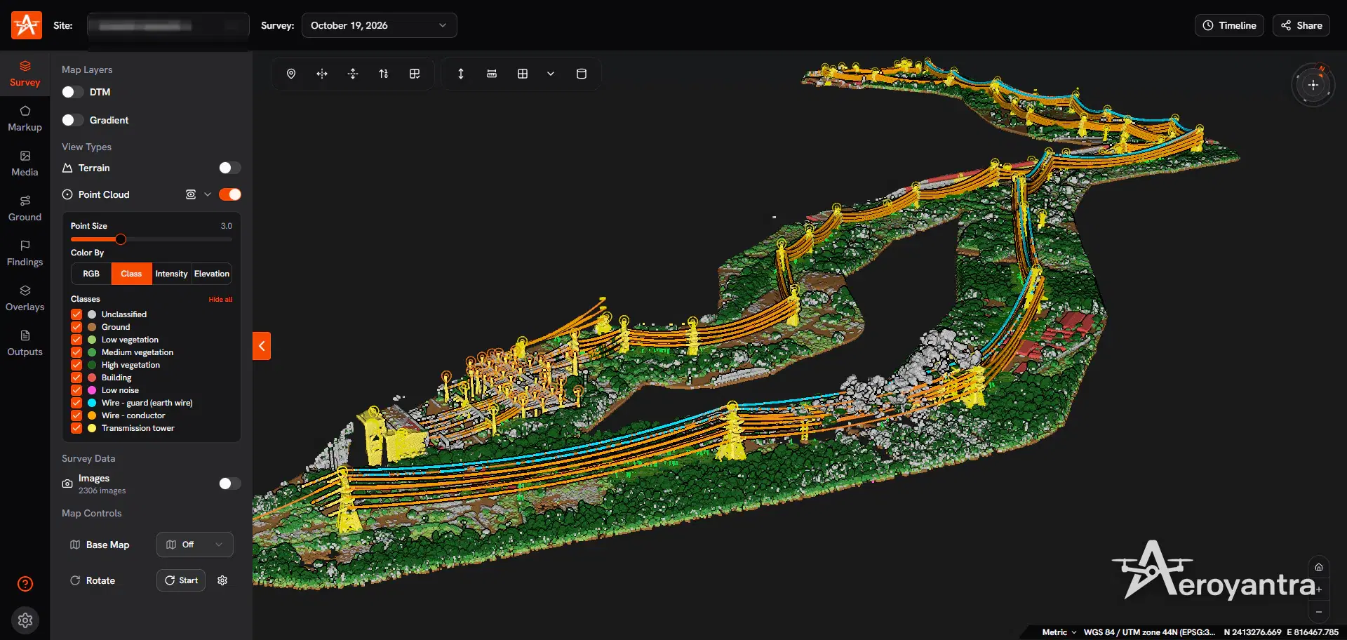
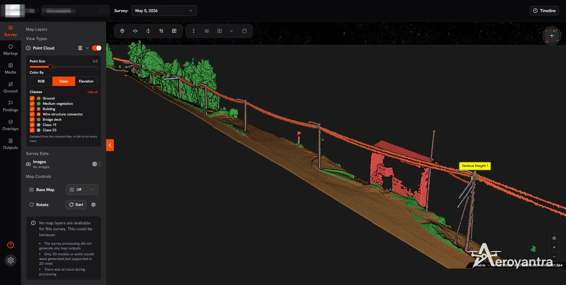
powerline corridor asprs classification
ASPRS-classified point cloud: ground, vegetation, building, wire-structure connector and bridge deck

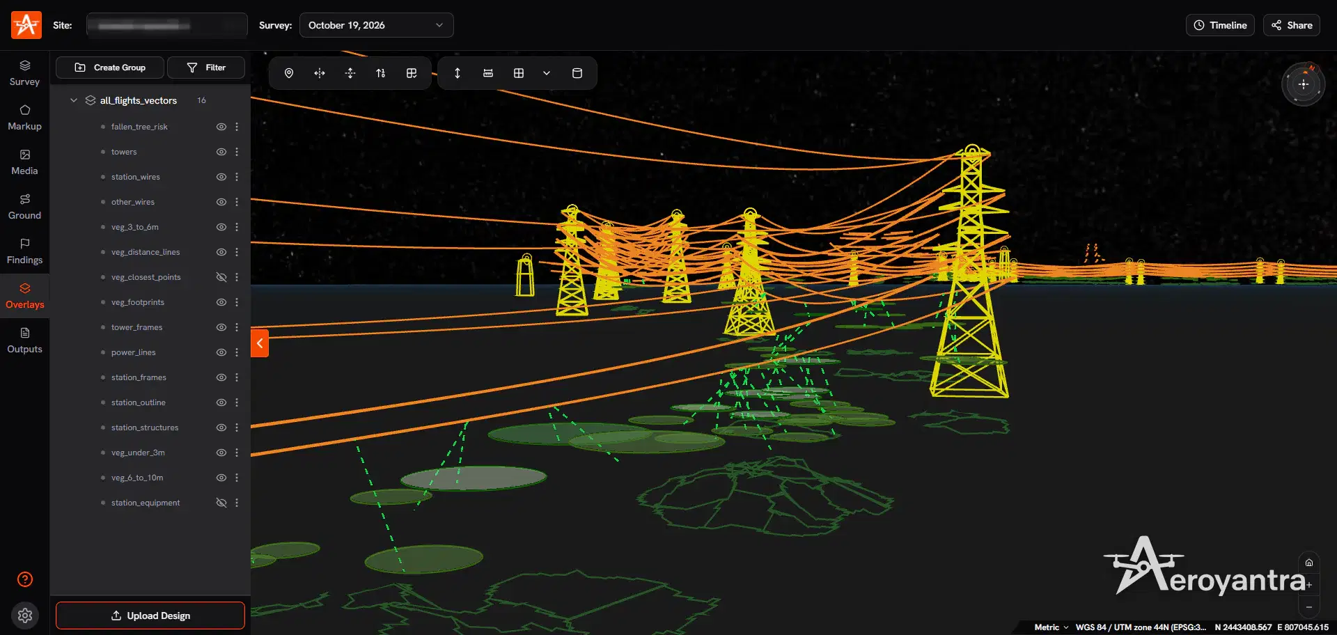
powerline vegetation encroachment analysis
Vector overlay set: fallen tree risk, vegetation distance lines, tower frames and power lines
Typical project teams that benefit from lidar survey in Rudrapur.
Used for pit visibility, stockpile tracking, terrain analysis, and compliance-oriented reporting.
Useful for large-area monitoring, vegetation-heavy terrain, and repeatable coverage requirements.
Mapped outputs for planning, coordination, and execution across large project footprints.
Decision-ready datasets that help consultants and execution teams move faster with less rework.
A practical five-step workflow from first brief to final delivery.
We define scope, accuracy needs, terrain constraints, and the final outputs your team needs.
Our team prepares mobilization, safety checks, and the mission plan suited to site conditions.
DGCA-compliant pilots capture the site with the right sensors, overlap, and control workflow.
Data is processed, checked, and packaged into survey-ready outputs with internal QA.
You receive files, summaries, and follow-up support for project teams, consultants, or clients.
Additional drone survey services available in Rudrapur.
Comprehensive aerial survey coverage for large-scale site documentation, terrain analysis, and infrastructure planning workflows.
Night thermal drone patrols that catch cable and material theft at solar plants and industrial sites, with WhatsApp alerts and an evidence pack for every incident.
Boundary, parcel, and control-focused survey support for landowners, developers, planners, and due diligence teams.
Recurring drone survey support for progress monitoring, earthwork verification, as-built records, and stakeholder reporting.
Inspection-oriented drone capture for plants, rooftops, solar sites, and other asset-heavy environments where visual condition data matters.
Photogrammetry workflows for orthomosaics, GIS layers, 3D surfaces, and planning-ready basemaps that move cleanly into design tools.
Stockpile, pit, and terrain analytics for production planning, reconciliation, compliance reporting, and change measurement.
Comprehensive drone survey services available across all our service locations.

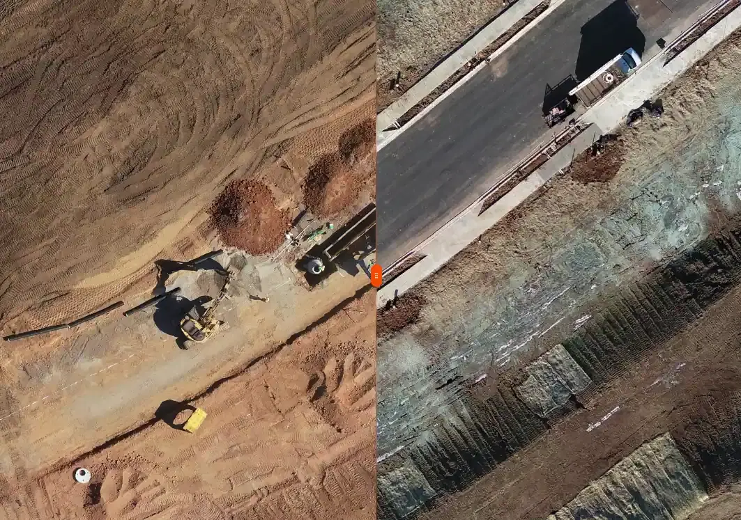
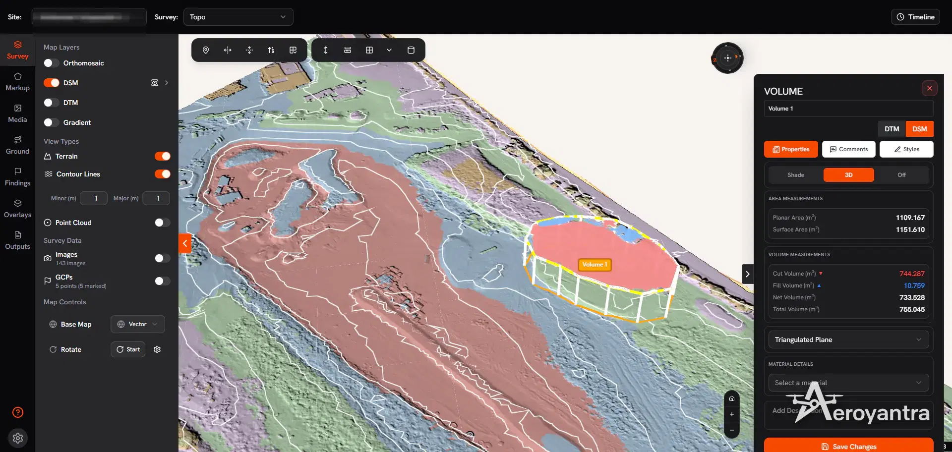
Topographic survey | DSM with 1 m contours and a volume polygon
Topographic
Terrain capture with RTK and PPK workflows for contours, DSM, DTM, and grading decisions on civil and land development projects.

Construction monitoring | progress tracking and earthwork verification
Construction
Recurring drone survey support for progress monitoring, earthwork verification, as-built records, and stakeholder reporting.

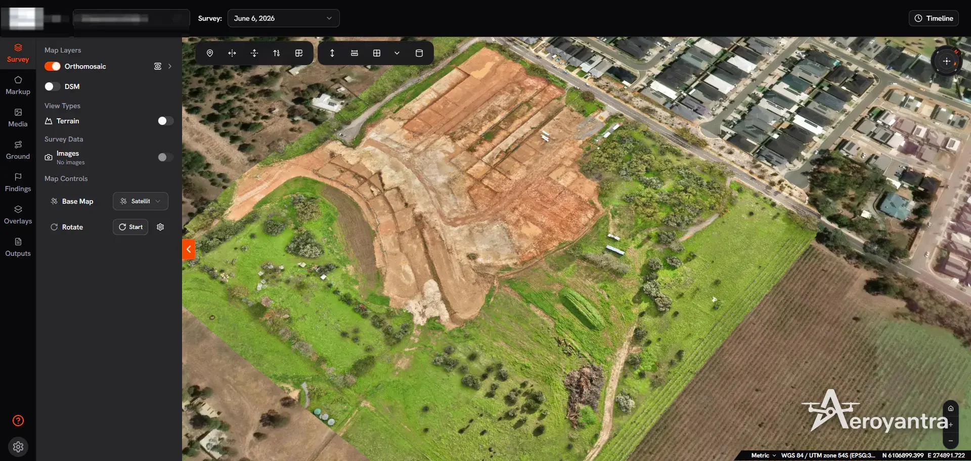
Land survey | orthomosaic of a land subdivision
Land Survey
Boundary, parcel, and control-focused survey support for landowners, developers, planners, and due diligence teams.

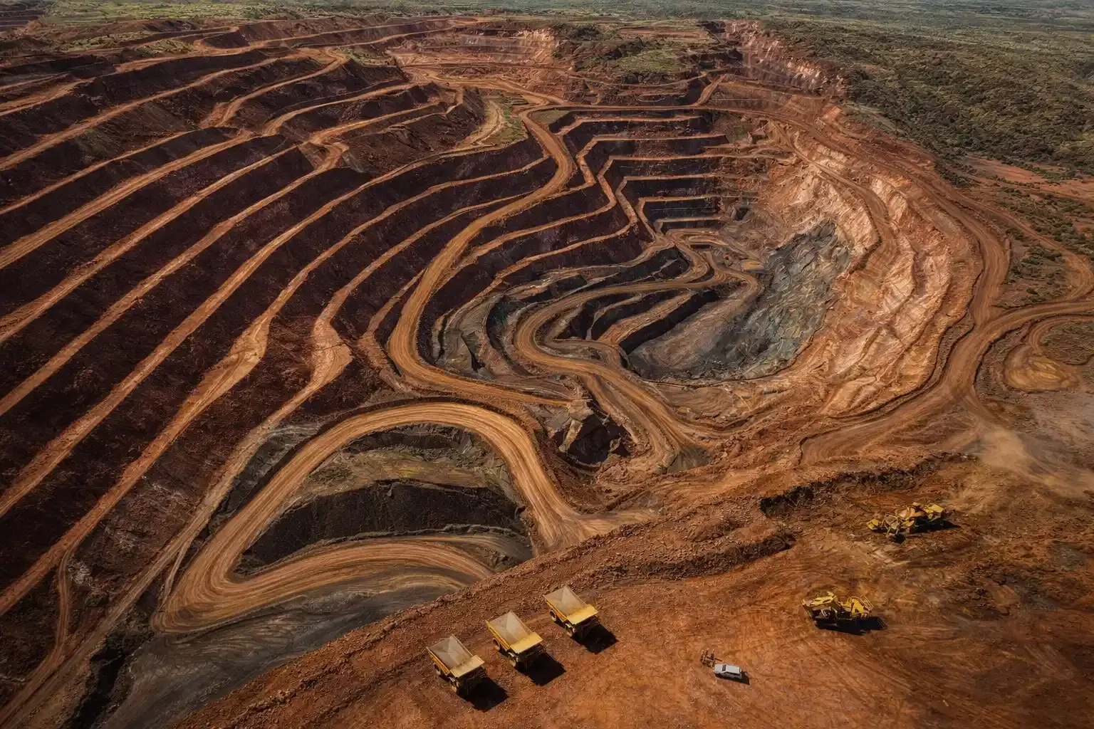
Mining survey | volumes, terrain change, and compliance support
Mining Survey
Stockpile, pit, and terrain analytics for production planning, reconciliation, compliance reporting, and change measurement.

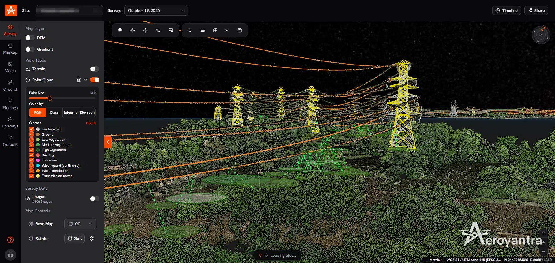
LiDAR survey | classified point cloud of a transmission corridor
LiDAR
Bare-earth terrain capture and classified point clouds for vegetated, difficult, or corridor-heavy sites that need higher-confidence elevation data.

Asset inspection | transmission tower and conductors in 3D
Inspection
Inspection-oriented drone capture for plants, rooftops, solar sites, and other asset-heavy environments where visual condition data matters.
LiDAR Survey services available in other cities across Uttarakhand.
LiDAR Survey
View LiDAR Survey services available in Dehradun, Uttarakhand.
LiDAR Survey
View LiDAR Survey services available in Haldwani, Uttarakhand.
LiDAR Survey
View LiDAR Survey services available in Haridwar, Uttarakhand.
LiDAR Survey
View LiDAR Survey services available in Rishikesh, Uttarakhand.
LiDAR Survey
View LiDAR Survey services available in Nainital, Uttarakhand.
LiDAR Survey
View LiDAR Survey services available in Roorkee, Uttarakhand.
Common questions about lidar survey services, timelines, and deliverables.
Given Rudrapur's flat terai industrial zone terrain, this typically includes point cloud, bare-earth dtm, corridor surfaces, plus any additional outputs shaped by local site conditions — flat terrain with industrial cluster density.
In Rudrapur, standard DGCA compliance applies. After field capture, processed outputs are delivered within 48 to 72 hours depending on area, terrain complexity, and output package.
For most lidar survey work in Rudrapur's flat terai industrial zone terrain, photogrammetry delivers strong results. LiDAR becomes the better choice when you need bare-earth DTMs under vegetation, higher point density for complex surfaces, or corridor-level terrain data where canopy or structural obstruction is a factor.
In Rudrapur, the primary demand for lidar survey comes from sidcul industrial estate, automotive manufacturing, food processing projects. Industrial estate expansion surveys, factory construction monitoring, and logistics park development.
Share the site location, scope, and expected outputs. We will align the right capture and delivery workflow for your project.