Pathankot, Punjab

Drone Surveillance Services in Pathankot, Punjab

See the Full Programme
Night thermal patrolsWhatsApp alertsEvidence pack
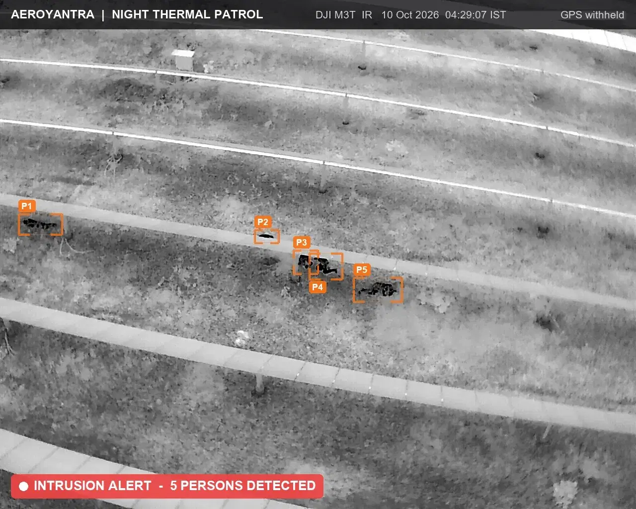
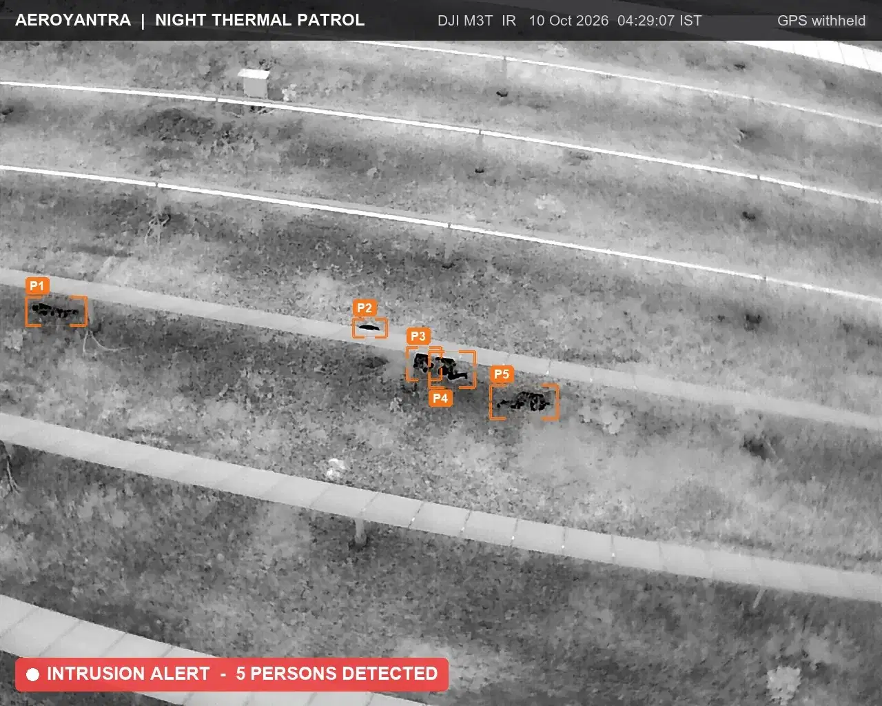
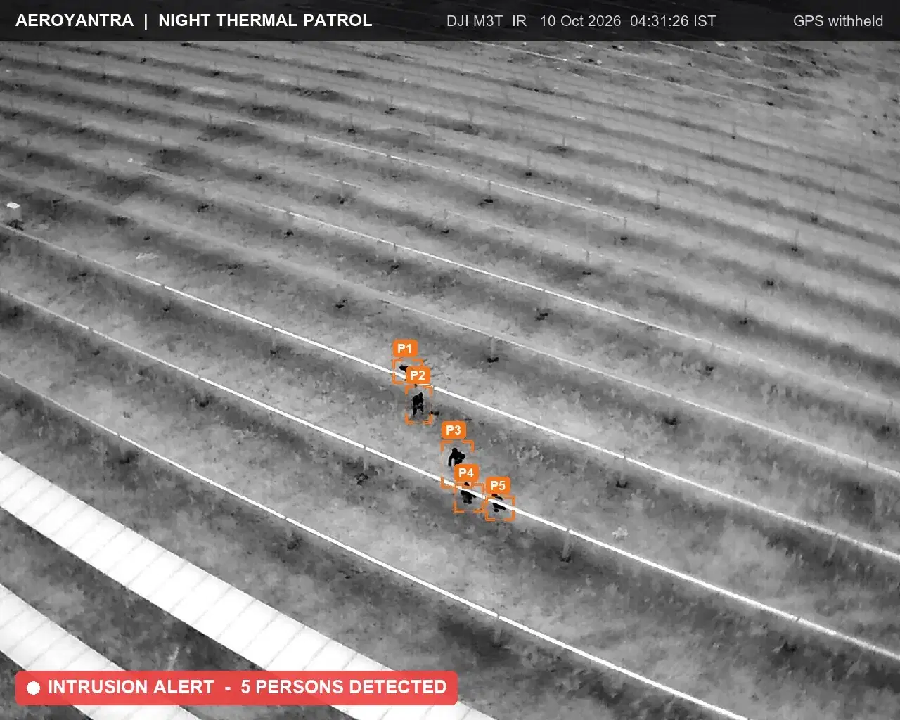
Night thermal drone frame at 04:29 IST: five intruders tagged P1 to P5 crouched under a solar module row - solar plant night thermal patrol
Real night patrol | five intruders tagged at 04:29 IST
8
sorties a day
2 min
alert target
Thermal
night payload

Aeroyantra runs night thermal drone patrols for solar plants and industrial sites in Pathankot, Punjab. A DGCA-certified crew flies randomised sorties through the night, tags every intruder on video, sends a WhatsApp alert with a GPS pin and holds overwatch while your team responds.

What one theft night costs: One cable-theft night on a 2 MW solar block costs about ₹5.2 lakh in Aeroyantra's illustrative estimate, and the stolen cable is only about 40% of it. See the assumptions

Why Drone Surveillance Matters in Pathankot, Punjab

A strategic military town at the Punjab-Himachal-J&K tri-junction in the Shivalik foothills. Major military base and gateway to Himachal and Kashmir.

Military infrastructure mapping, border connectivity road projects, and railway modernization surveys.

Drone surveillance in Pathankot covers sites where a ground patrol is slow and a fixed camera sees little: long perimeters on broken ground, remote substations, and solar or industrial sites on slopes. Across Punjab — Shivalik foothills with military base — a thermal sortie sweeps the whole boundary from above at night, and a recorded, time-stamped track replaces a guard's verbal report.

Terrain: Shivalik foothills with military base

Why Teams in Pathankot Choose Aeroyantra

Pathankot has active demand from military infrastructure and border connectivity projects — sectors where drone surveillance outputs directly support planning, execution, and reporting workflows.

Hilly and elevated terrain around Pathankot limits ground survey efficiency. Drone-based capture covers large areas safely and quickly, producing terrain models that would take ground crews significantly longer to achieve.

Local conditions include major military base creating extensive restricted airspace. Our team plans for these factors in advance, adjusting flight parameters, timing, and control workflows to ensure consistent output quality.

Pathankot falls under restricted or sensitive airspace. Aeroyantra handles the DGCA, local administration, and security clearances required to operate legally and safely in this zone.

Theft around Pathankot happens after dark and away from the lights. Aeroyantra's crew flies thermal sorties at randomised times through the night, posts a WhatsApp alert with a snapshot and GPS pin to your security group, and closes each incident with an evidence pack for the FIR or the insurer.

Airspace and Compliance

Standard DGCA compliance; international border proximity adds security clearance requirements in Amritsar and Pathankot areas.

Delivery Timeline

Clearance in this zone typically adds 5-10 working days, and night flying needs its own DGCA permission. From the first night, alerts go out live and each incident gets an evidence pack by the next morning.

Drone SurveillanceNorth India

What security teams in Pathankot need from drone surveillance

Night thermal drone patrols that catch cable and material theft at solar plants and industrial sites, with WhatsApp alerts and an evidence pack for every incident. This page covers drone surveillance and night patrol services available in Pathankot, Punjab.

Thermal patrol sorties through the night at randomised times, plus daylight damage checks.

Every person and vehicle seen on thermal marked on the video with time and position.

WhatsApp alert with an annotated snapshot and GPS pin to your security group.

Evidence pack for each incident, formatted for an FIR or an insurance claim.

Best fit for

Solar plant theft

Industrial and scrap yards

Long or unlit perimeters

One Pre-Dawn Patrol, Five Intruders on Thermal

Real frames from an Aeroyantra night patrol over a solar plant on 10 October 2026. The plant's location is withheld for the client.

  1. Night thermal drone frame at 04:29 IST: five intruders tagged P1 to P5 crouched under a solar module row - solar plant night thermal patrol

    104:29:07 IST

    Five people crouched under a module row, in cable-cutting position.

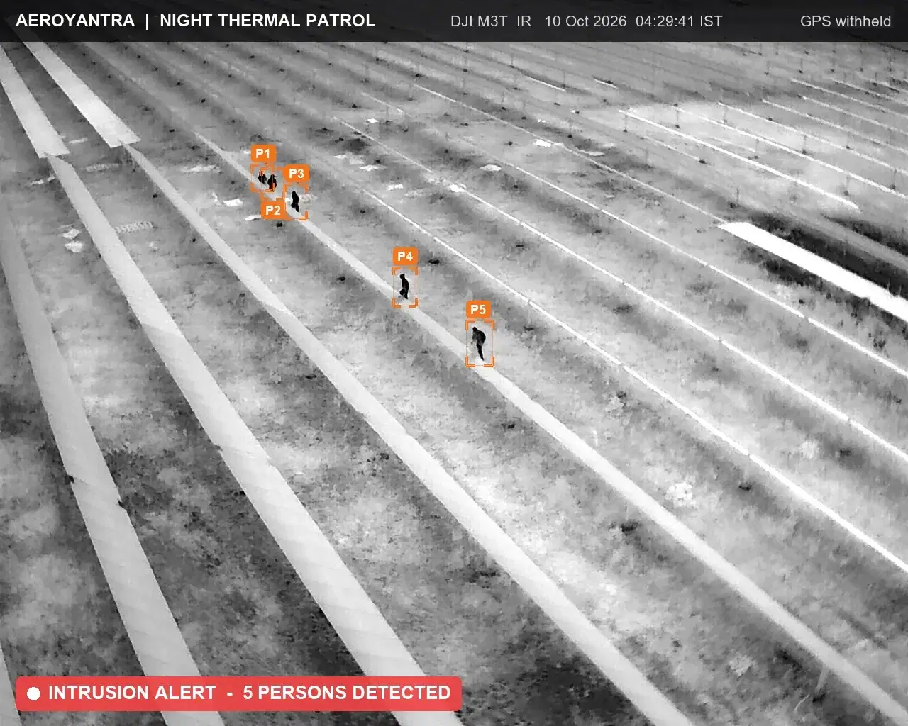
  2. Night thermal drone frame at 04:29 IST: the group breaks up and moves across the module rows - solar plant night thermal patrol

    204:29:41 IST

    The group breaks up and moves across the rows.

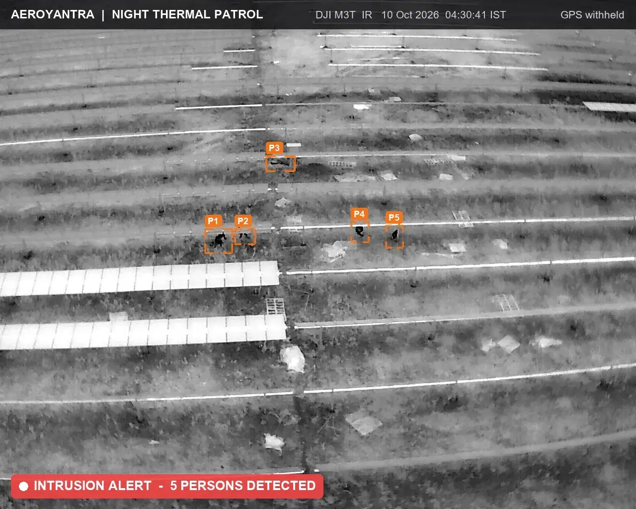
  3. Night thermal drone frame at 04:30 IST: intruders crossing into the next block of the solar plant - solar plant night thermal patrol

    304:30:41 IST

    Crossing into the next block, still tracked.

  4. Night thermal drone frame at 04:31 IST: five intruders leaving in single file with the exit route logged - solar plant night thermal patrol

    404:31:26 IST

    Leaving in single file. The exit route is logged.

What Your Security Team Sees

Every finding on a site map, every sortie reviewable frame by frame, and a morning report for HQ, in the Aeroyantra surveillance platform.

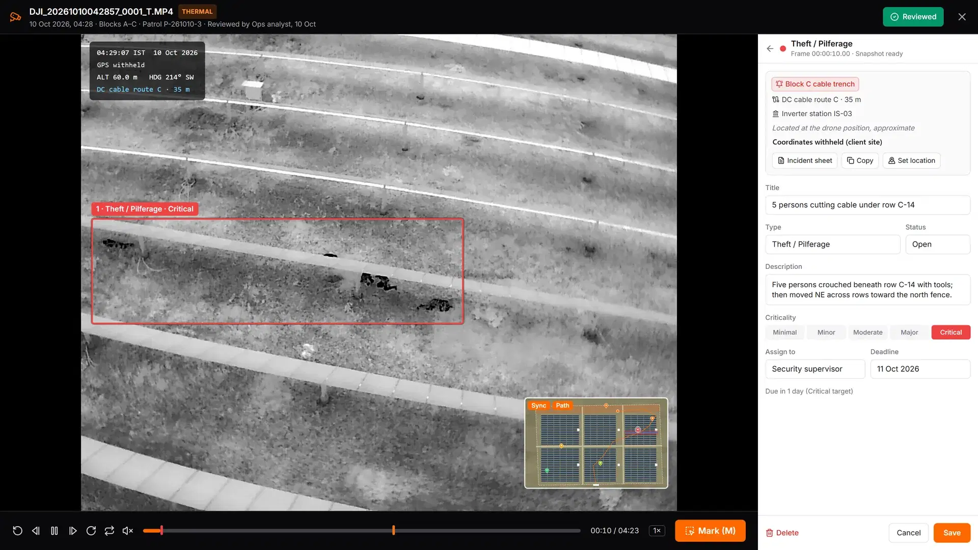
Frame-accurate thermal video review with a telemetry overlay and an intruder marked as a theft finding - Aeroyantra surveillance module

Aeroyantra surveillance module

Frame-accurate thermal video review with a telemetry overlay and an intruder marked as a theft finding

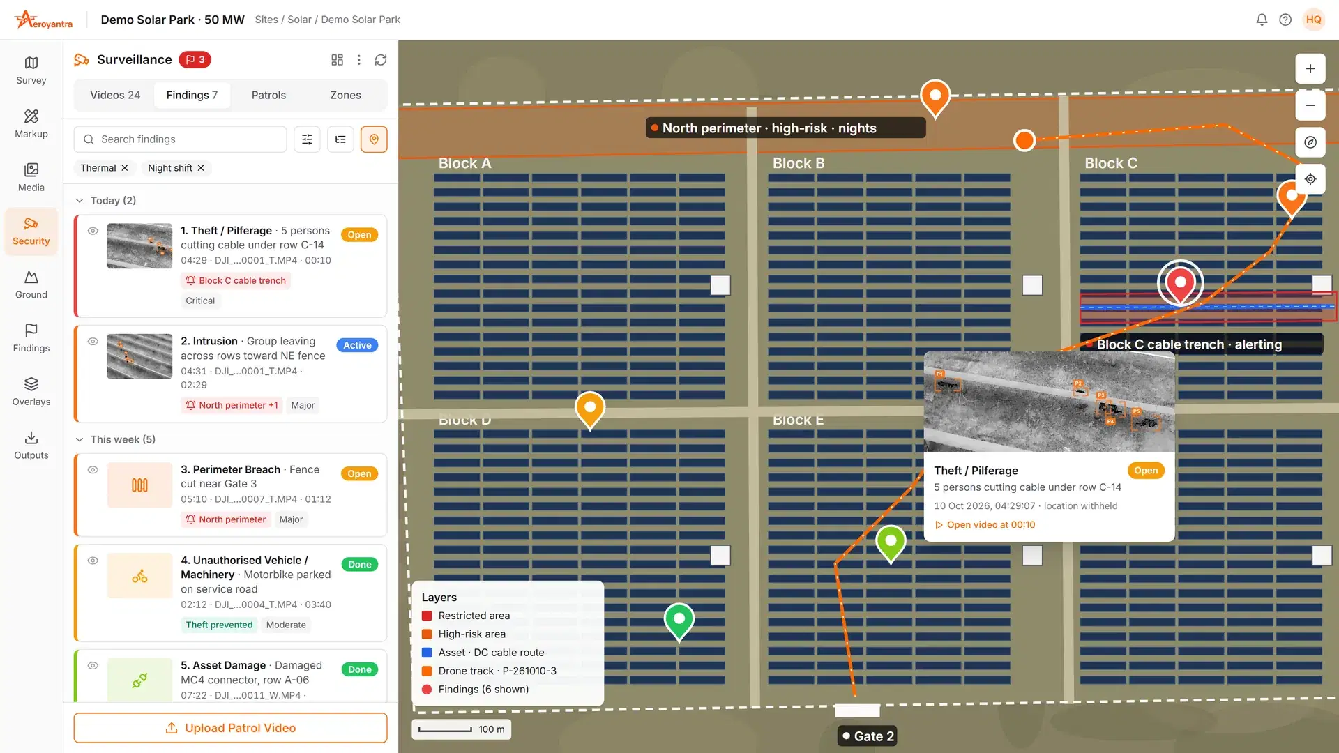
Surveillance site map with alert zones, cable-route assets, the drone track and findings pinned by severity - Aeroyantra surveillance module

Aeroyantra surveillance module

Surveillance site map with alert zones, cable-route assets, the drone track and findings pinned by severity

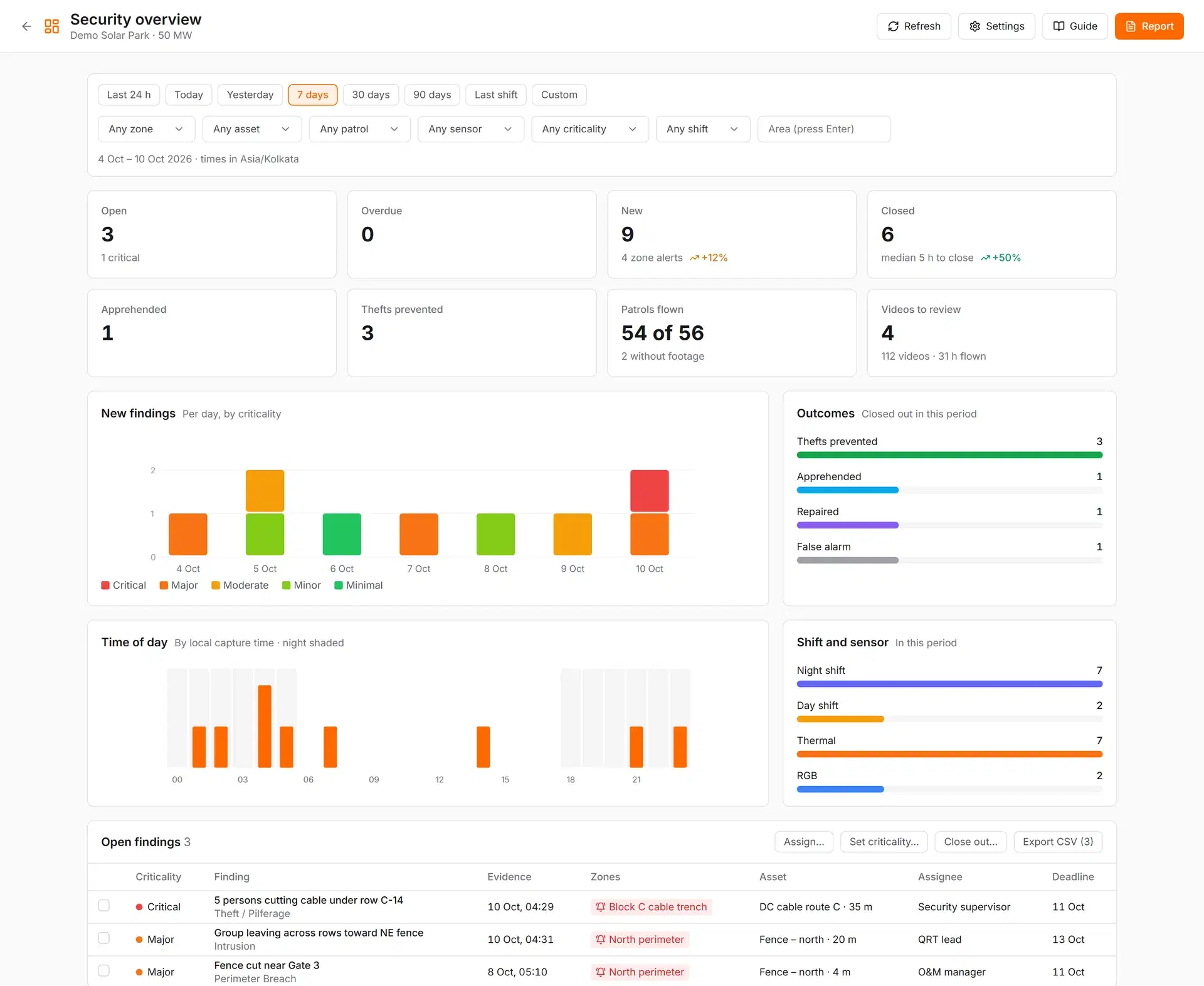
Security overview for HQ: open and overdue findings, thefts prevented, patrols flown and incidents by time of day - Aeroyantra surveillance module

Aeroyantra surveillance module

Security overview for HQ: open and overdue findings, thefts prevented, patrols flown and incidents by time of day

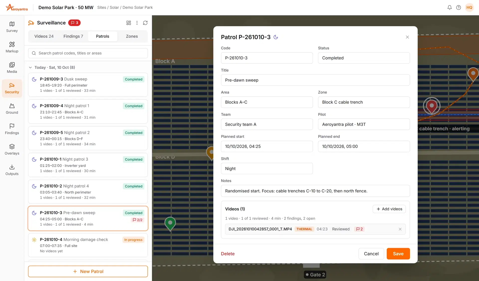
Patrol plan for one night: dusk sweep, randomised night patrols and a pre-dawn sweep with footage matched to each - Aeroyantra surveillance module

Aeroyantra surveillance module

Patrol plan for one night: dusk sweep, randomised night patrols and a pre-dawn sweep with footage matched to each

Sites We Protect

Where the asset is portable, the boundary is long and the losses happen at night, in and around Pathankot.

Solar Plants

Copper DC and earthing cable, connectors and modules taken from unlit array rows at night.

Industrial Plants and Yards

Scrap, metal stock, spares and fuel moved out after shift hours across long, partly fenced boundaries.

Oil, Gas and Pipelines

Pilferage, tapping and unauthorised approach along tank farms and pipeline right-of-way.

Construction Sites

Rebar, cable and fuel lifted from sites that sit unmanned overnight.

How a Patrol Night Works

Five steps from the first sortie to the evidence pack on your desk by morning.

01

Patrol

Scheduled thermal sorties by day and night, at randomised times a gang cannot wait out.

02

Detect

Every person and vehicle seen on thermal is marked on the video with time and position.

03

Alert

A WhatsApp alert with an annotated snapshot and GPS pin goes to your security group within minutes.

04

Respond

The drone holds overwatch and the pilot guides your quick-response team to the spot.

05

Report

A 07:00 summary for HQ and an evidence pack for every incident, ready for an FIR or insurer.

Other Services in Pathankot

Additional drone survey services available in Pathankot.

Explore Our Core Survey Capabilities

Comprehensive drone survey services available across all our service locations.

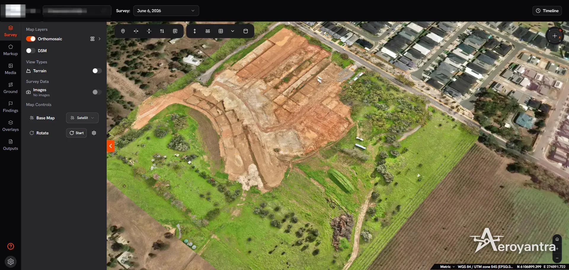
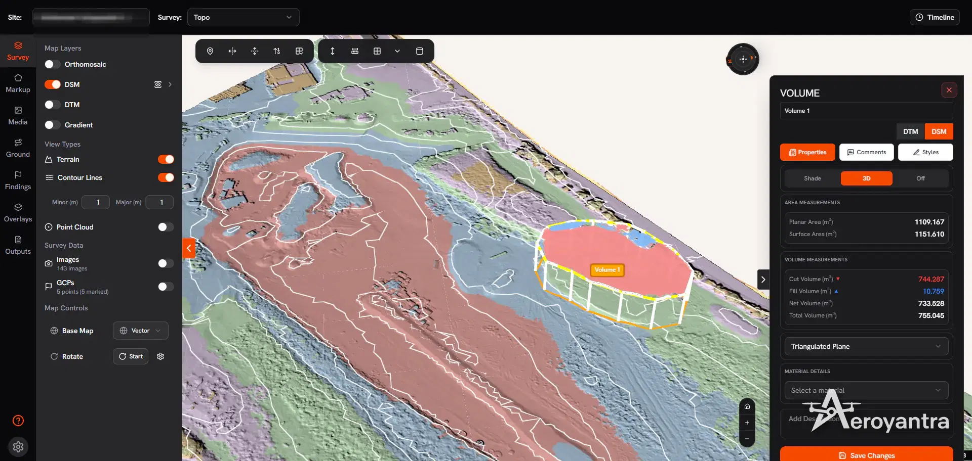
DSM with 1 m contour lines and a volume measurement polygon - topographic and stockpile survey

Topographic survey | DSM with 1 m contours and a volume polygon

Topographic

Topographic Survey

Terrain capture with RTK and PPK workflows for contours, DSM, DTM, and grading decisions on civil and land development projects.

Civil designDrainage planningLand development
ContoursDSM / DTMCross-sections
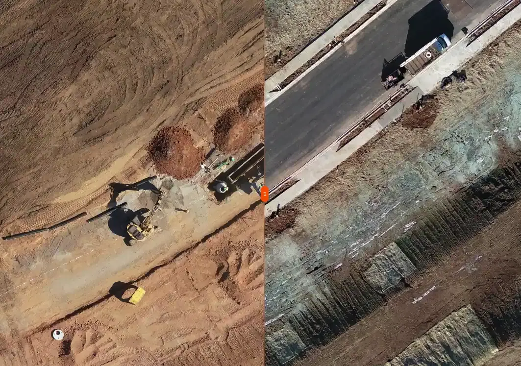
Construction site viewed from drone for progress tracking

Construction monitoring | progress tracking and earthwork verification

Construction

Construction Survey and Monitoring

Recurring drone survey support for progress monitoring, earthwork verification, as-built records, and stakeholder reporting.

Monthly monitoringBilling verificationRERA reporting
Progress reportsCut/fill mapsAs-built evidence
Drone orthomosaic of the subdivision earthworks and benched cut - land subdivision earthworks

Land survey | orthomosaic of a land subdivision

Land Survey

Land and Property Survey

Boundary, parcel, and control-focused survey support for landowners, developers, planners, and due diligence teams.

Land acquisitionRERA layoutsSite planning
Boundary mappingArea reportsControl support
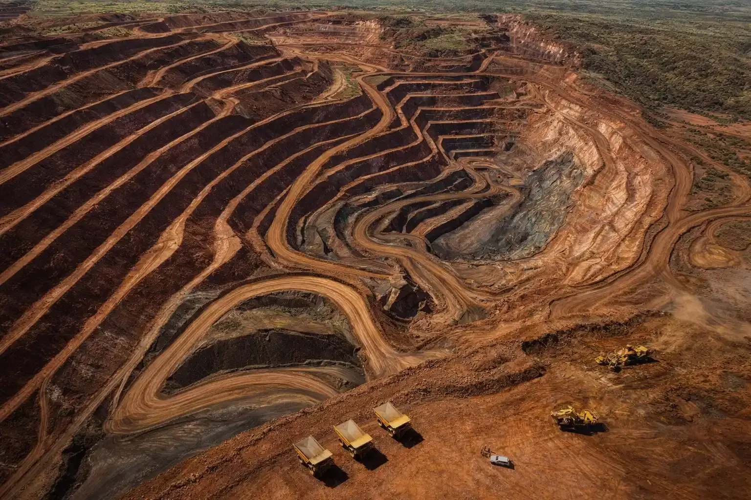
Aerial drone view of active mining and quarry operations

Mining survey | volumes, terrain change, and compliance support

Mining Survey

Mining and Volumetric Survey

Stockpile, pit, and terrain analytics for production planning, reconciliation, compliance reporting, and change measurement.

IBM Rule 34AStockpile auditsEarthwork reconciliation
Volume reportsPit progressionCompliance maps
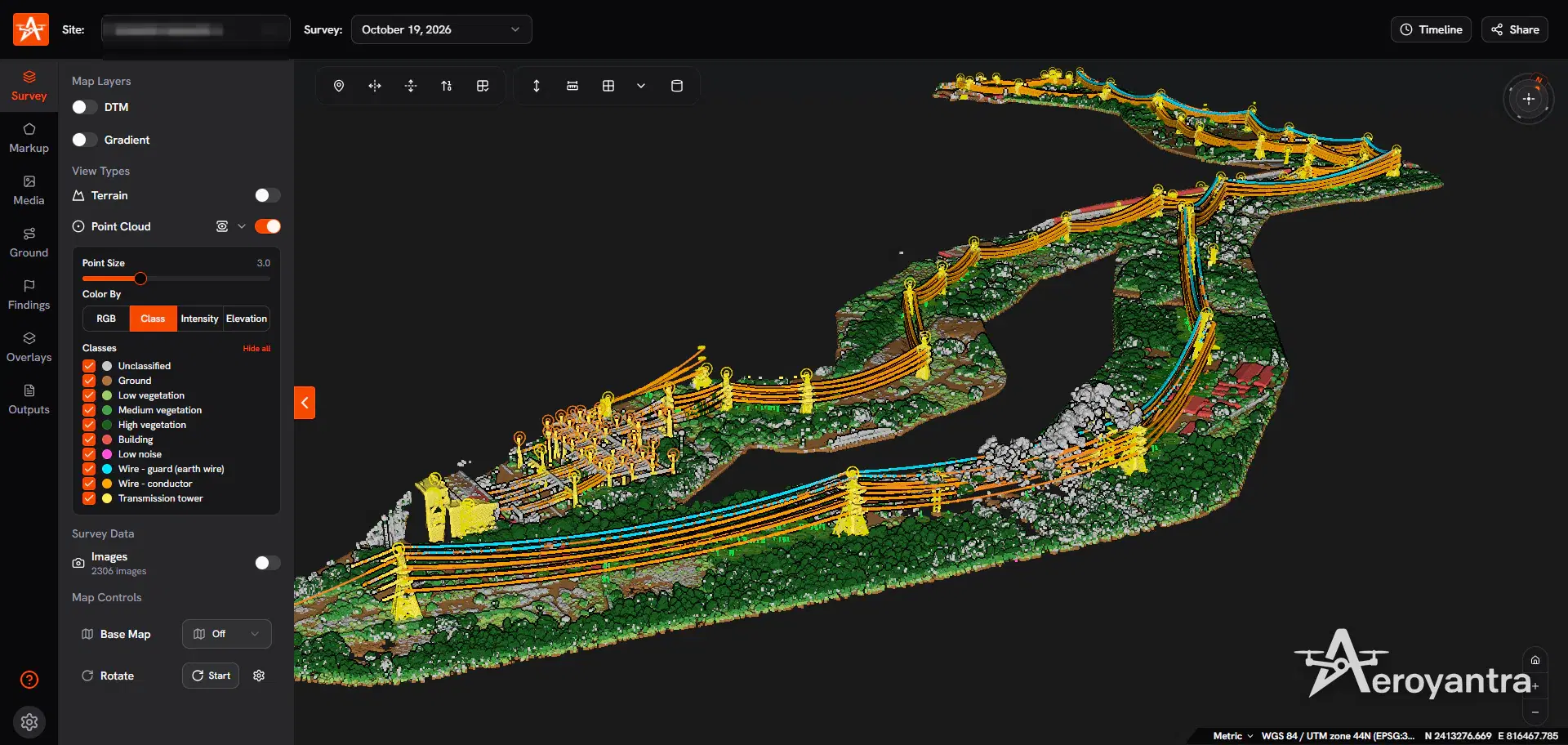
Classified point cloud of corridor assets, conductors and earth wire - transmission corridor asset mapping, lidar

LiDAR survey | classified point cloud of a transmission corridor

LiDAR

LiDAR Survey

Bare-earth terrain capture and classified point clouds for vegetated, difficult, or corridor-heavy sites that need higher-confidence elevation data.

Vegetated terrainLinear infrastructureDense sites
Point cloudBare-earth DTMCorridor surfaces
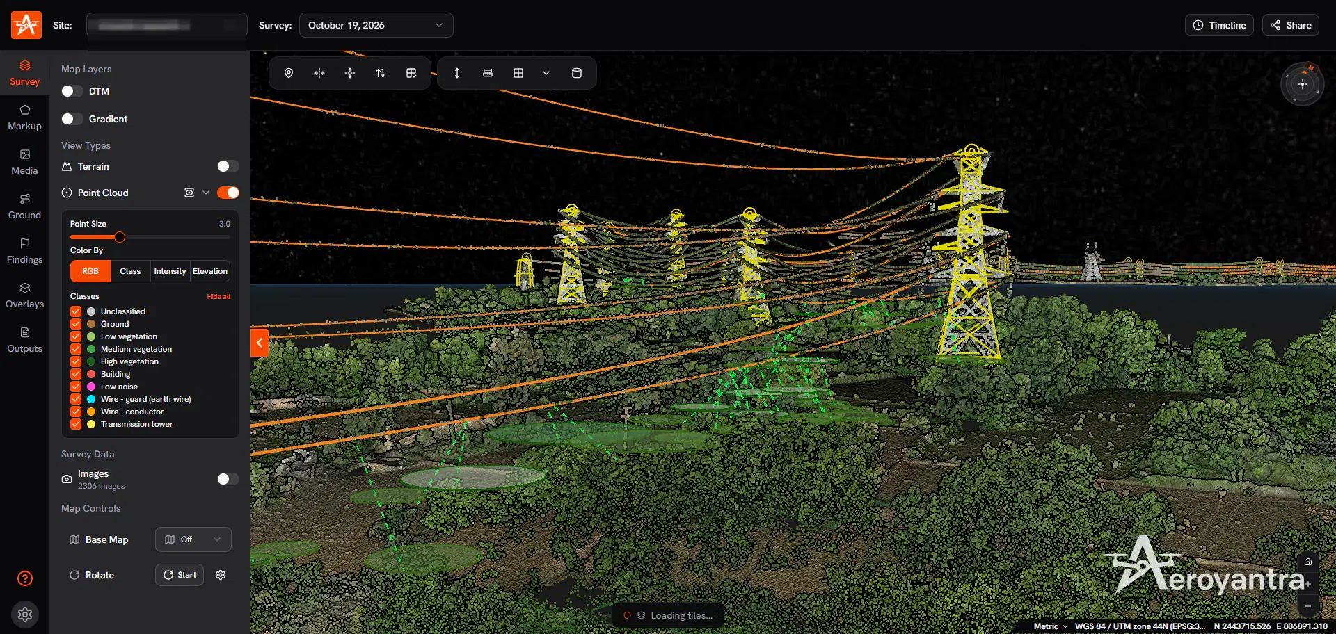
RGB point cloud close-up of transmission towers and conductor spans - powerline vegetation encroachment analysis

Asset inspection | transmission tower and conductors in 3D

Inspection

Industrial and Inspection Survey

Inspection-oriented drone capture for plants, rooftops, solar sites, and other asset-heavy environments where visual condition data matters.

Solar EPCIndustrial plantsCondition review
Inspection imageryAnnotated findingsAsset context

Nearby Cities for Drone Surveillance

Drone Surveillance services available in other cities across Punjab.

FAQs for Drone Surveillance in Pathankot

Common questions about drone surveillance services, timelines, and deliverables.

How does drone surveillance work in Pathankot?

Aeroyantra's crew flies scheduled thermal sorties over your site through the night, at randomised times so a gang cannot wait out the pattern. Thermal picks up people and vehicles by their heat, between module rows and beyond the floodlights. When the pilot sees one, your security group gets a WhatsApp alert with an annotated snapshot and GPS pin, and the drone holds overwatch while your team responds.

Is night drone surveillance allowed in Pathankot?

Yes, with permissions. Standard DGCA compliance; international border proximity adds security clearance requirements in Amritsar and Pathankot areas. Night flying needs its own DGCA permission on top of that, and Aeroyantra files all of it before the first patrol.

How many drone patrol sorties are flown in a night?

Aeroyantra's standard plan is 8 sorties a day: a dusk sweep, four randomised patrols through peak theft hours and a pre-dawn sweep at night, plus a morning damage check and an afternoon perimeter patrol by day. Each sortie runs about 30 to 35 minutes, and an alarm from guards or CCTV gets an extra verification flight.

What evidence do you hand over after a theft attempt?

Every sortie is recorded as thermal video with time, GPS and altitude on each frame. For an incident Aeroyantra hands over the clip, annotated snapshots with each person tagged, and an incident sheet with the time, location, zone and nearest asset, ready for an FIR or an insurance claim. The crew observes, guides and records; it never confronts intruders.

Need Drone Surveillance in Pathankot?

Share the site type, the boundary length and the losses you are seeing. We will propose a patrol plan and start with a 30-night pilot.

Night thermal patrols at randomised times
WhatsApp alerts with a GPS pin
Evidence pack for FIR and insurance
Review after 30 nights, then pick a plan

Trusted by teams in construction, mining, energy & infrastructure

  • ITC logo
  • Greenko logo
  • Proterra Outdoor Design logo
  • Begrar Group GmbH logo
  • Petagma logo
  • 33Visual logo
Read client stories